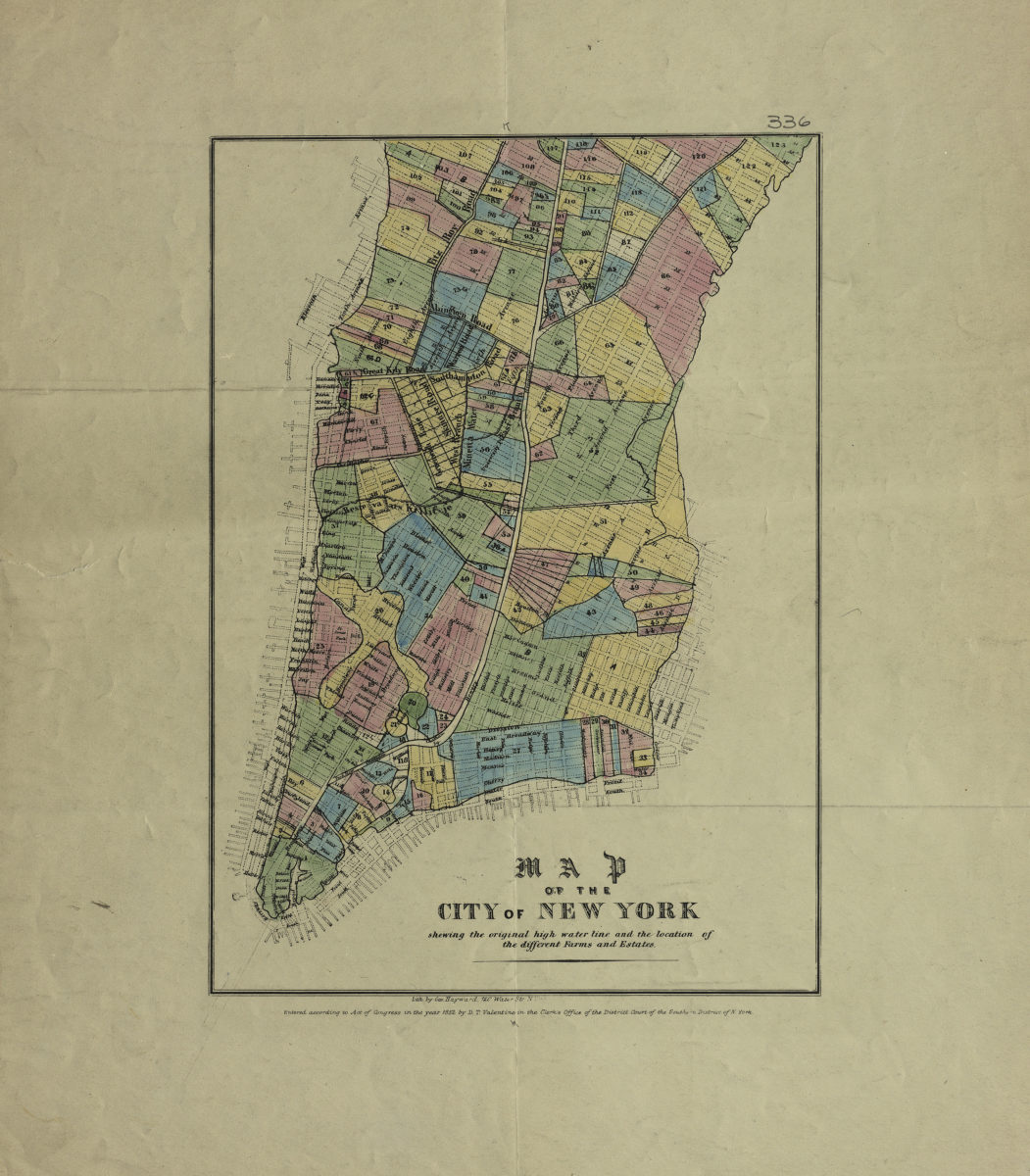
Map of the city of New York: shewing [i.e. showing] the original high water line and the location of the different farms and estates [ca. 1852]
Map No. M-1852a.Fl
Covers Manhattan from the Battery to approximately 51st St. Also shows piers and coastline ca. 1852. “Entered according to Act of Congress in the year 1852 by D.T. Valentine in the Clerk’s Office of the District Court of the Southern District of N. York.” Keyed to index no index present.
Map area shown
Genre
MapRelation
Full catalog recordSize
31 × 22 cmDownload
Low Resolution Image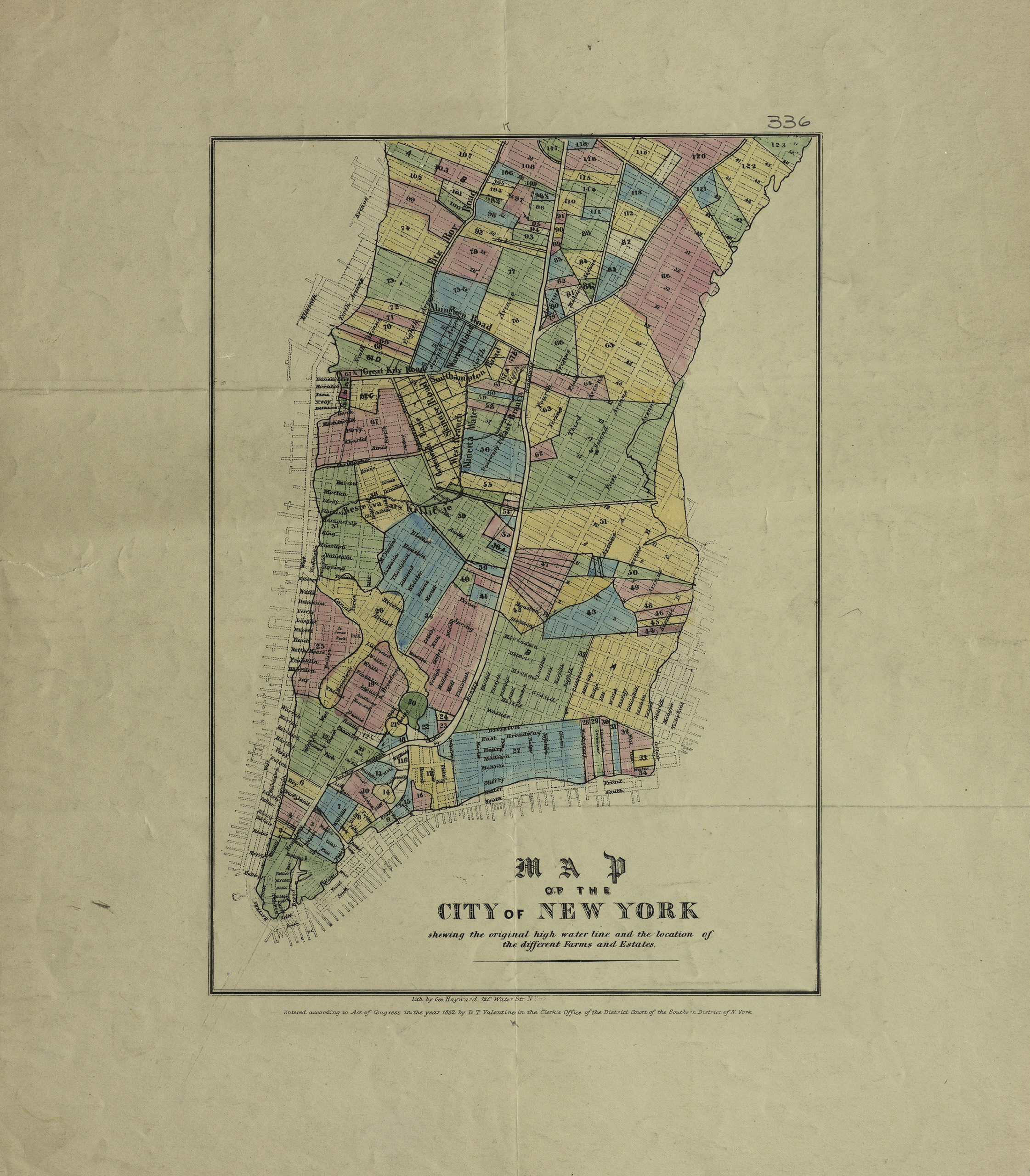
Creator
Valentine, D. T.,Publisher
Brooklyn Historical SocietyCitation
Map of the city of New York: shewing [i.e. showing] the original high water line and the location of the different farms and estates; [ca. 1852], Map Collection, M-1852a.Fl; Brooklyn Historical Society.Scale
Scale not givenLoading zoom image...