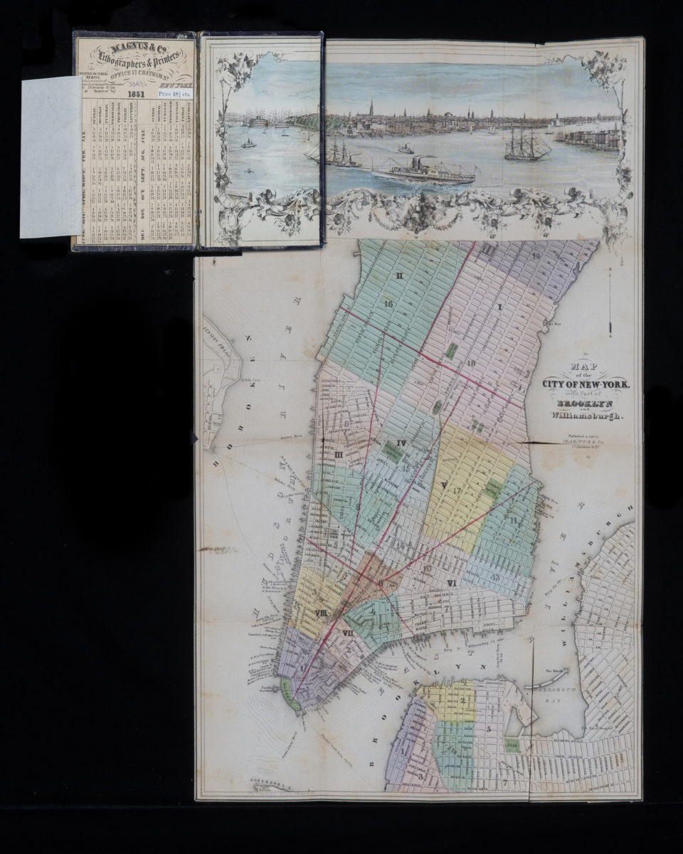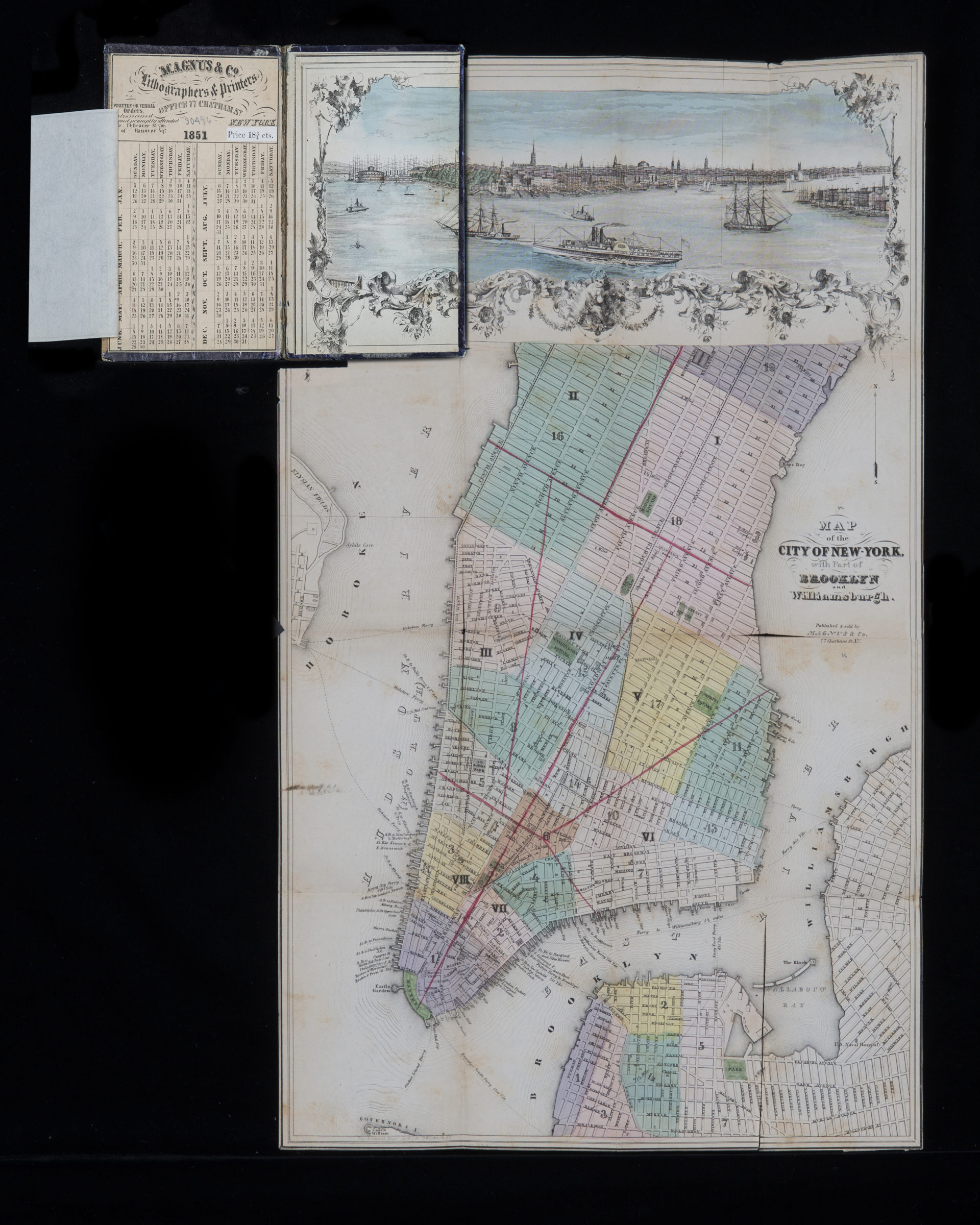
Map of the city of New York, with part of Brooklyn and Williamsburgh [1851]
Map No. NYC-[1851].Fd.RA
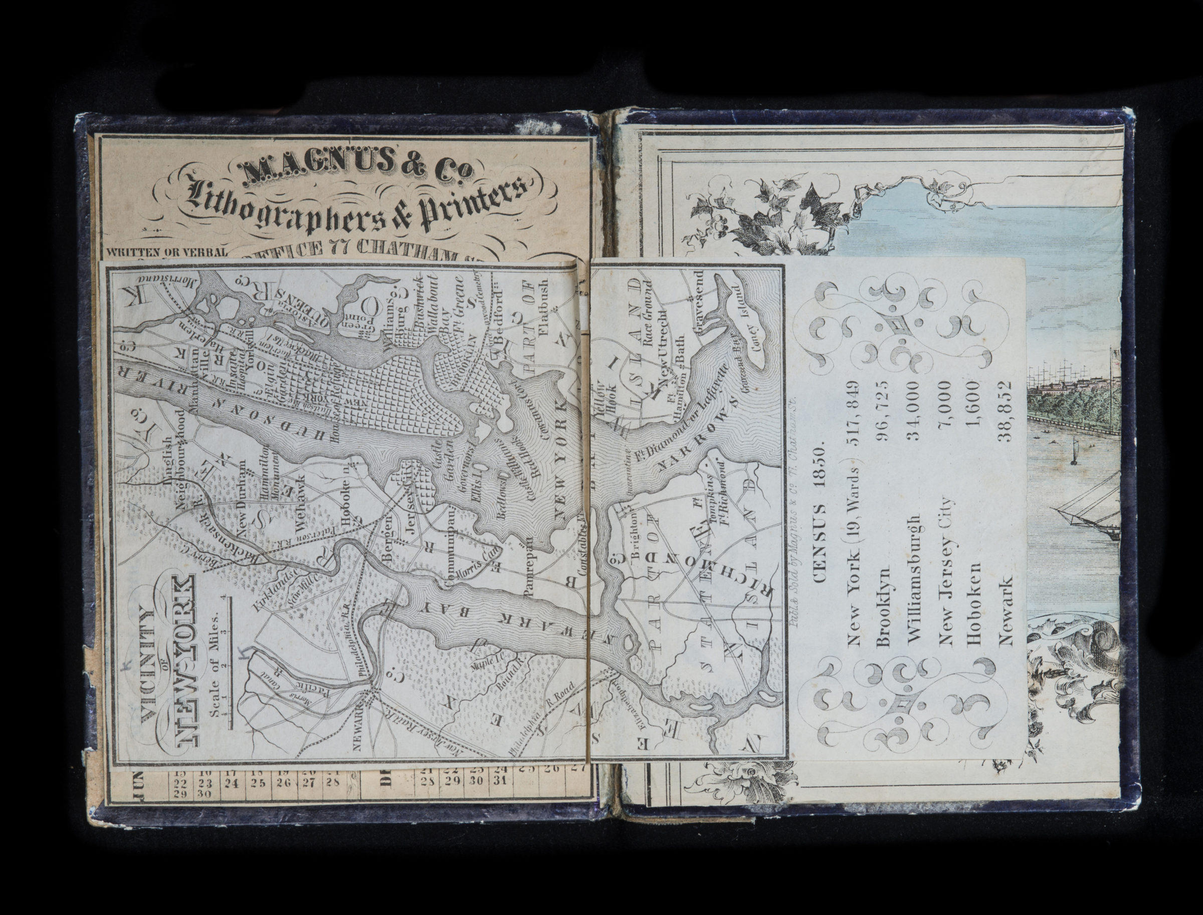
Covers Manhattan north to 51st St. also covers portions of northwest Brooklyn, Williamsburgh, Hoboken, and Governors Island. Shows Manhattan and Brooklyn wards, slips (including names of docking lines), piers, and ferry lines. Includes view of Lower Manhattan and decorative border. Inside front cover: Text and calendar for 1851. Accompanying map: Vicinity of New York (Scale [ca. 1:270,336]). BHS copy annotated in red ink.
Map area shown
Genre
MapRelation
Full catalog recordSize
46 × 28 cmDownload
Low Resolution Image
Creator
Magnus, Charles,Publisher
Brooklyn Historical SocietyCitation
Map of the city of New York, with part of Brooklyn and Williamsburgh; [1851], Map Collection, NYC-[1851].Fd.RA; Brooklyn Historical Society.Scale
Scale not givenLoading zoom image...