Map of the city of New York 1852
Map No. M-1852.Fl
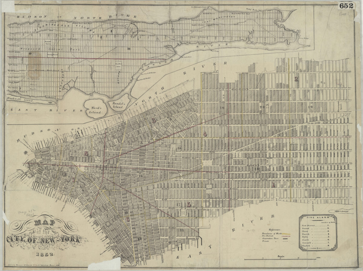
Covers the entirety of Manhattan also shows Ward’s Island, Randel’s Island, and Blackwell’s Island. Shows wards, piers (corporate and private), ferry slips, the bulkhead line, fire districts, and the proposed Central Park. “Lith by Geo. Hayward, 120 Water St. N.Y. for D.T. Valentine’s Manual 1852.” Includes inset continuation map, key, and description of fire alarm bells.
Map area shown
Genre
Zoning mapsRelation
Full catalog recordSize
40 × 53 cmDownload
Low Resolution Image
Creator
Hayward, George; Valentine, D. T.,Publisher
Brooklyn Historical SocietyCitation
Map of the city of New York; 1852, Map Collection, M-1852.Fl; Brooklyn Historical Society.Scale
Scale [ca. 1:14,908]Loading zoom image...