
Map of the consolidated city of Brooklyn 1868; [ca. 1861]
Map No. B A-1868b.Fl
Covers the city of Brooklyn north from 60th St. to Green Point and east to the Cemetery of the Evergreens also shows Governor’s Island and portions of New Utrecht, Flatbush, East New York, southern Queens, and Lower Manhattan. Shows wards, railroads, ferry lines, and school districts. Oriented with north to the lower left. “Lith. by A. Brown … for William G. Bishop’s Manual.” “Entered according to Act of Congress in the Year 1861 by A. Brown & Co. in the Clerks Office of the District Court of the Southern District of New York.” Includes ill., key, and decorative border.
Map area shown
Genre
MapRelation
Full catalog recordSize
44 × 53 cmDownload
Low Resolution Image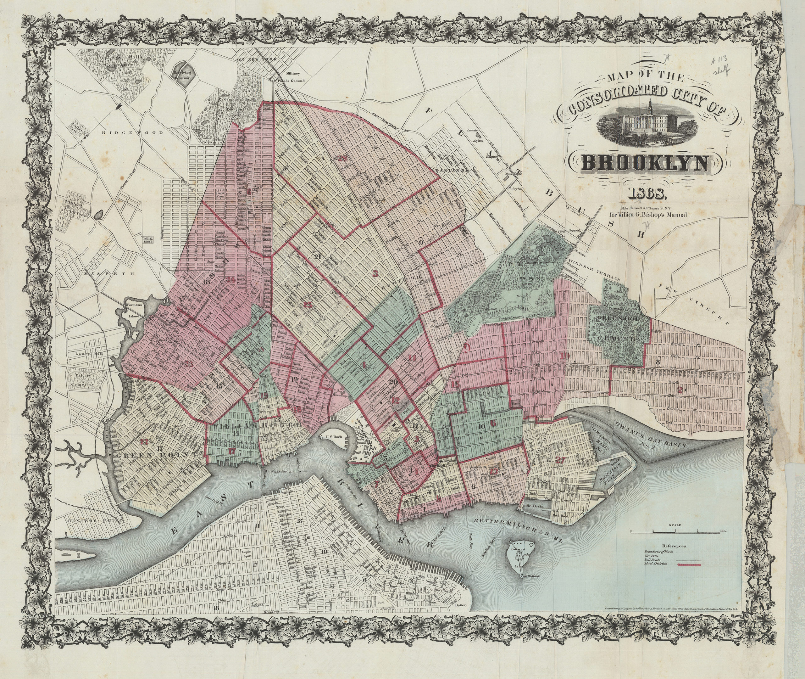
Creator
Bishop, William G.; A. Brown & Co.,Publisher
Brooklyn Historical SocietyCitation
Map of the consolidated city of Brooklyn; 1868; [ca. 1861], Map Collection, B A-1868b.Fl; Brooklyn Historical Society.Scale
Scale [ca. 1:23,040]Loading zoom image... 