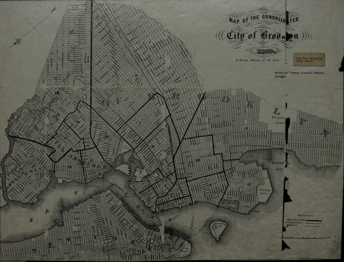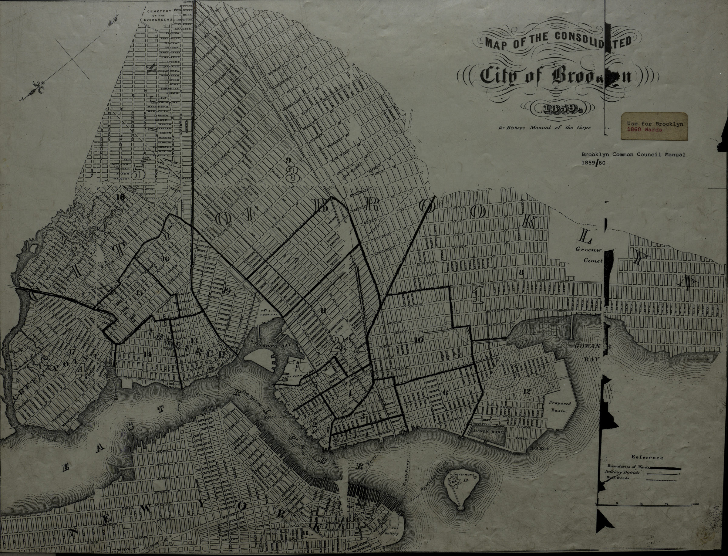
Map of the consolidated city of Brooklyn [19??]
Map No. B A-1859 (19--?)a.Fl
Covers the city of Brooklyn north from 60th St. to Greenpoint and east to the Cemetery of the Evergreens also covers a portion of Lower Manhattan. Shows wards, judiciary districts, railroads, and ferry lines. Oriented with north to the lower left.
Map area shown
Genre
Zoning mapsRelation
Full catalog recordSize
42 × 54 cmDownload
Low Resolution Image
Creator
Bishop, William G.,Publisher
Brooklyn Historical SocietyCitation
Map of the consolidated city of Brooklyn; [19??], Map Collection, B A-1859 (19--?)a.Fl; Brooklyn Historical Society.Scale
Scale [1:22,528]Loading zoom image...