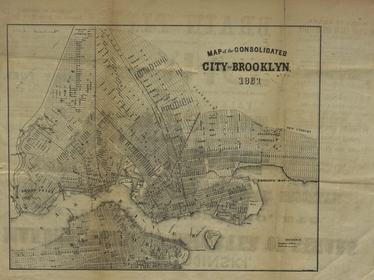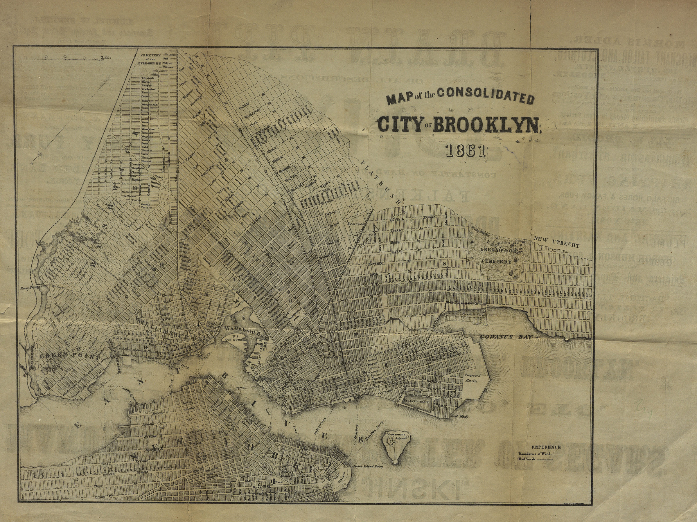

Map of the Consolidated City of Brooklyn 1861
Map No. B A-1861a.Fl
Covers Brooklyn and a portion of lower Manhattan. Shows streets, property plots and ferry lines. Advertising on verso.
Map area shown
Genre
MapRelation
Full catalog recordSize
34 × 42 cmDownload
Low Resolution Image
Creator
Publisher
Brooklyn Historical SocietyCitation
Map of the Consolidated City of Brooklyn; 1861, Map Collection, B A-1861a.Fl; Brooklyn Historical Society.Scale
Scale not givenLoading zoom image...