
Map of the consolidated City of Brooklyn: comprising the City of Brooklyn, City of Williamsburgh and Town of Bushwick, Kings County, Long Island: compiled from the Commissioners maps by George Hayward 1854
Map No. B A-1854a.Fl
Covers modern Brooklyn south to 60th Street and east to the Cemetery of the Evergreens and Greenwood Cemetery. Shows boundaries of wards, fire districts, railroads and ferries. “Entered according to Act of Congress in the Year 1854 by G. Hayward ….” Oriented with north to lower left of sheet. Includes key. NYHS copy soiled, mounted on board. Lower left corner torn. Encapsulated. M008359
Map area shown
Genre
MapRelation
Full catalog recordSize
42 × 54 cmDownload
Low Resolution Image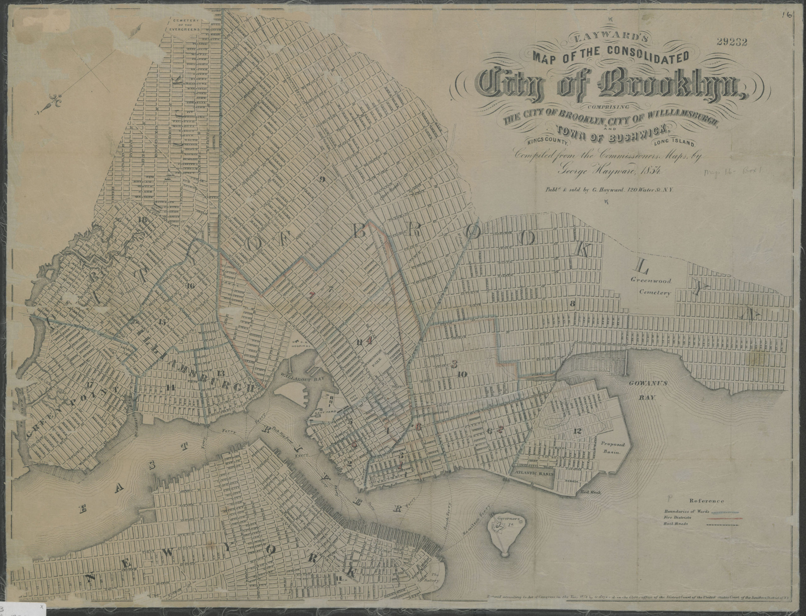
Creator
Hayward, George,Publisher
Brooklyn Historical SocietyCitation
Map of the consolidated City of Brooklyn: comprising the City of Brooklyn, City of Williamsburgh and Town of Bushwick, Kings County, Long Island: compiled from the Commissioners maps by George Hayward; 1854, Map Collection, B A-1854a.Fl; Brooklyn Historical Society.Scale
Scale [ca. 1:22,500]Loading zoom image... 