
Map of the country thirty miles round the City of New York: designed & drawn by I.H. Eddy of N. York 1812 ; engrd. by P. Maverick, Newark, N. Jersey ; revised & corrected by W. Hooker & E. Blunt 1828
Map No. NYC-1828.Fl
Road map. Covers parts of New York and New Jersey. Shows relief by hachures. Map is circular, of diameter 51 cm. Printed dedication: “To Dewitt Clinton Esqr. Mayor of the City of New York THIS MAP is inscribed by his respectful friend THE AUTHOR.” Includes key. NYHS copy creased, soiled, stained, abraded. Mounted on cloth. Encapsulated. M008060.1
Places
Map area shown
Genre
Intaglio printsRelation
Full catalog recordSize
57 × 57 cmDownload
Low Resolution Image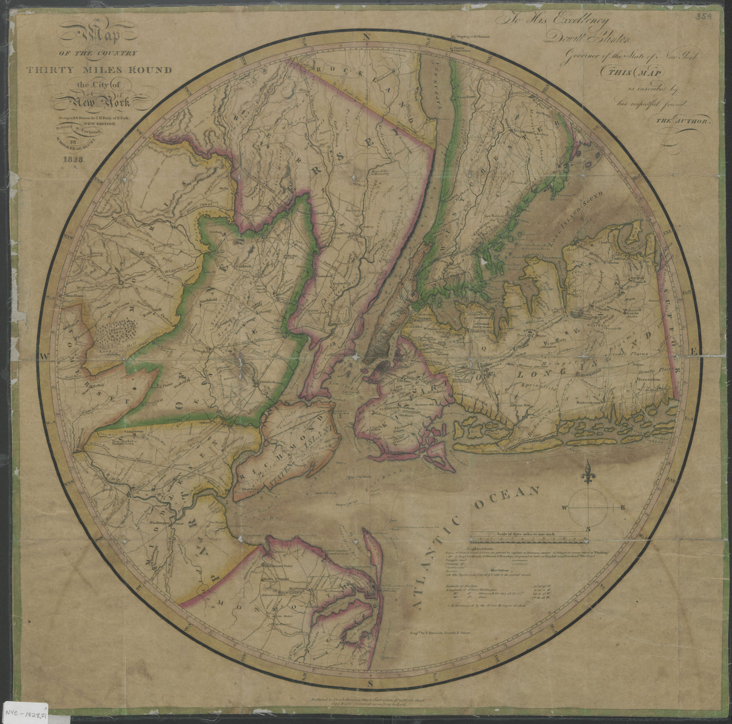
Creator
Eddy, John H.,Publisher
Brooklyn Historical SocietyCitation
Map of the country thirty miles round the City of New York: designed & drawn by I.H. Eddy of N. York 1812 ; engrd. by P. Maverick, Newark, N. Jersey ; revised & corrected by W. Hooker & E. Blunt; 1828, Map Collection, NYC-1828.Fl; Brooklyn Historical Society.Scale
Scale [1:190,000] 1 in toLoading zoom image... 