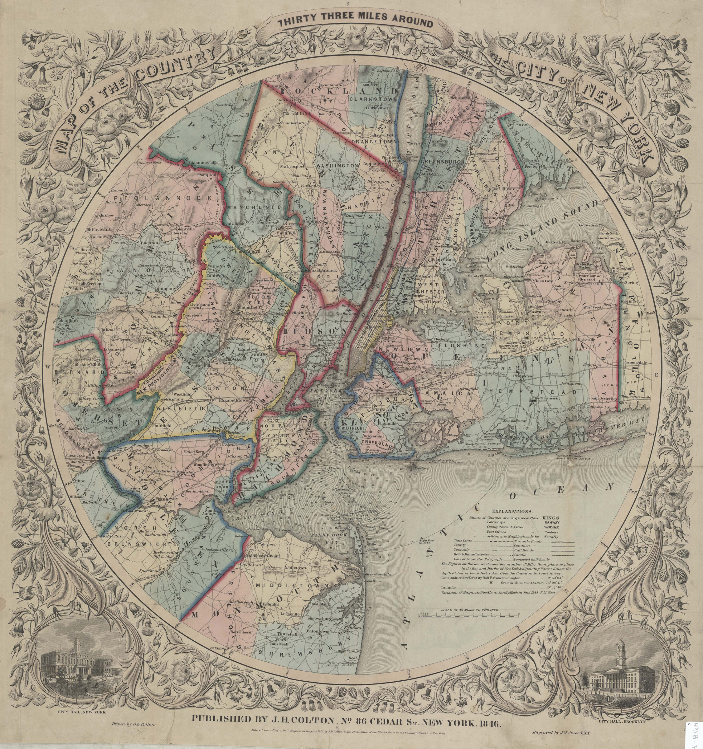
Map of the country thirty three miles around the City of New York: drawn by G.W. Colton ; engraved by J.M. Atwood 1846
Map No. Mid Atl.-1846.Fl
Road map. Covers parts of New York, New Jersey and Connecticut. Shows relief by hachures. Shows depths by soundings. Based on an 1812 map by J.H. Eddy. “Entered according to Act of Congress in the year 1846 …” Includes key. NYHS copy shellacked, abraded, mounted on cloth in turn backed by cloth. Imperfect: lacking 3 x 5 cm. at left margin. M010769
Places
Map area shown
Genre
Bathymetric mapsRelation
Full catalog recordSize
69 × 60 cmDownload
Low Resolution Image
Creator
Colton, J. H.,Publisher
Brooklyn Historical SocietyCitation
Map of the country thirty three miles around the City of New York: drawn by G.W. Colton ; engraved by J.M. Atwood; 1846, Map Collection, Mid Atl.-1846.Fl; Brooklyn Historical Society.Scale
Scale [1:206,000] 1 in toLoading zoom image... 