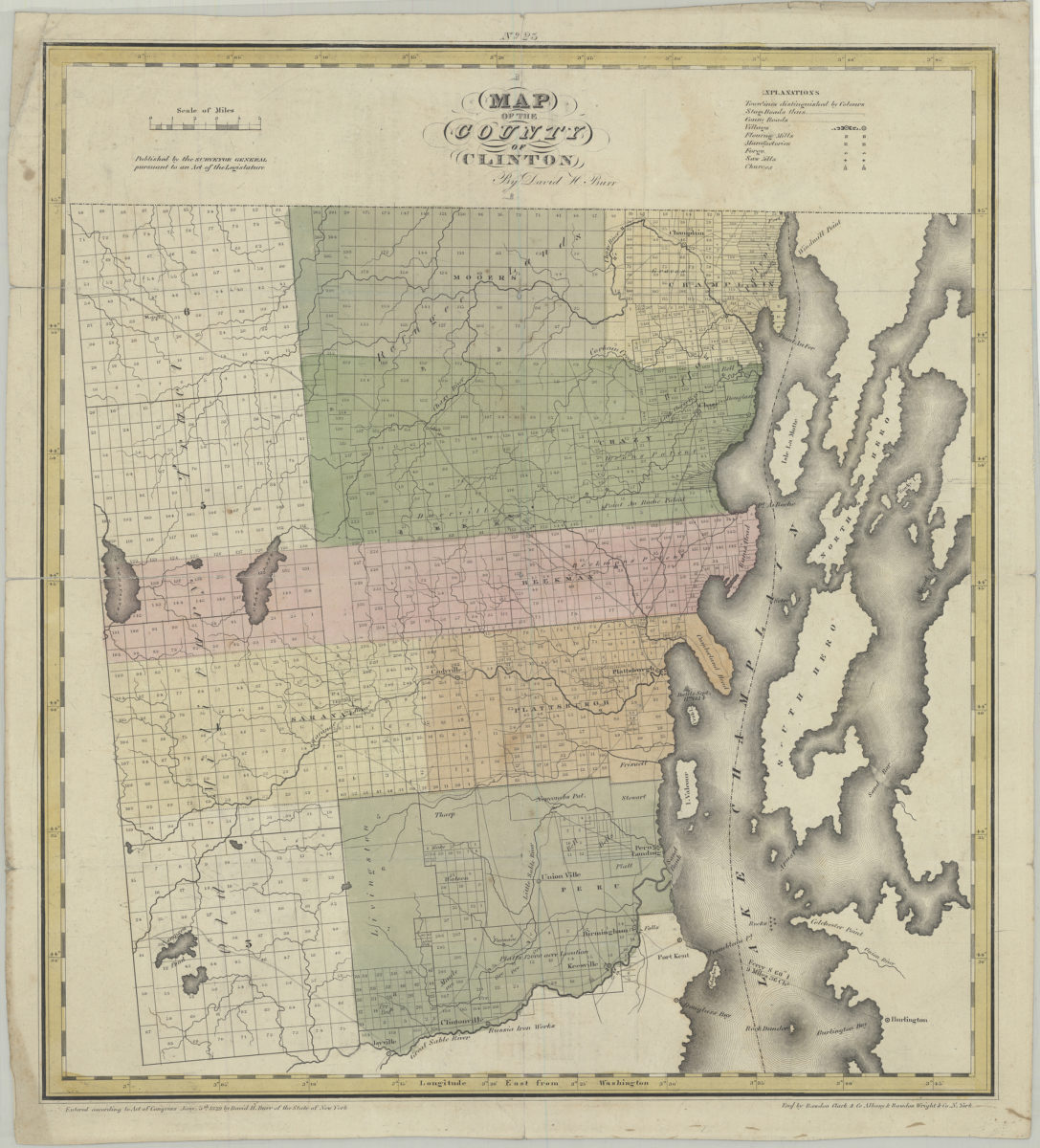
Map of the county of Clinton: by David H. Burr [1829]
Map No. NYS-[1829].Fl
Shows town lines, stage roads, county roads, flouring mills, factories, forges, saw mills, churches, parcels, and landowners. Likely extracted from: Burr, David H., 1803-1875. An atlas of the state of New York. New York : David H. Burr, 1829. Prime meridian: Washington, D.C. “Published … pursuant to an Act of the Legislature.” “Entered according to Act of Congress Jany. 5th 1829 by David H. Burr of the State of New York.” “Engd. by Rawdon Clark & Co. Albany & Rawdon Wright & Co. N. York.” Includes key. On verso: Text and statistics for Clinton County. “No. 25”–Upper center margin.
Map area shown
Genre
Cadastral mapsRelation
Full catalog recordSize
47 × 43 cmDownload
Low Resolution Image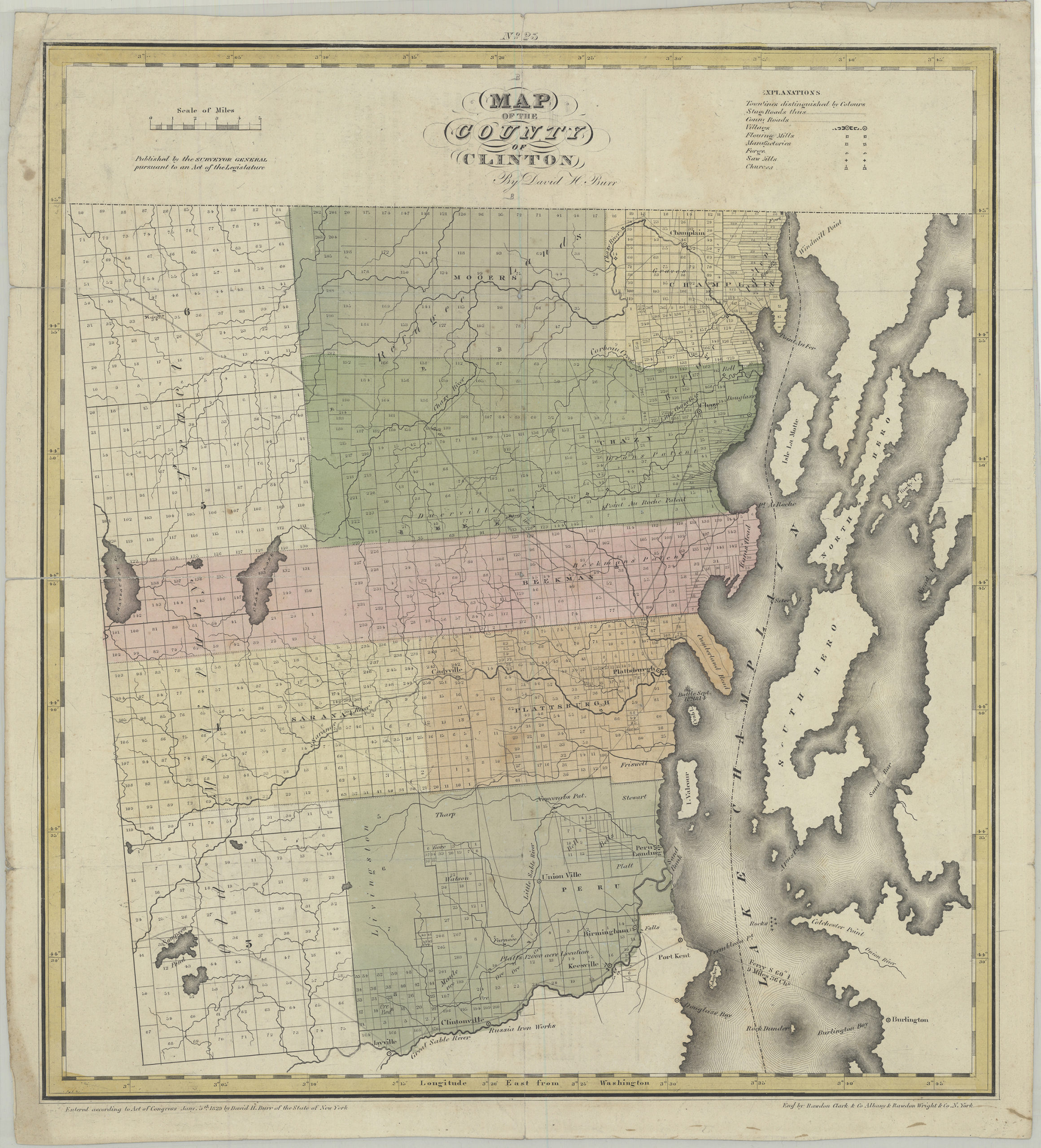
Creator
Burr, David H.,Publisher
Brooklyn Historical SocietyCitation
Map of the county of Clinton: by David H. Burr; [1829], Map Collection, NYS-[1829].Fl; Brooklyn Historical Society.Scale
Scale [ca. 1:160,914]Loading zoom image...