Map of the county of Oswego: by David H. Burr 1840
Map No. NYS-1840.Fl
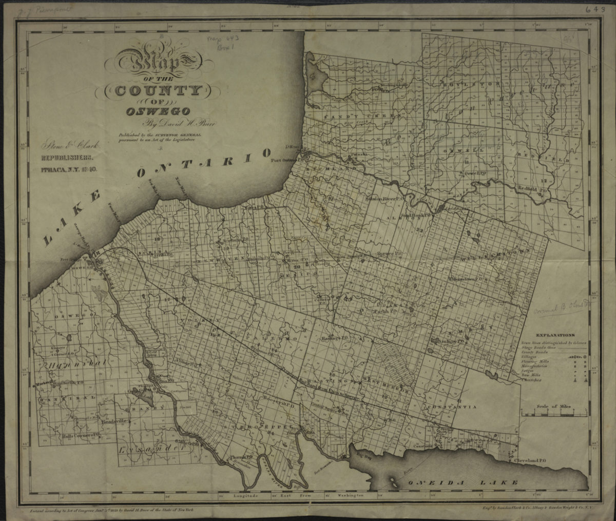
Shows towns, stage and county roads, flour mills, factories, forges, saw mills, and churches. Prime meridian: Washington. Includes key. BHS copy imperfect missing portion of upper center margin, obscurring some text.
Places
Map area shown
Genre
MapRelation
Full catalog recordSize
36 × 43 cmDownload
Low Resolution Image
Creator
Burr, David H.,Publisher
Brooklyn Historical SocietyCitation
Map of the county of Oswego: by David H. Burr; 1840, Map Collection, NYS-1840.Fl; Brooklyn Historical Society.Scale
Scale [ca. 1:163,510]Loading zoom image...