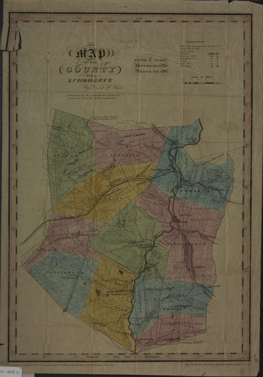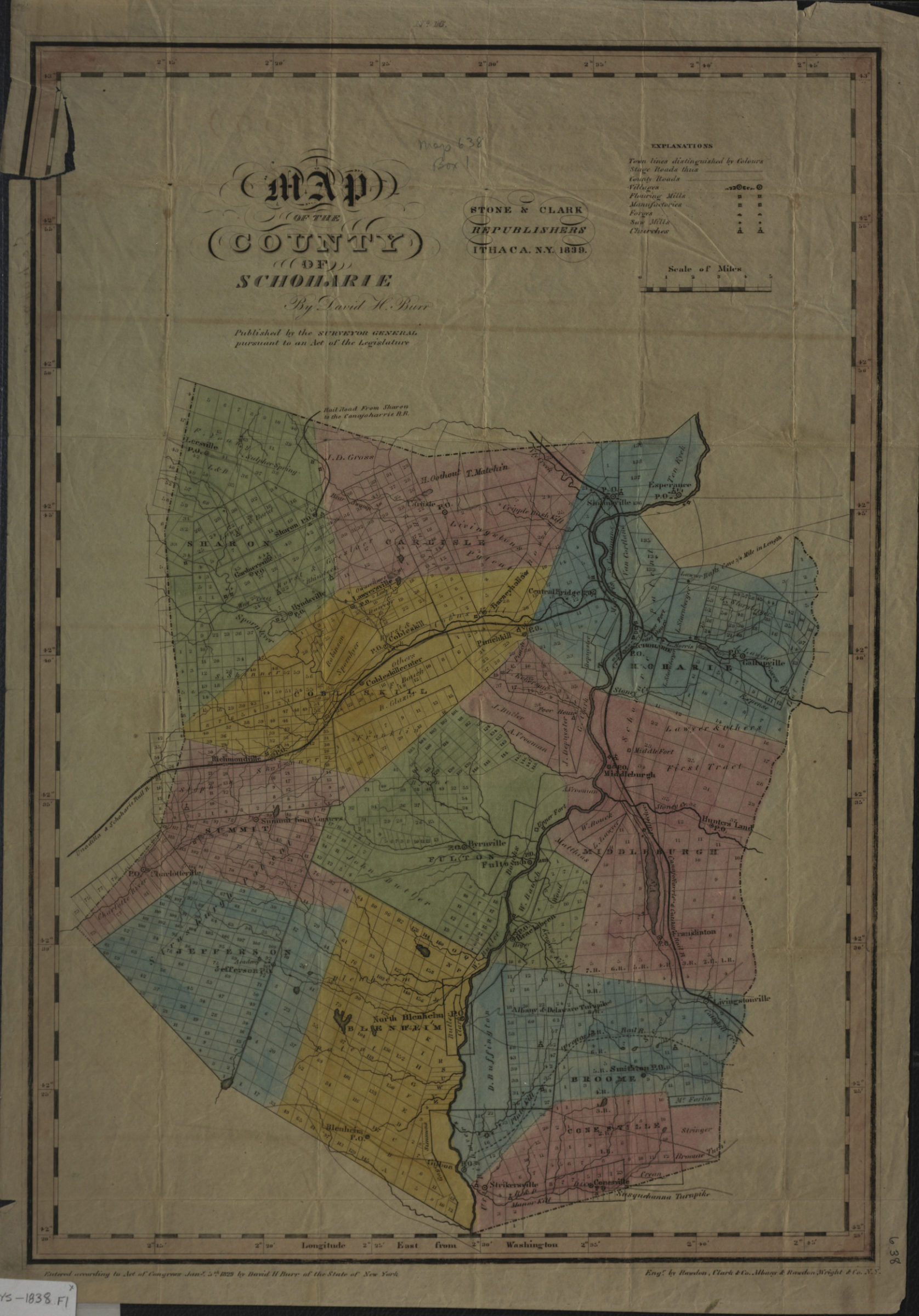
Map of the county of Schoharie: by David H. Burr 1839
Map No. NYS-1838.Fl
Shows railroads, town lines, stage roads, county roads, flouring mills, factories, forges, saw mills, churches, parcels, and names of landowners. Prime meridian: Washington, D.C. “No. 16”–Upper center margin.
Map area shown
Genre
Cadastral mapsRelation
Full catalog recordSize
47 × 32 cmDownload
Low Resolution Image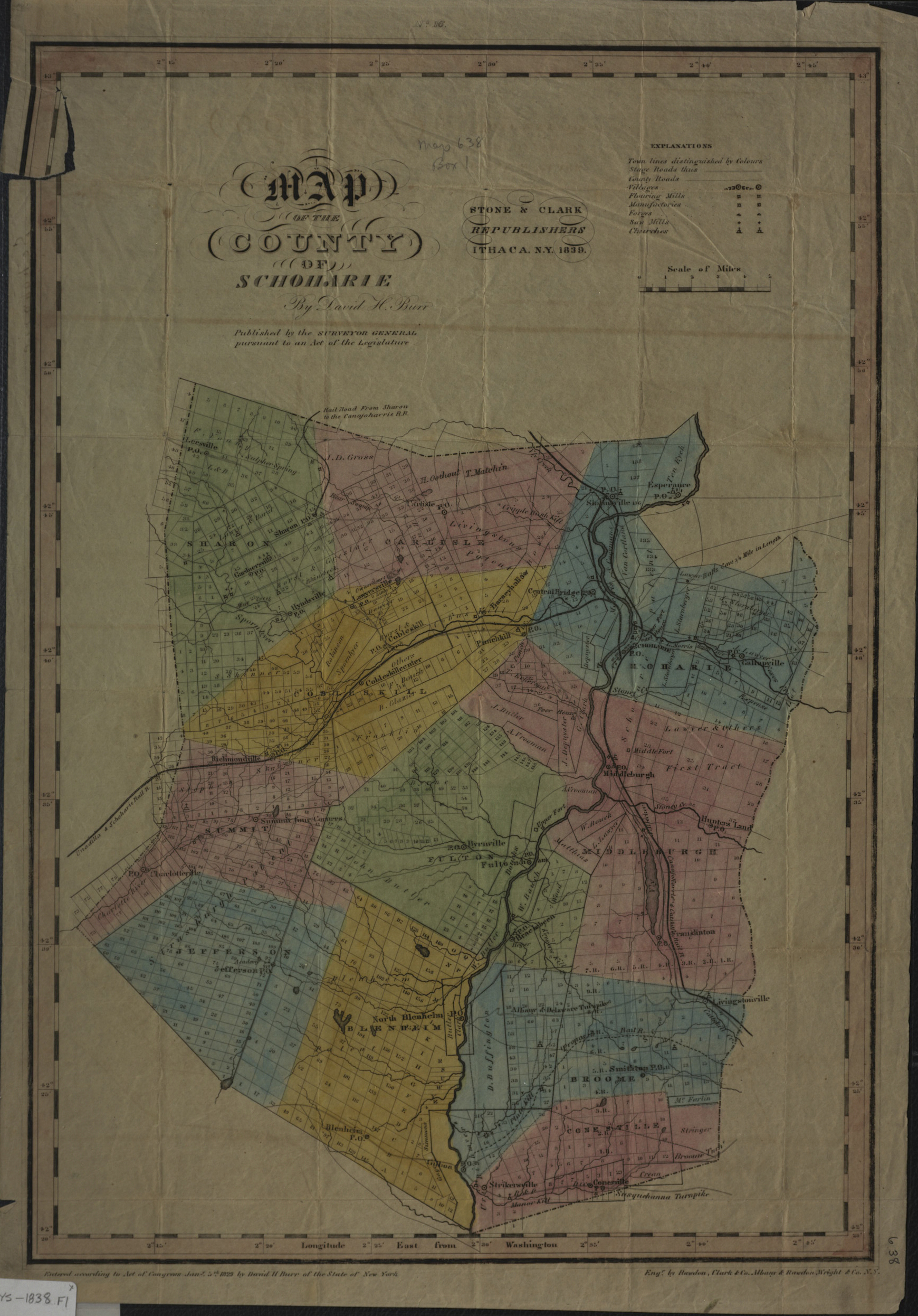
Creator
Burr, David H.,Publisher
Brooklyn Historical SocietyCitation
Map of the county of Schoharie: by David H. Burr; 1839, Map Collection, NYS-1838.Fl; Brooklyn Historical Society.Scale
Scale [ca. 1:158,400]Loading zoom image...