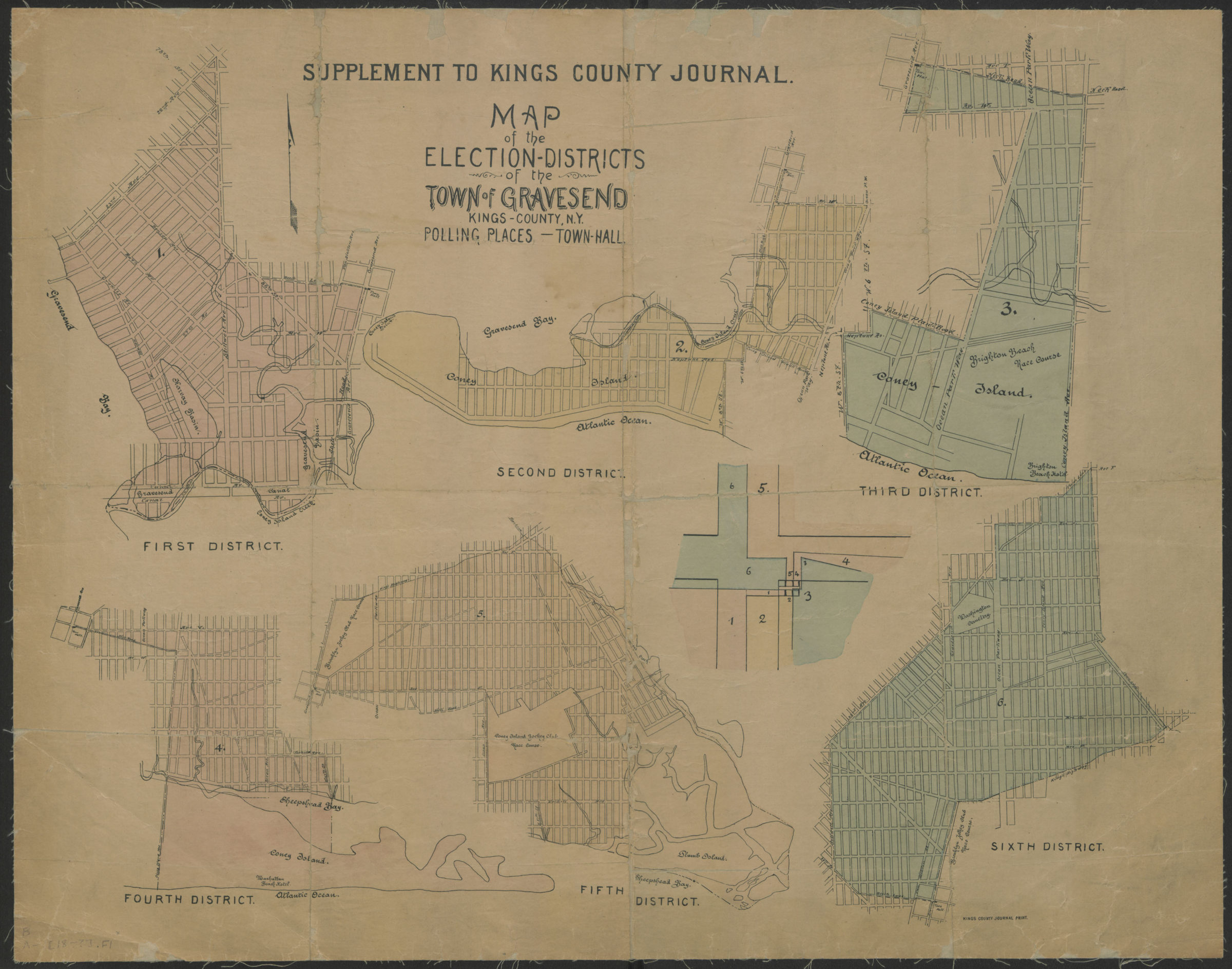
Map of the election districts of the Town of Gravesend, Kings County, N.Y., polling places, Town Hall [18??]
Map No. B A-[18--?].Fl
Political maps showing election districts, polling places, and Town Halls in Gravsend. Covers Coney Island and portions of Sheepshead Bay and Brighton Beach. Also shows roads, cemeteries, hotels, race courses, and basins. Includes index map. “Kings County Journal Print.” First District. Second District. Third District. Fourth District. Fifth District. Sixth District. [Index map].
Subjects
Places
Map area shown
Relation
Full catalog recordSize
55 × 71 cmDownload
Low Resolution Image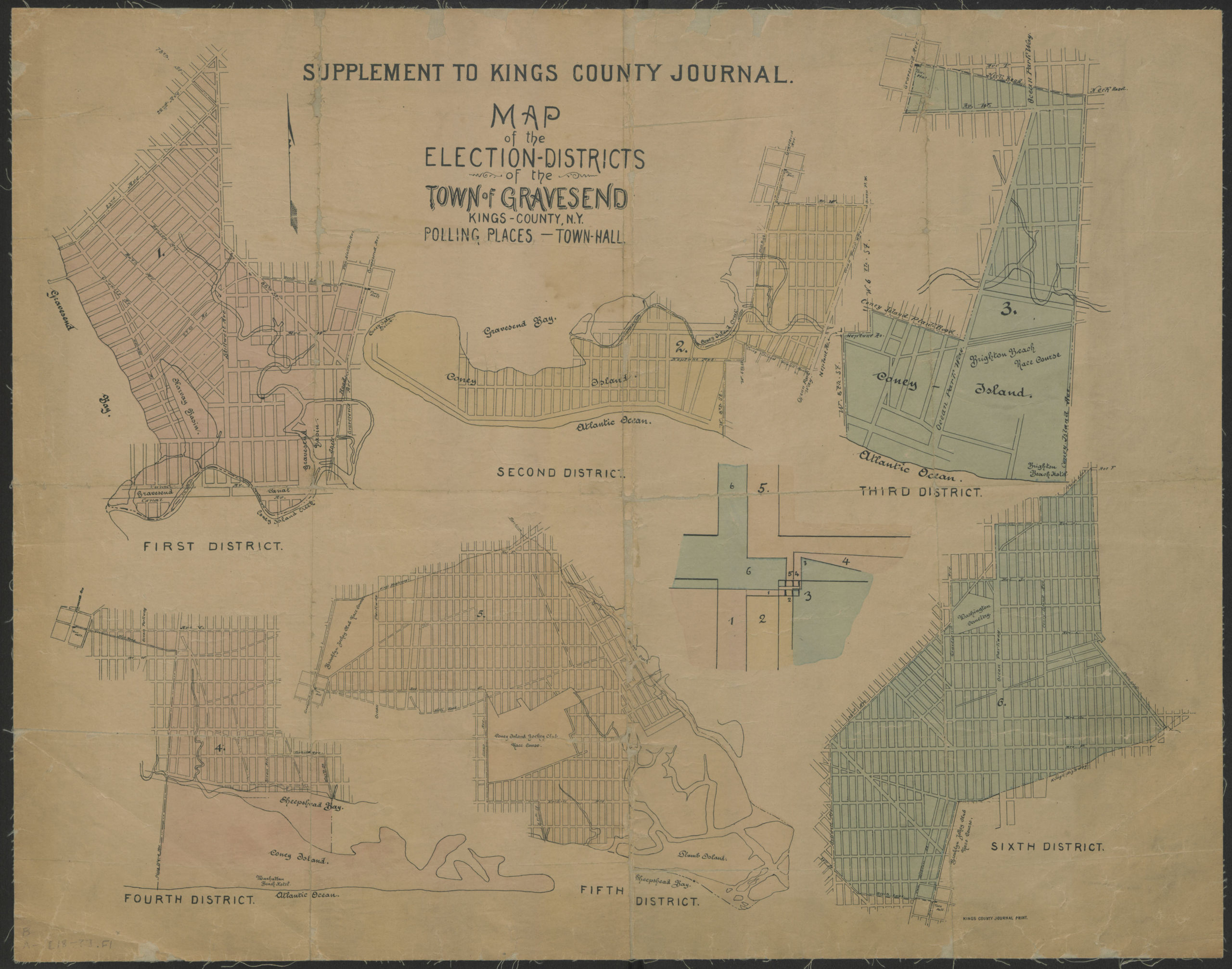
Creator
Publisher
Brooklyn Historical SocietyCitation
Map of the election districts of the Town of Gravesend, Kings County, N.Y., polling places, Town Hall; [18??], Map Collection, B A-[18--?].Fl; Brooklyn Historical Society.Scale
Scale not givenLoading zoom image... 