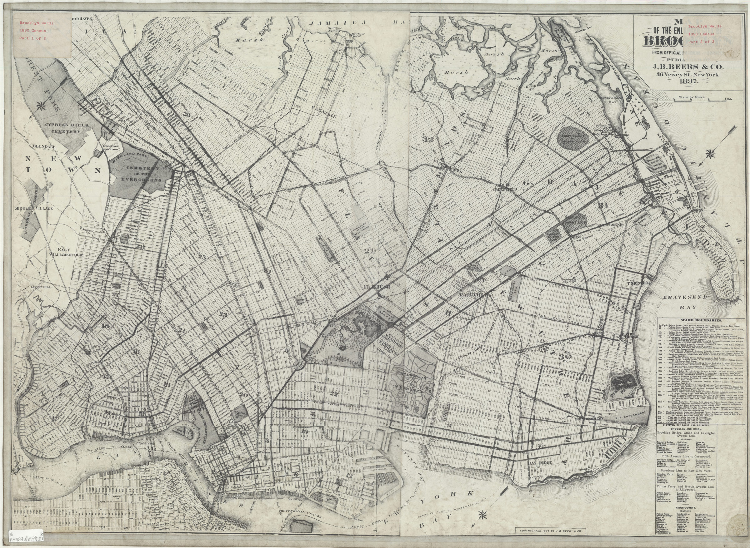
Map of the enlarged city of Brooklyn from official records and surveys: published by J.B. Beers & Co 1897
Map No. B A-1897 (19--?).Fl
Covers the entirety of Brooklyn as well as a portion of Queens and Lower Manhattan. Shows wards, piers, and ferry lines. Photostat. Oriented with north to lower left corner. Includes listing of ward boundaries and elevated railroad stations. “Copyrighted 1897 by J.B. Beers & Co.”
Map area shown
Genre
MapRelation
Full catalog recordSize
58 × 81 cmDownload
Low Resolution Image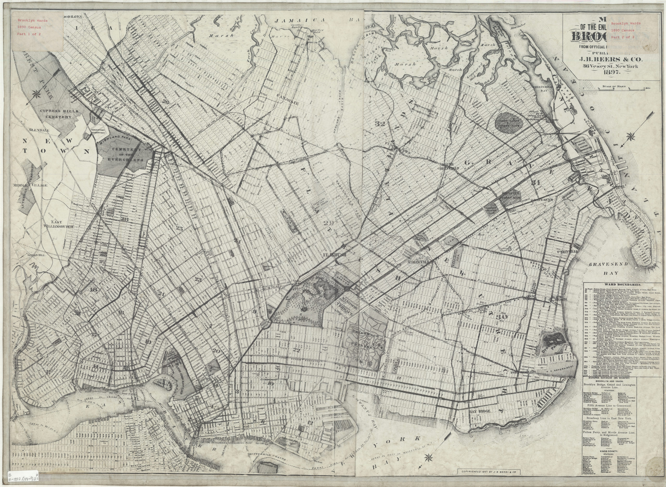
Creator
J.B. Beers & Co.,Publisher
Brooklyn Historical SocietyCitation
Map of the enlarged city of Brooklyn from official records and surveys: published by J.B. Beers & Co; 1897, Map Collection, B A-1897 (19--?).Fl; Brooklyn Historical Society.Scale
Scale [ca. 1:21,000]Loading zoom image... 