
Map of the enlarged city of Brooklyn: from official records and surveys 1894
Map No. B A-1894.Fl;B A-1894.Fl c.2
Covers the entirety of Brooklyn as well as a portion of Queens and Lower Manhattan. Shows wards, piers, and ferry lines. Oriented with north to the lower left. “Copyrighted 1894 by J.B. Beers & Co.” Includes listing of ward boundaries and elevated railroad stations. BHS has 2 copies.
Map area shown
Genre
MapRelation
Full catalog recordSize
67 × 94 cmDownload
Low Resolution Image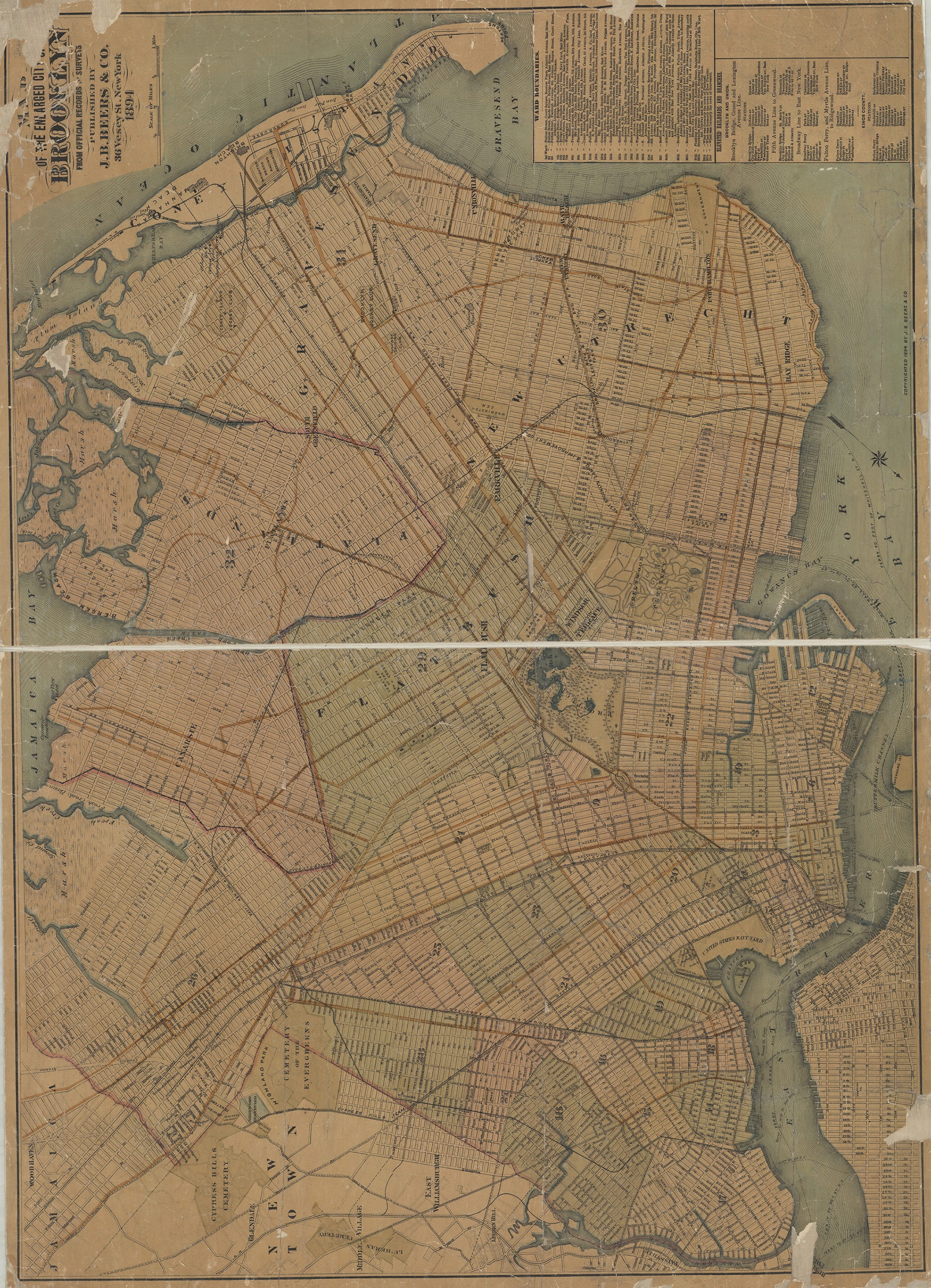
Creator
J.B. Beers & Co.,Publisher
Brooklyn Historical SocietyCitation
Map of the enlarged city of Brooklyn: from official records and surveys; 1894, Map Collection, B A-1894.Fl;B A-1894.Fl c.2; Brooklyn Historical Society.Scale
Scale [ca. 1:16,896]Loading zoom image... 