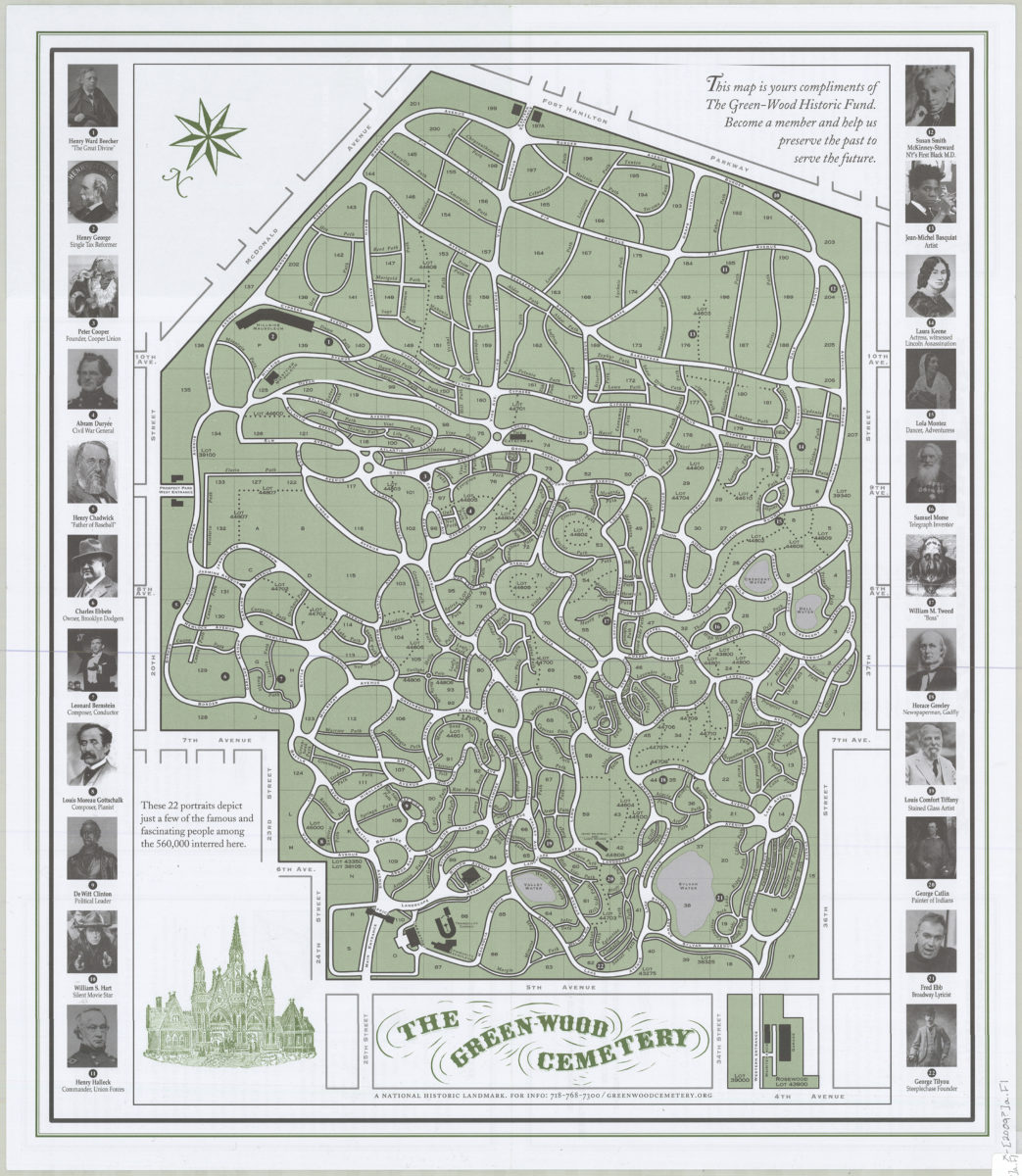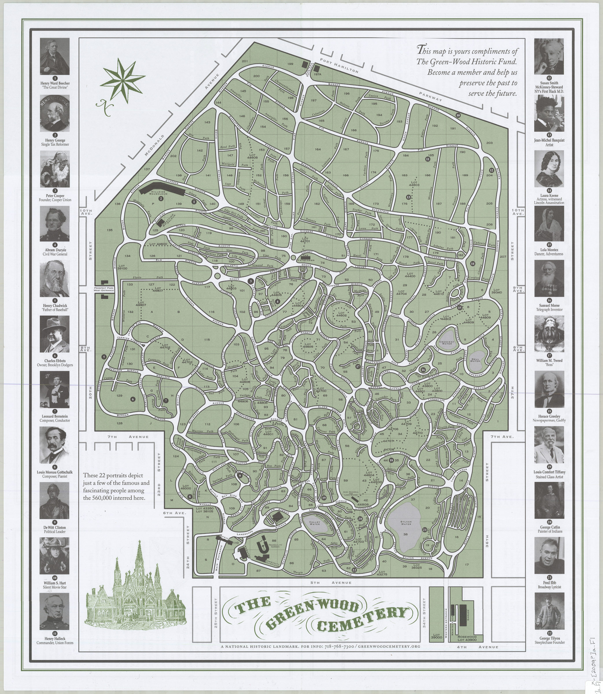
Map of the Green-Wood Cemetery: a National Historic Landmark founded 1838, Brooklyn, New York [2009]
Map No. B A-[2009?]a.Fl c.2;B A-[2009?]a.Fl
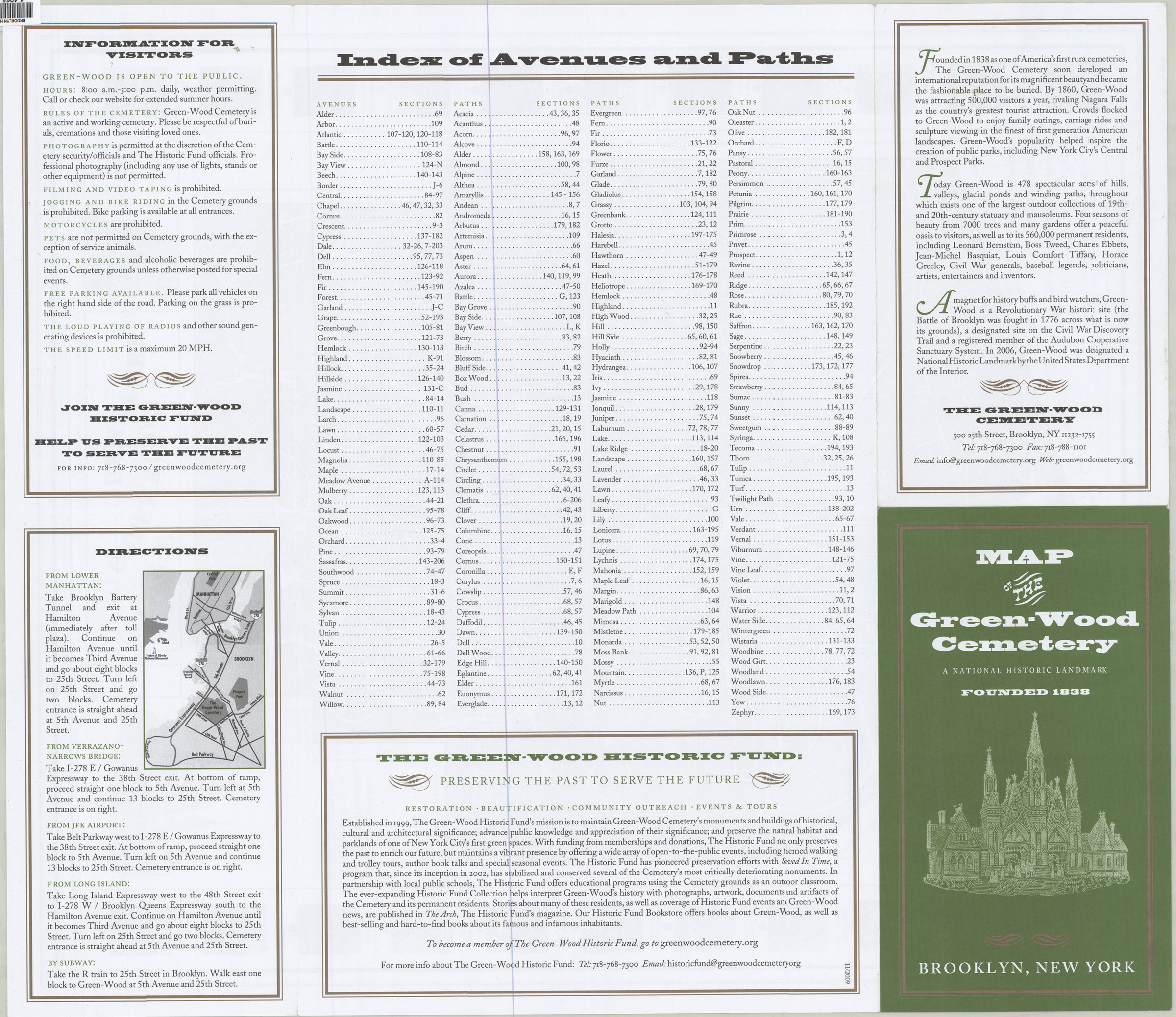
Shows roads, ponds and other features. Panel title. Oriented with north to the upper right. Also issued in smaller (29 x 21 cm) version. Includes portraits of 22 people of historical significance and the places of burial for each. On verso: index, information for visitors and map for directions to Green-Wood Cemetery. BHS copy 2 originally part of the collection of Everett and Evelyn Ortner papers and photographs (ARC.306).
Map area shown
Genre
Tourist mapsRelation
Full catalog recordSize
65 × 56 cmDownload
Low Resolution Image
Creator
Green-Wood Historic Fund,Publisher
Brooklyn Historical SocietyCitation
Map of the Green-Wood Cemetery: a National Historic Landmark founded 1838, Brooklyn, New York; [2009], Map Collection, B A-[2009?]a.Fl c.2;B A-[2009?]a.Fl; Brooklyn Historical Society.Scale
Scale not givenLoading zoom image...