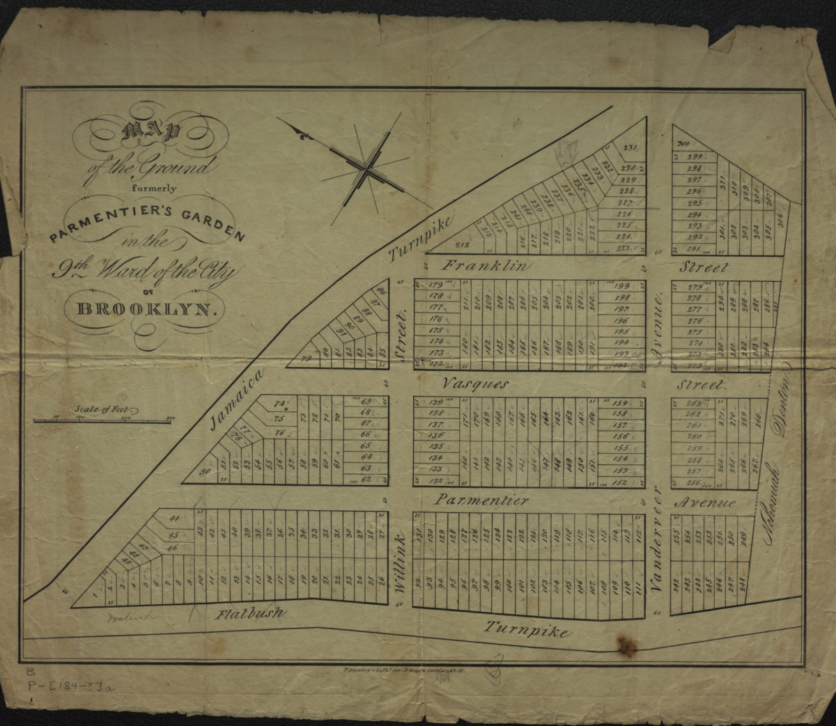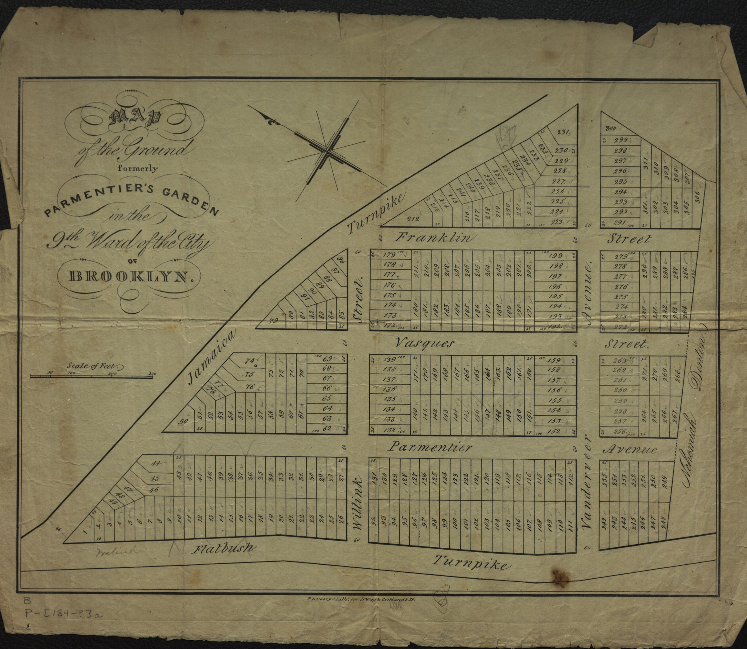
Map of the ground formerly Parmentier’s Garden in the 9th Ward of the city of Brooklyn [184?]
Map No. B P-[184-?]a.Fl
Cadastral map covering area bounded by the Flatbush Turnpike, the Jamaica Turnpike, and Vanderveer Ave. (modern-day Fort Greene). Shows property (including lot numbers and dimensions), and names of landowners. Oriented with north to the upper left. BHS copy annotated in gray pencil.
Map area shown
Genre
Cadastral mapsRelation
Full catalog recordSize
28 × 39 cmDownload
Low Resolution ImageCreator
Desobry, Prosper,Publisher
Brooklyn Historical SocietyCitation
Map of the ground formerly Parmentier’s Garden in the 9th Ward of the city of Brooklyn; [184?], Map Collection, B P-[184-?]a.Fl; Brooklyn Historical Society.Scale
Scale [ca. 1:1,340]Loading zoom image...