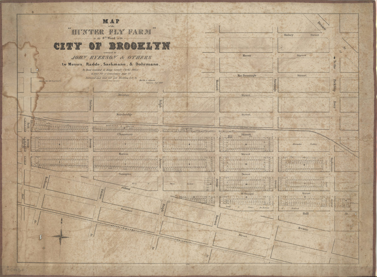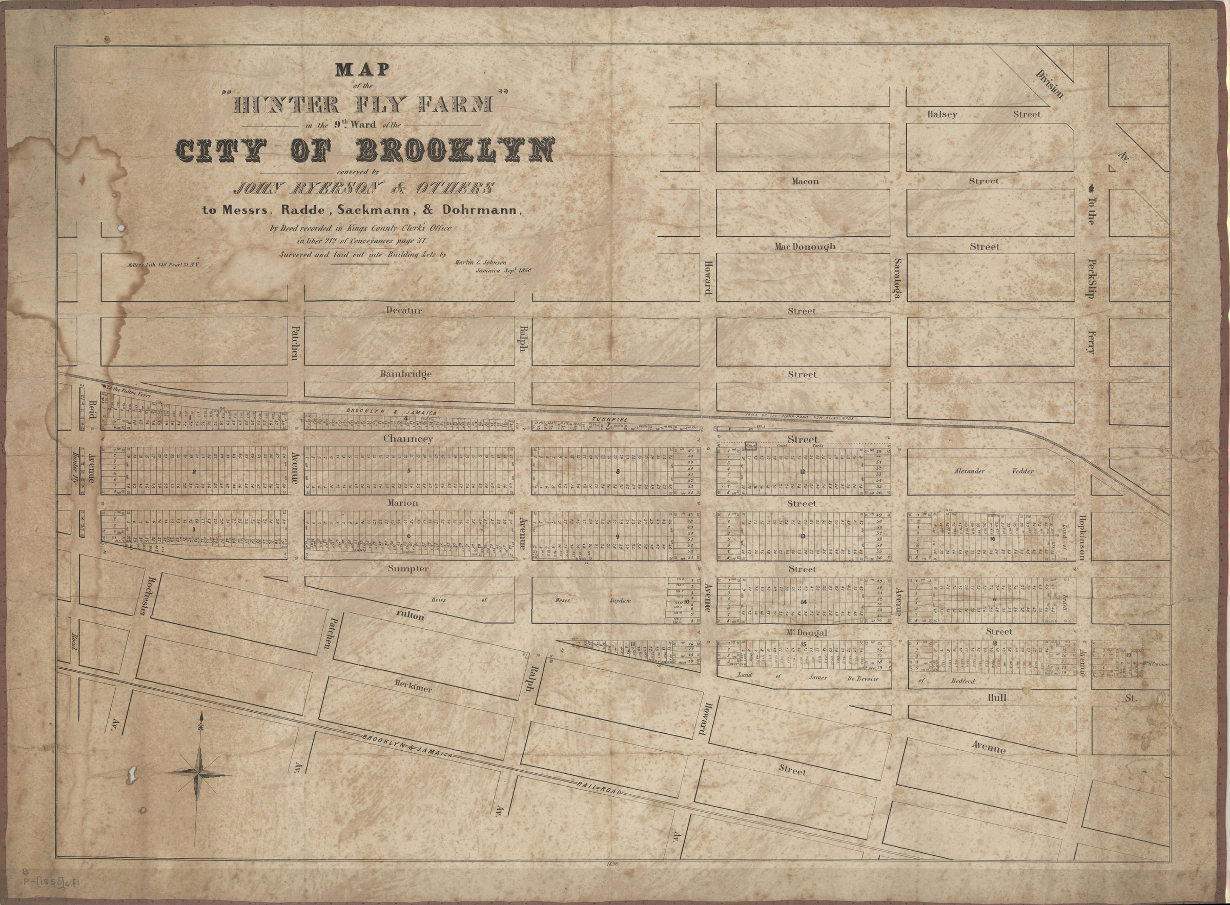
Map of the “Hunter Fly Farm” in the 9th ward of the city of Brooklyn: conveyed by John Ryerson & others to Messrs. Radde, Sackmann, & Dohrmann, by deed recorded in Kings County Clerk’s Office in liber 212 of conveyances page 31 [1850]
Map No. B P-[1850]c.Fl
Cadastral map covering present-day Brooklyn from Hunter Fly Road to Hopkinson Avenue, and Halsey Street to Herkimer Street. Shows lots for area between Reid and Hopkinson avenues and between Bainbridge and Fulton streets. Also shows lot numbers and dimensions, names of property owners, and Brooklyn and Jamaica Railroad. This area is predominantly within today’s Bedford-Stuyvesant neighborhood. “1690”–Center, lower margin. BHS copy mounted on linen with brown fabric border.
Map area shown
Genre
Cadastral mapsRelation
Full catalog recordSize
53 × 72 cmDownload
Low Resolution Image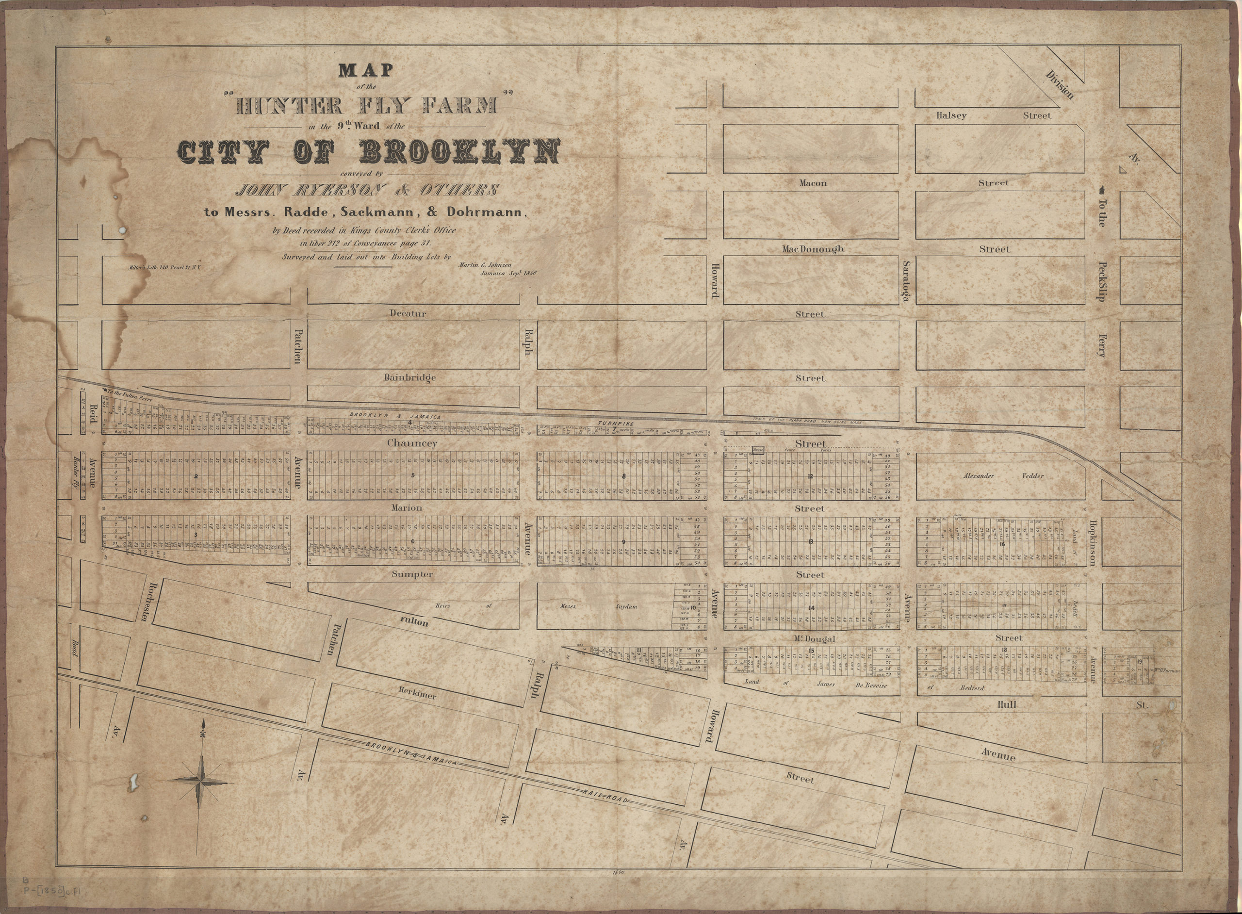
Creator
Johnson, Martin G.,Publisher
Brooklyn Historical SocietyCitation
Map of the “Hunter Fly Farm” in the 9th ward of the city of Brooklyn: conveyed by John Ryerson & others to Messrs. Radde, Sackmann, & Dohrmann, by deed recorded in Kings County Clerk’s Office in liber 212 of conveyances page 31; [1850], Map Collection, B P-[1850]c.Fl; Brooklyn Historical Society.Scale
Scale not givenLoading zoom image...