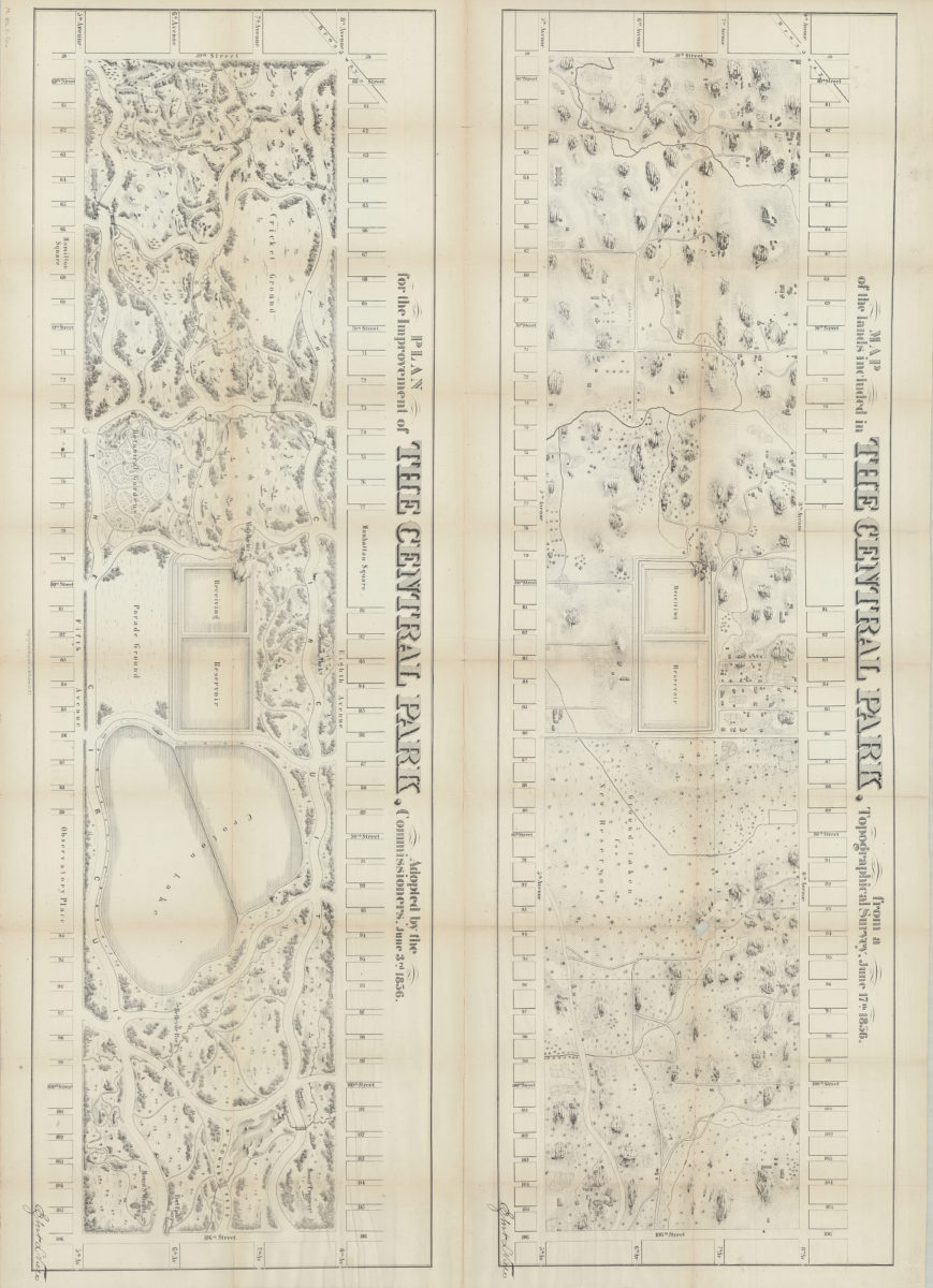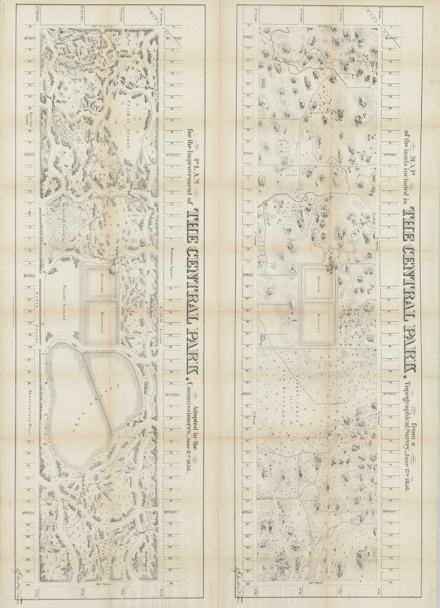
Map of the lands included in the Central Park, from a topographical survey, June 17th, 1856 ; Plan for the improvement of the Central Park, adopted by the Commissioners, June 3rd, 1856 [1856]
Map No. M-1856.Fl.Folio
Maps cover Central Park from 59th St. to 106th St., and 5th Ave. to 8th Ave. Show structures, park roads and paths. Relief shown pictorially and by hachures. Oriented with north to the right.
Map area shown
Relation
Full catalog recordSize
83 × 118 cmDownload
Low Resolution Image
Creator
Viele, Egbert L.,Publisher
Brooklyn Historical SocietyCitation
Map of the lands included in the Central Park, from a topographical survey, June 17th, 1856 ; Plan for the improvement of the Central Park, adopted by the Commissioners, June 3rd, 1856; [1856], Map Collection, M-1856.Fl.Folio; Brooklyn Historical Society.Scale
Scale not givenLoading zoom image...