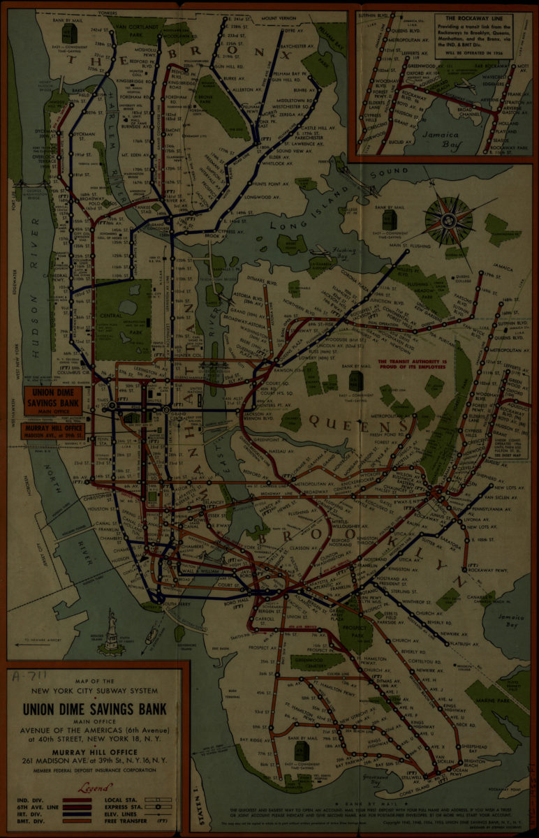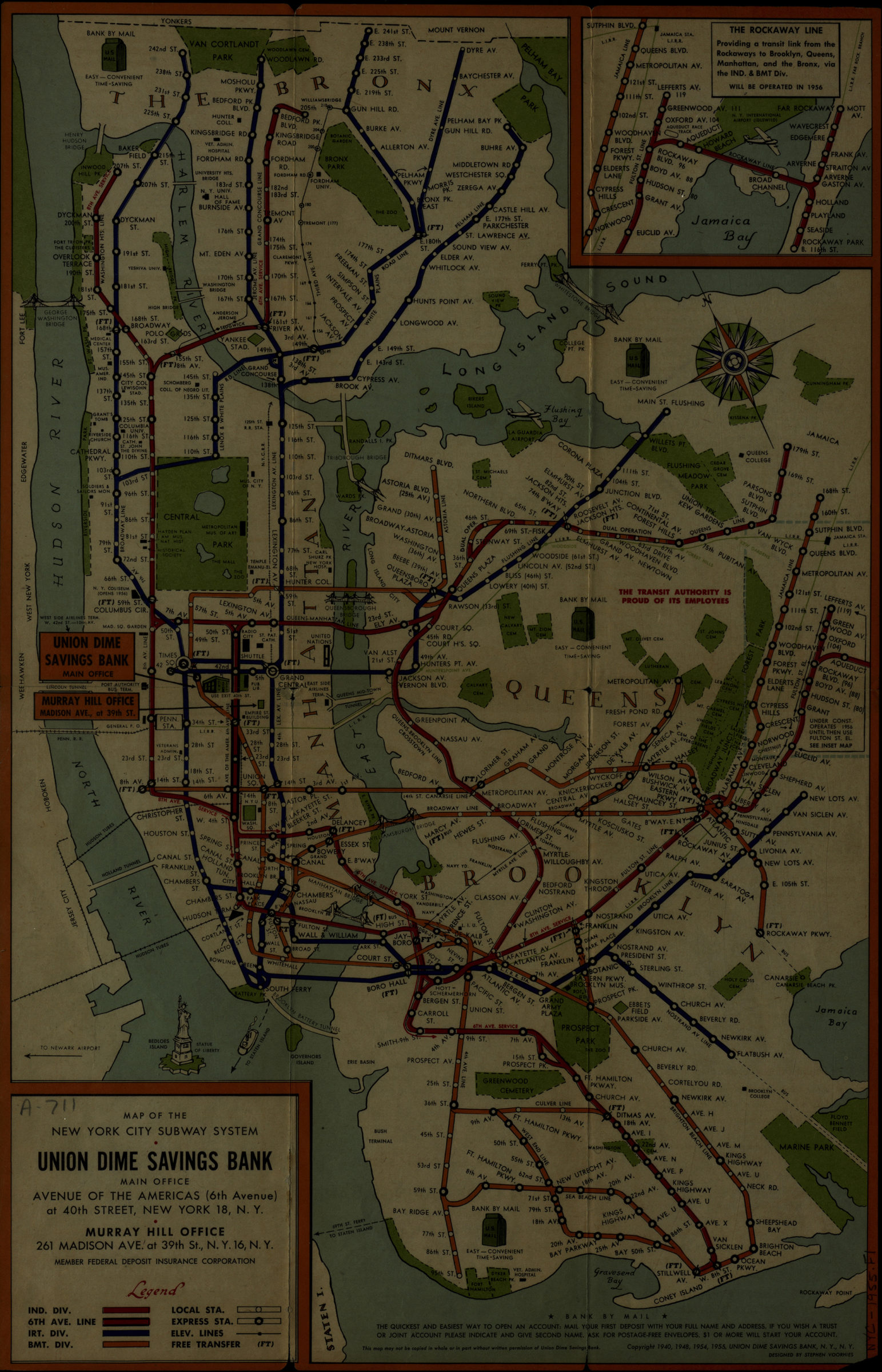

Map of the New York City subway system: designed by Stephen Voorhies [1955; 1955]
Map No. NYC-1955.Fl
Includes inset of the Rockaway Line. On verso: text, house number directory, places to visit, aerial photograph of Manhattan, illustrations and advertising for Union Dime Savings Bank.
Map area shown
Genre
Transportation mapsRelation
Full catalog recordSize
46 × 30 cmDownload
Low Resolution Image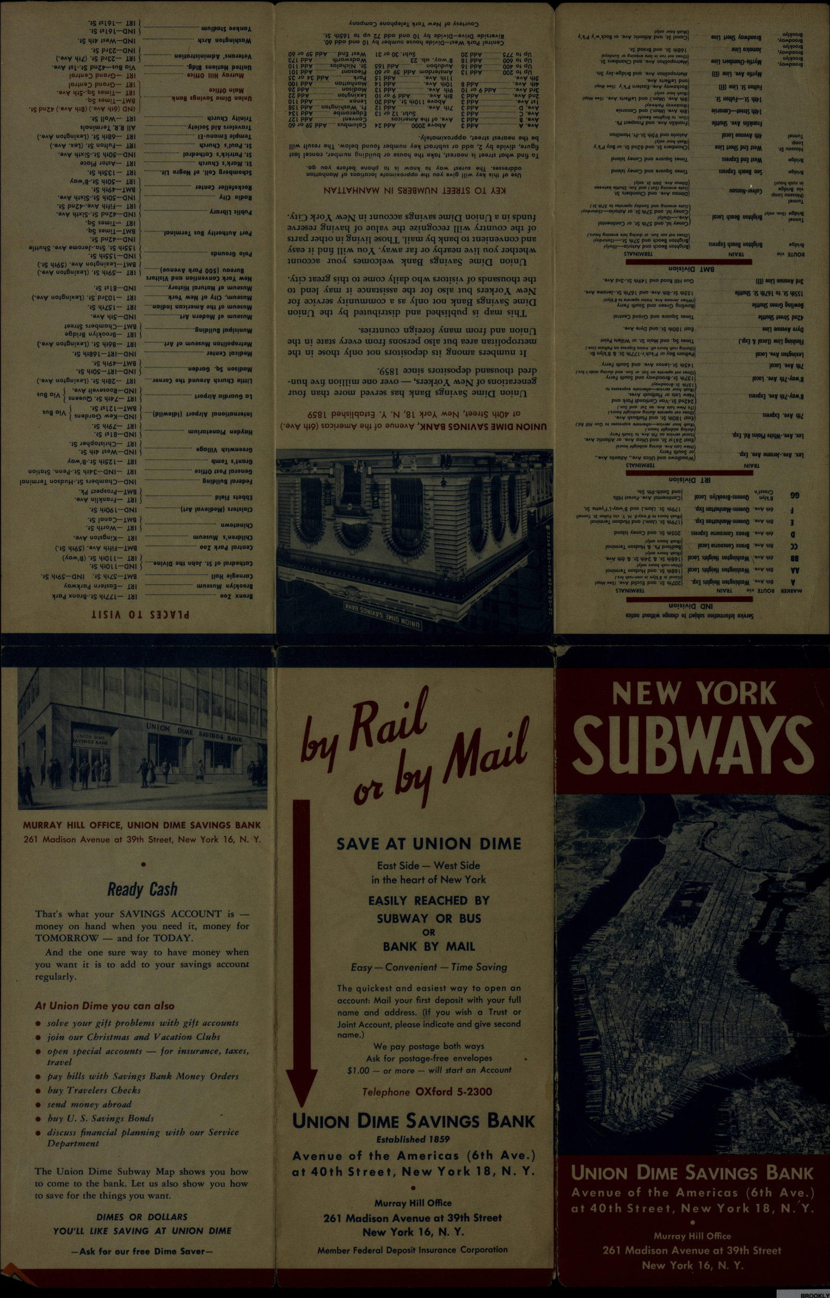
Creator
Voorhies, Stephen J.,Publisher
Brooklyn Historical SocietyCitation
Map of the New York City subway system: designed by Stephen Voorhies; [1955; 1955], Map Collection, NYC-1955.Fl; Brooklyn Historical Society.Scale
Not drawn to scaleLoading zoom image...