Map of the New York World’s Fair with a new transit map of Greater New York: auto routes, places of interest [1939]
Map No. Q-1939.Fl
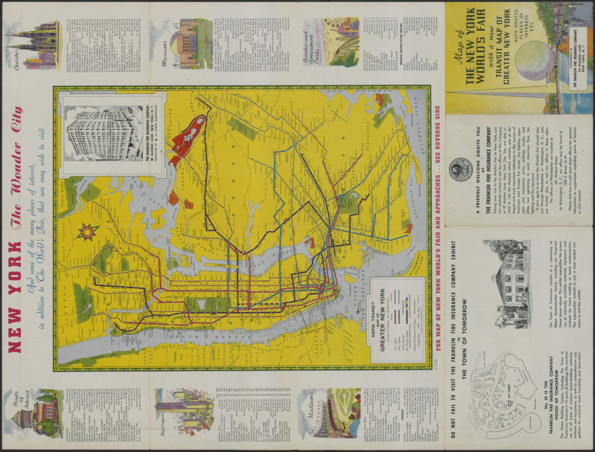
Panel title. Fairgrounds regional map is a bird’s-eye-view showing buildings at the site of the Fair and the surrounding road and rail networks. Fairgrounds view is oriented with north to the upper right. “Approved by New York World’s Fair 1939 Inc.” “N.Y.W.F. License No. 2436.” Fairgrounds map includes a list of “World’s Fair Buildings.” Transit map includes directories, lists of points of interest, skyscrapers, stadiums, churches, museums, and beaches and amusement parks, text about the transit system, advertisement, and col. ill. Map of the New York World’s Fair and approaches. Rapid transit map of Greater New York.
Subjects
Places
Map area shown
Relation
Full catalog recordSize
64 × 48 cmDownload
Low Resolution Image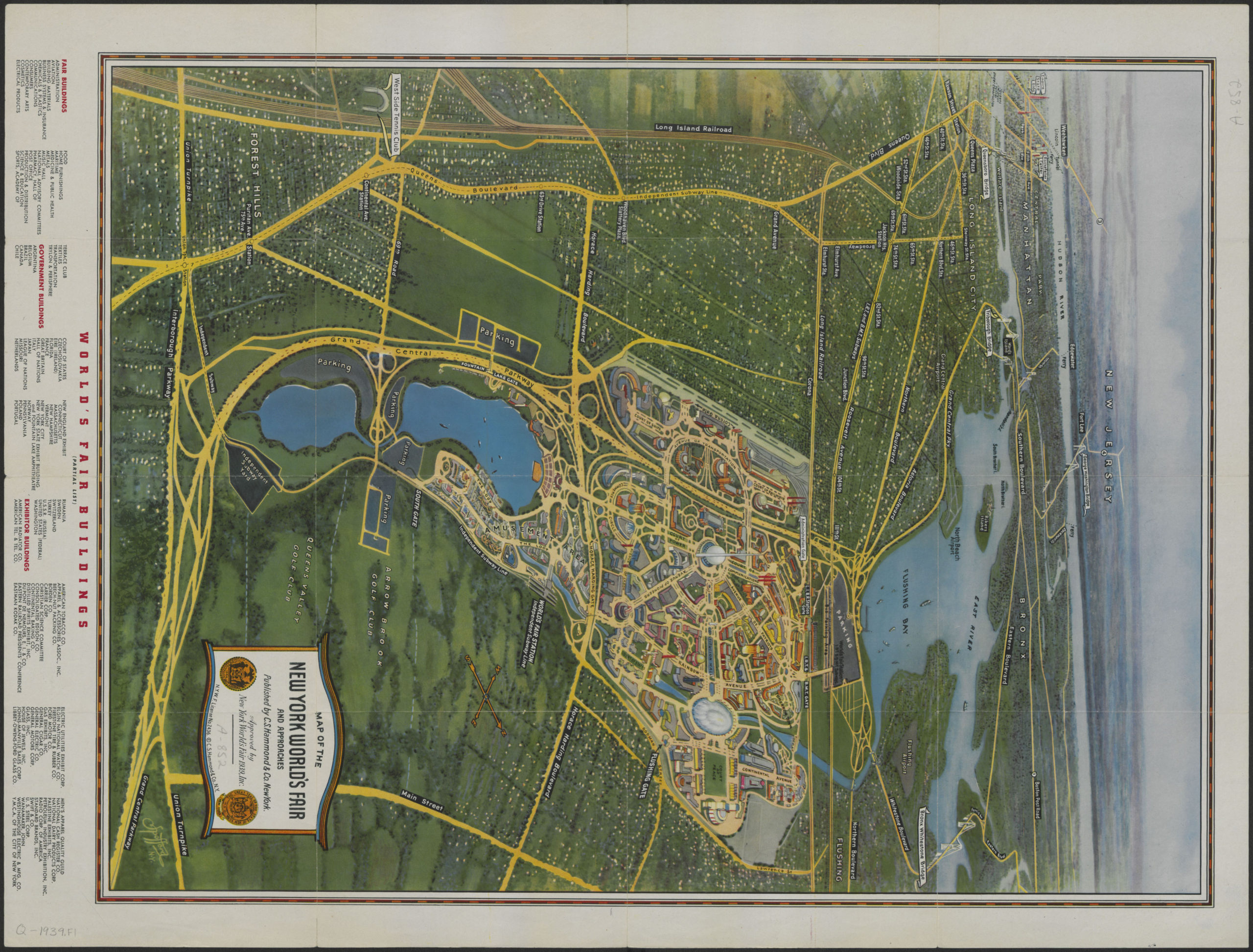
Creator
C.S. Hammond & Company,Publisher
Brooklyn Historical SocietyCitation
Map of the New York World’s Fair with a new transit map of Greater New York: auto routes, places of interest; [1939], Map Collection, Q-1939.Fl; Brooklyn Historical Society.Scale
Not drawn to scaleLoading zoom image...