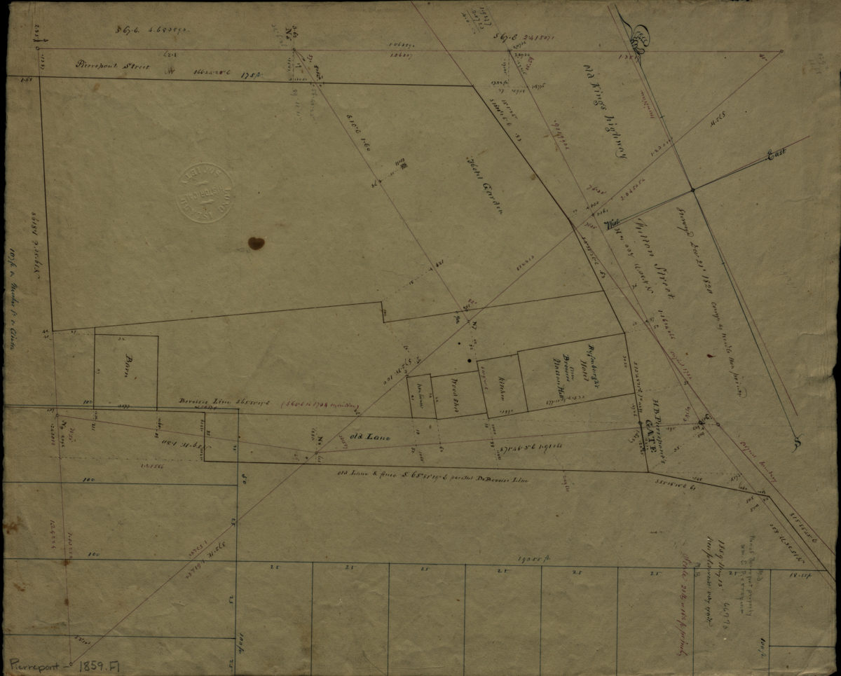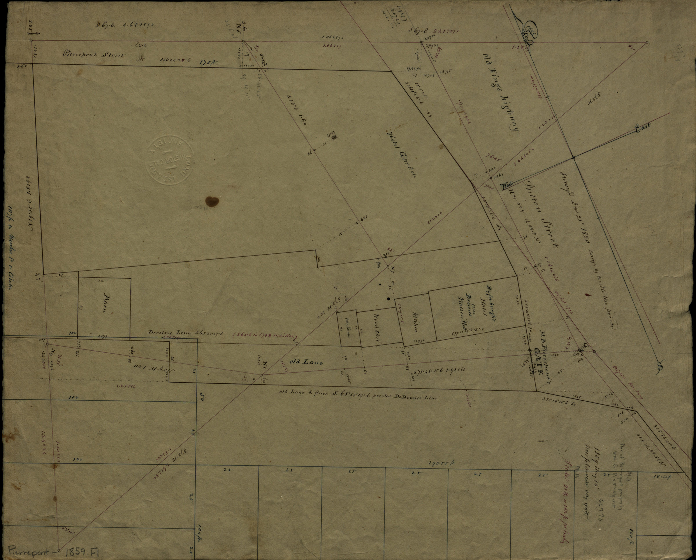


[Map of the Pierrepont Estate, at the intersection of Pierrepont St. and Fulton St.]. May 13, 1859
Map No. Pierrepont-1859.Fl
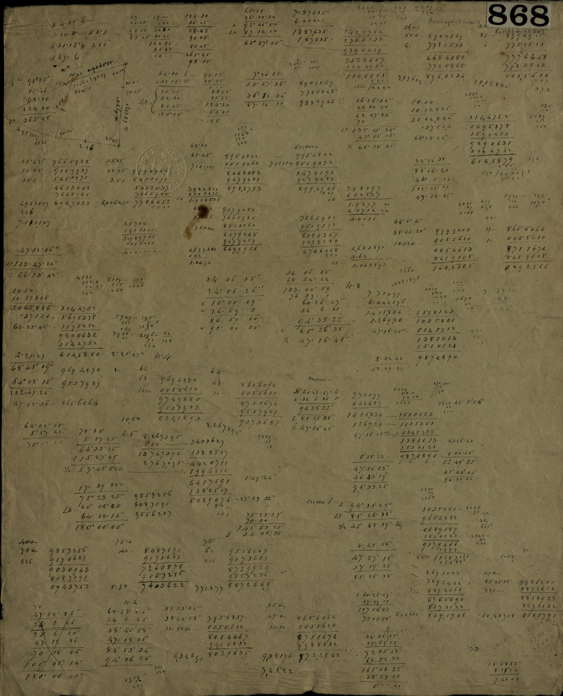
Cadastral map covering area in modern-day Brooklyn Heights. Title devised by cataloger. Likely made by William C. Pierrepont, based on handwriting on piece. Oriented with north to the lower left. Includes measurements and notes. On verso: Calculations.
Subjects
Places
Map area shown
Relation
Full catalog recordSize
42 × 34 cmDownload
Low Resolution Image
Creator
Pierrepont, W. C., Pierrepont, W. C.,Publisher
Brooklyn Historical Society, Brooklyn Historical SocietyCitation
[Map of the Pierrepont Estate, at the intersection of Pierrepont St. and Fulton St.].; May 13, 1859, Map Collection, Pierrepont-1859.Fl; Brooklyn Historical Society.Scale
Scale [1:198] 1 in to 16.Loading zoom image...