Map of the property of the New York Dock Company, Borough of Brooklyn, City of New York [1927]
Map No. B P-[1927?].Fl
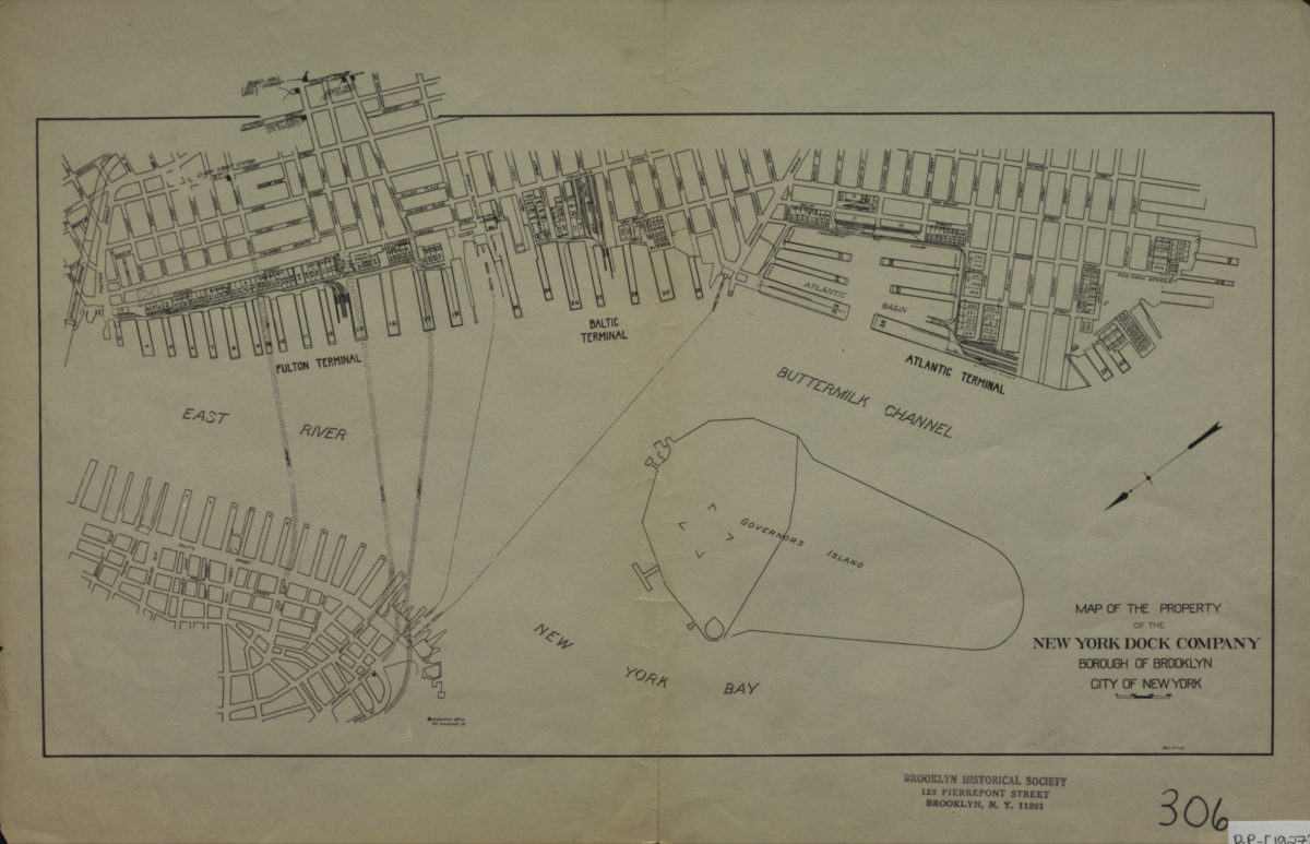
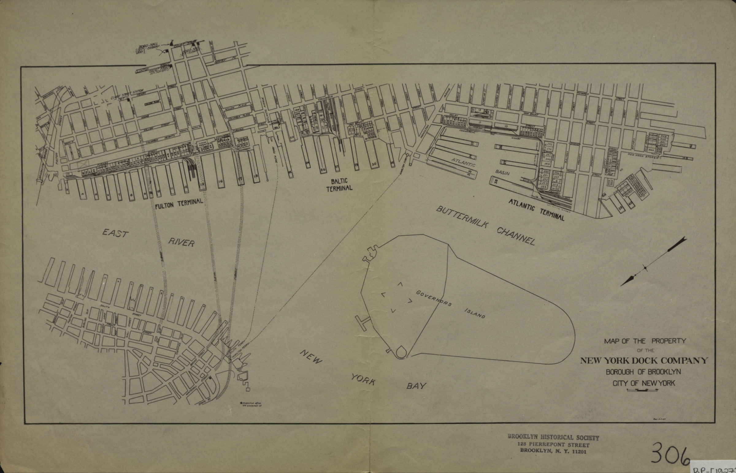
Cadastral map covering Brooklyn waterfront south from Fulton Street to the Red Hook Stores, including Fulton Terminal, Baltic Terminal and Atlantic terminal. Also covers Governors Island and a portion of Lower Manhattan. Shows piers and buildings owned by the New York Dock Company. Oriented with north to the lower left. “Rev. 5-7-27.”
Map area shown
Genre
Cadastral mapsRelation
Full catalog recordSize
23 × 41 cmDownload
Low Resolution Image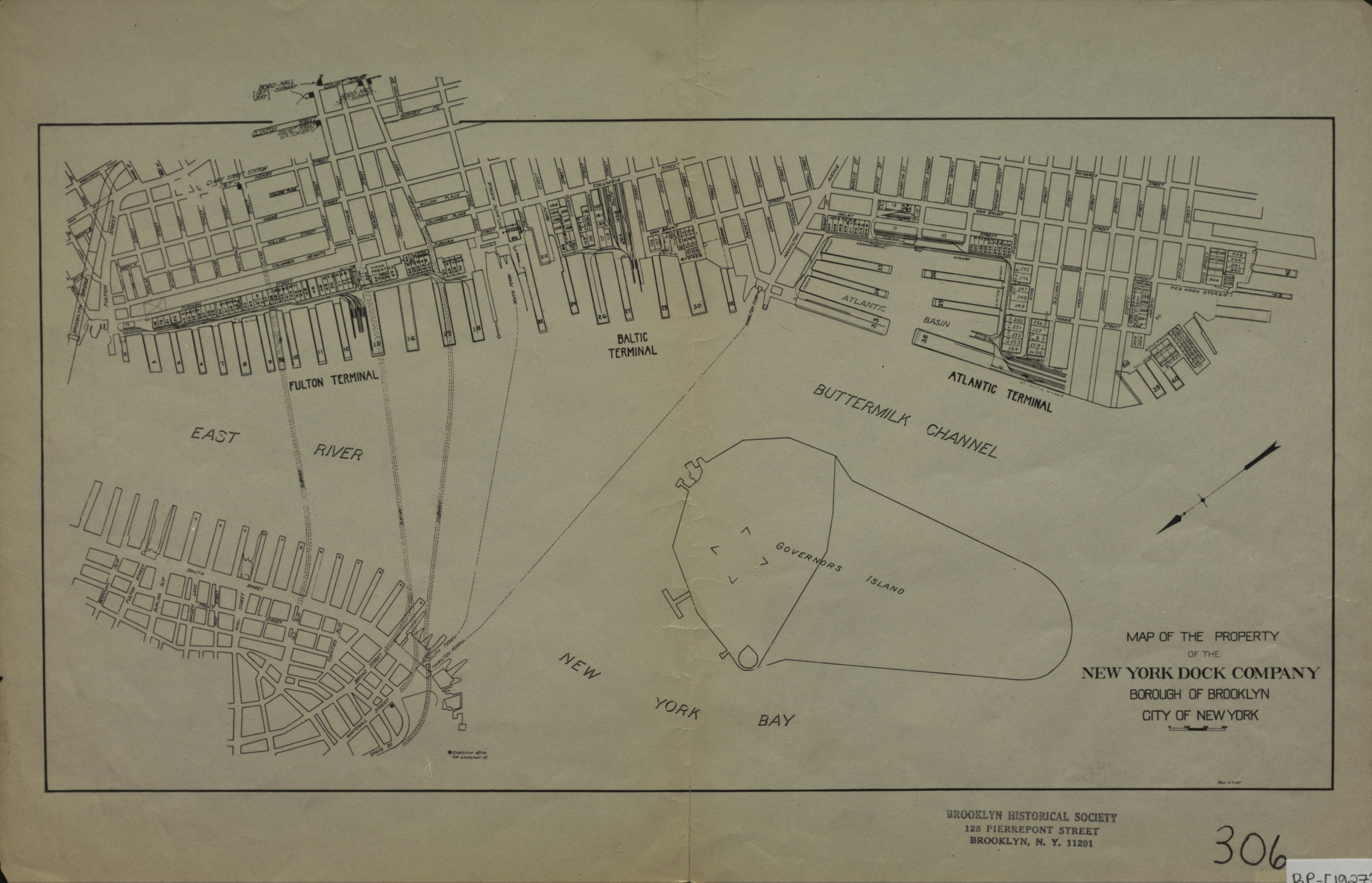
Creator
Publisher
Brooklyn Historical SocietyCitation
Map of the property of the New York Dock Company, Borough of Brooklyn, City of New York; [1927], Map Collection, B P-[1927?].Fl; Brooklyn Historical Society.Scale
Scale not givenLoading zoom image...