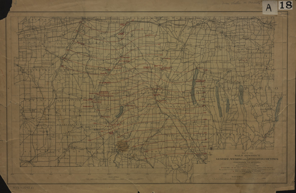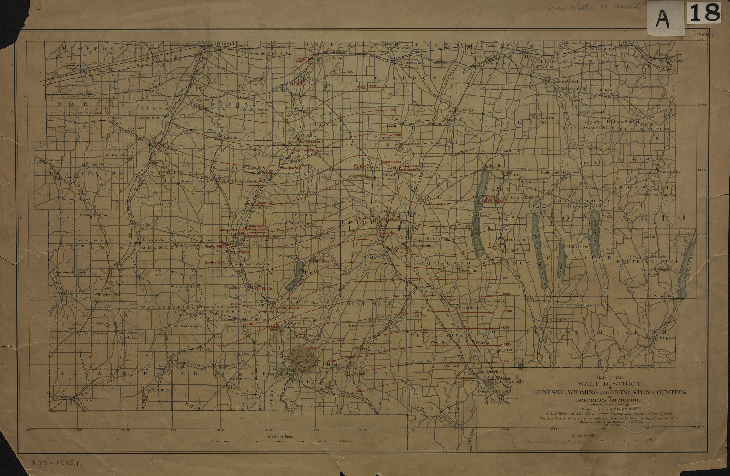
Map of the salt district of Genesee, Wyoming, and Livingston Counties: by Frederick J.H. Merrill ; base map compiled by C.C. Vermeule 1893
Map No. NYS-1893.Fl
Shows salt wells, mines, and beds. Relief shown by contours and spot heights.
Subjects
Places
Map area shown
Genre
Thematic mapsRelation
Full catalog recordSize
31 × 51 cmDownload
Low Resolution Image
Creator
Merrill, Frederick J. H.,Publisher
Brooklyn Historical SocietyCitation
Map of the salt district of Genesee, Wyoming, and Livingston Counties: by Frederick J.H. Merrill ; base map compiled by C.C. Vermeule; 1893, Map Collection, NYS-1893.Fl; Brooklyn Historical Society.Scale
Scale [ca. 1:188,235]Loading zoom image...