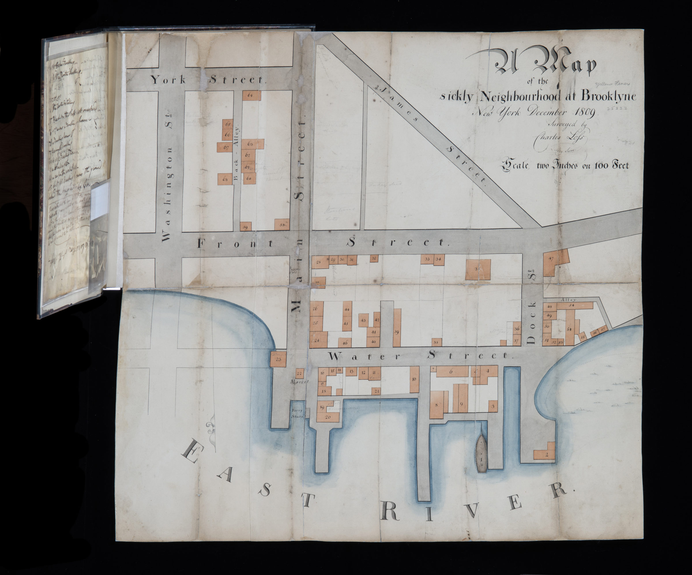
Map of the sickly neighbourhood of Brooklyne: New York December 1809 1809
Map No. B B-1809.Fd
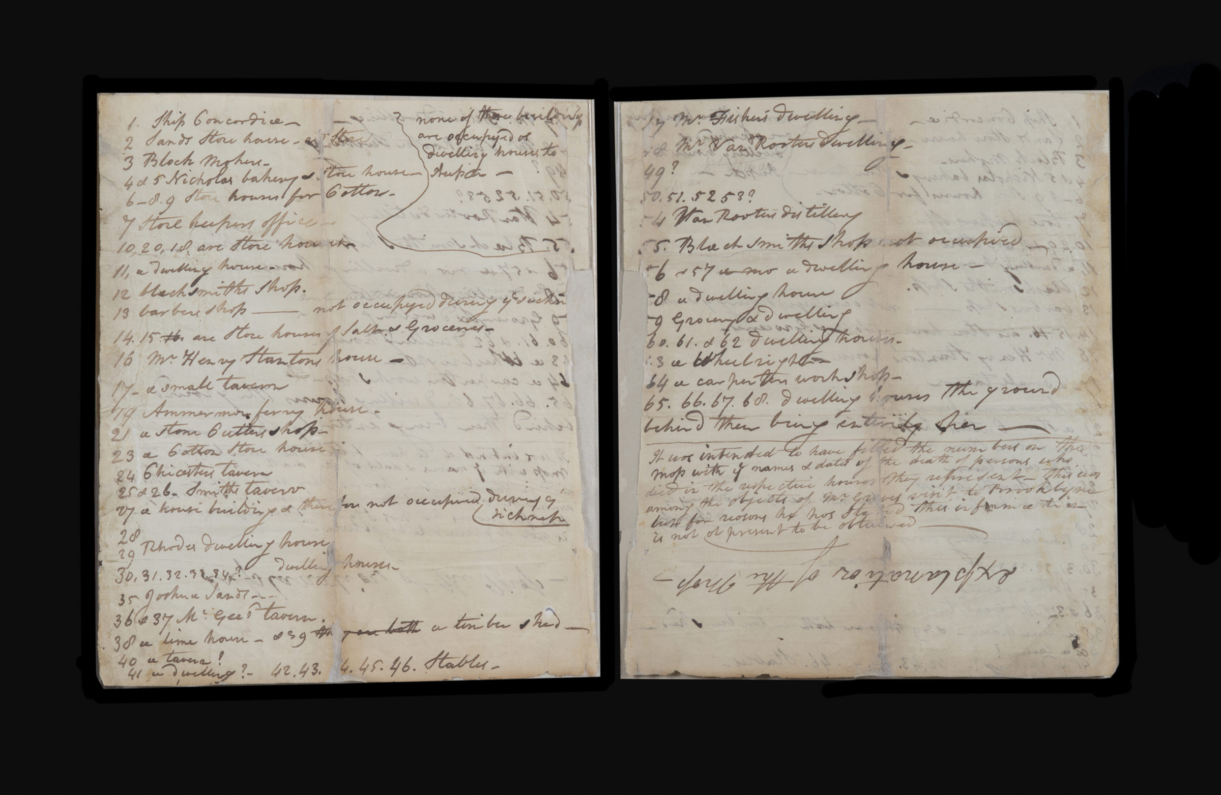
Shows area bound by James Street and the East River, Washington Street and Dock Street in Dumbo. Map is folded inside book and accompanied by list of people who died on numbered plots.
Map area shown
Genre
Thematic mapsRelation
Full catalog recordSize
55 × 59 cmDownload
Low Resolution Image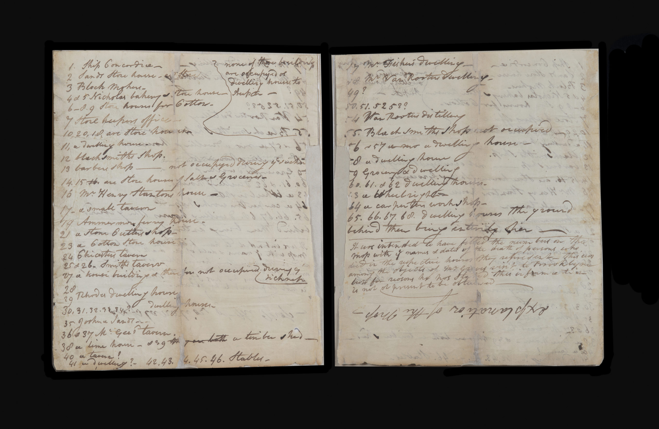
Creator
Lofs, Charles,Publisher
Brooklyn Historical SocietyCitation
Map of the sickly neighbourhood of Brooklyne: New York December 1809; 1809, Map Collection, B B-1809.Fd; Brooklyn Historical Society.Scale
Scale [ca. 1:600]Loading zoom image... 