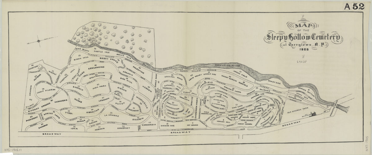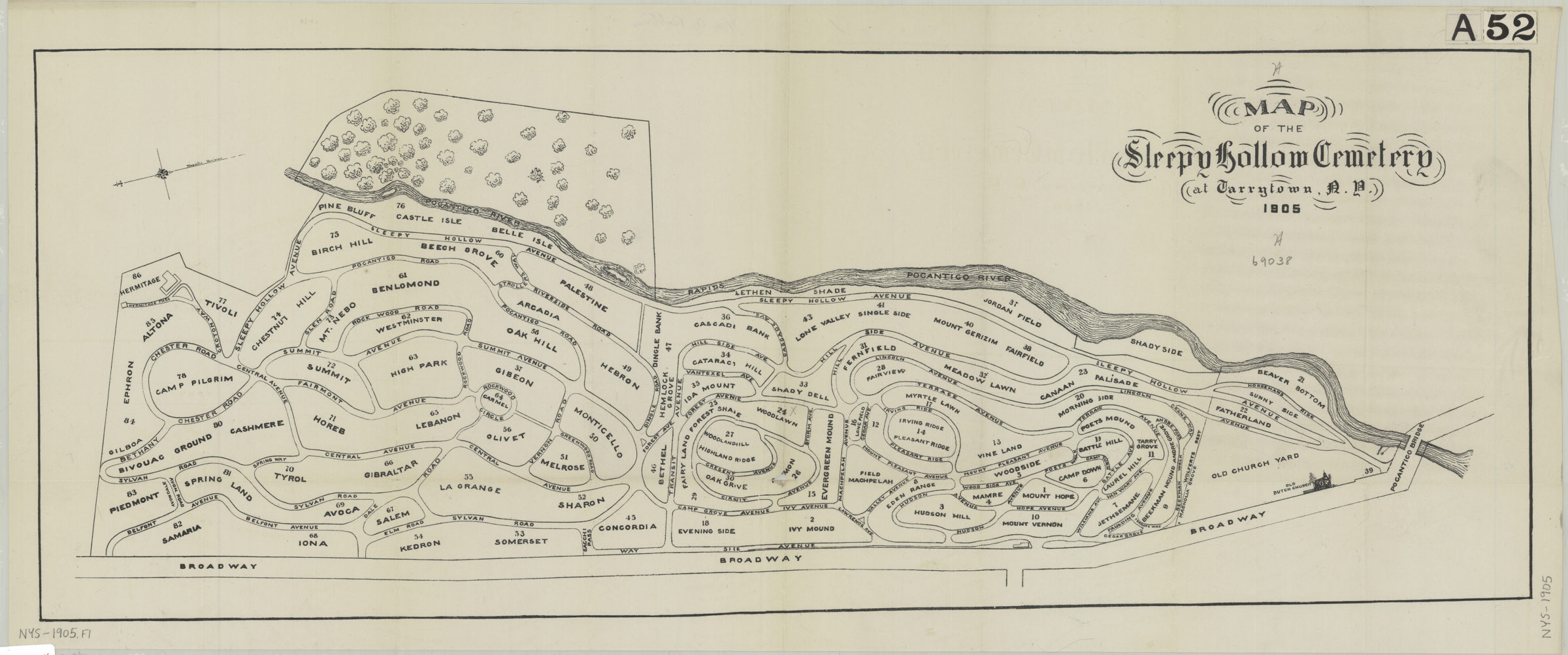
Map of the Sleepy Hollow Cemetery at Tarrytown, N.Y., 1905 [ca. 1905]
Map No. NYS-1905.Fl
Shows named and numbered sections of the cemetery. Oriented with north to the right.
Map area shown
Genre
MapRelation
Full catalog recordSize
28 × 74 cmDownload
Low Resolution Image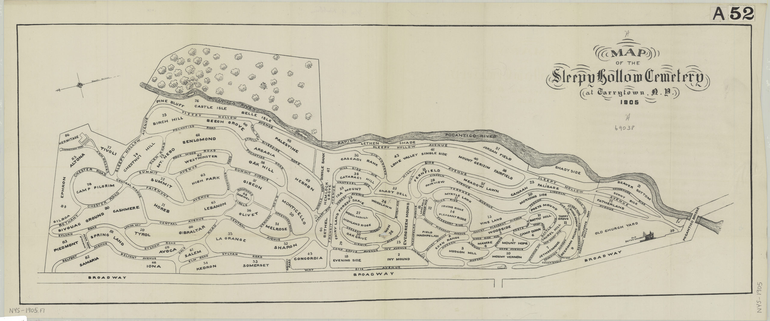
Creator
Publisher
Brooklyn Historical SocietyCitation
Map of the Sleepy Hollow Cemetery at Tarrytown, N.Y., 1905; [ca. 1905], Map Collection, NYS-1905.Fl; Brooklyn Historical Society.Scale
Scale not givenLoading zoom image...