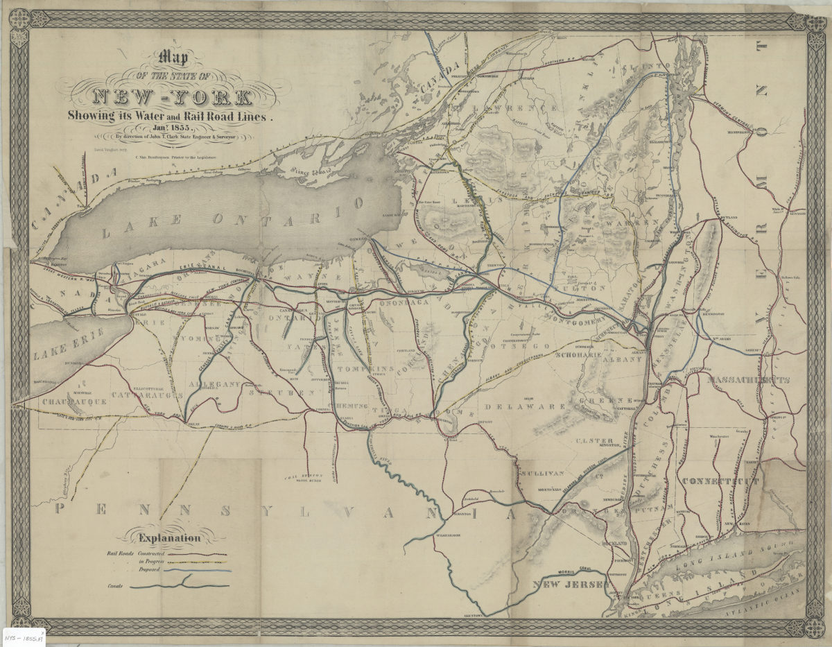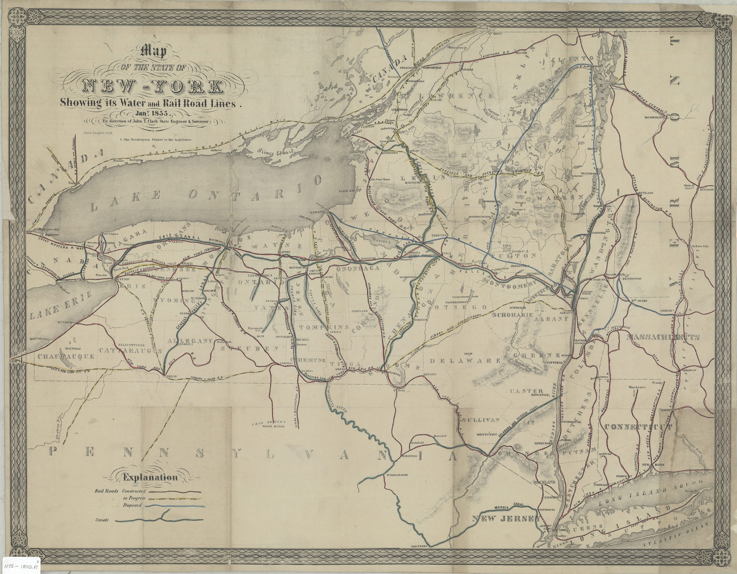
Map of the state of New York showing its water and rail road lines: by direction of John T. Clark, state engineer & surveyor 1855
Map No. NYS-1855.Fl
Shows county boundaries, and proposed, constructed and in-progress railroads. Also shows parts of Pennsylvania, New Jersey, Connecticut, Massachusetts and Vermont. Relief shown by hachures. “David Vaughan, scrip.” “Jan.y 1855.” Includes key to railroads and canals. BHS copy mounted on linen.
Map area shown
Genre
Transportation mapsRelation
Full catalog recordSize
51 × 66 cmDownload
Low Resolution Image
Creator
Clark, John T.,Publisher
Brooklyn Historical SocietyCitation
Map of the state of New York showing its water and rail road lines: by direction of John T. Clark, state engineer & surveyor; 1855, Map Collection, NYS-1855.Fl; Brooklyn Historical Society.Scale
Scale not givenLoading zoom image...