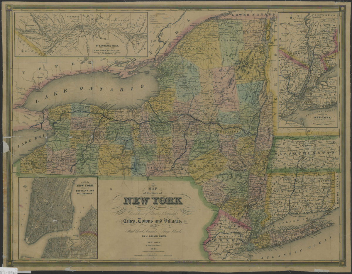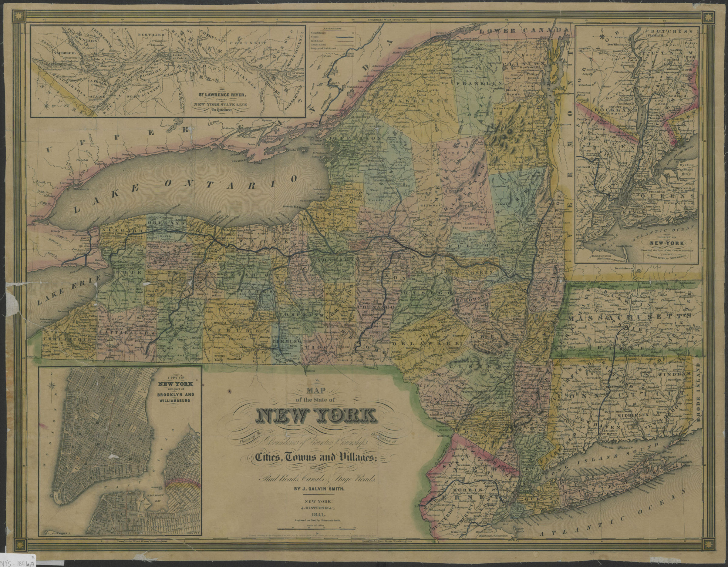
Map of the state of New York: showing the boundaries of counties & townships, the location of cities, towns and villages, the courses of rail roads, canals & stage roads: by J. Calvin Smith 1841
Map No. NYS-1841a.Fl
Shows court houses, proposed railroads, and portions of Massachusetts, Connecticut and New Jersey. Relief shown by hachures. Prime meridians: Washington and Greenwich. “Entered according to act of Congress in the year 1841 by J. Disturnell, in the Clerks Office of the District Court of the southern district of New York.” Originally in cover. Includes insets. Insets: The St. Lawrence River, from the New York State line to Quebec — City of New York, with part of Brooklyn and Williamsburg — Vicinity of New York, showing the line of the Croton Aqueduct and the Hudson River to Newburg. BHS copy mounted on linen, annotated in blue and pink ink, and missing cover.
Map area shown
Genre
MapRelation
Full catalog recordSize
47 × 59 cmDownload
Low Resolution Image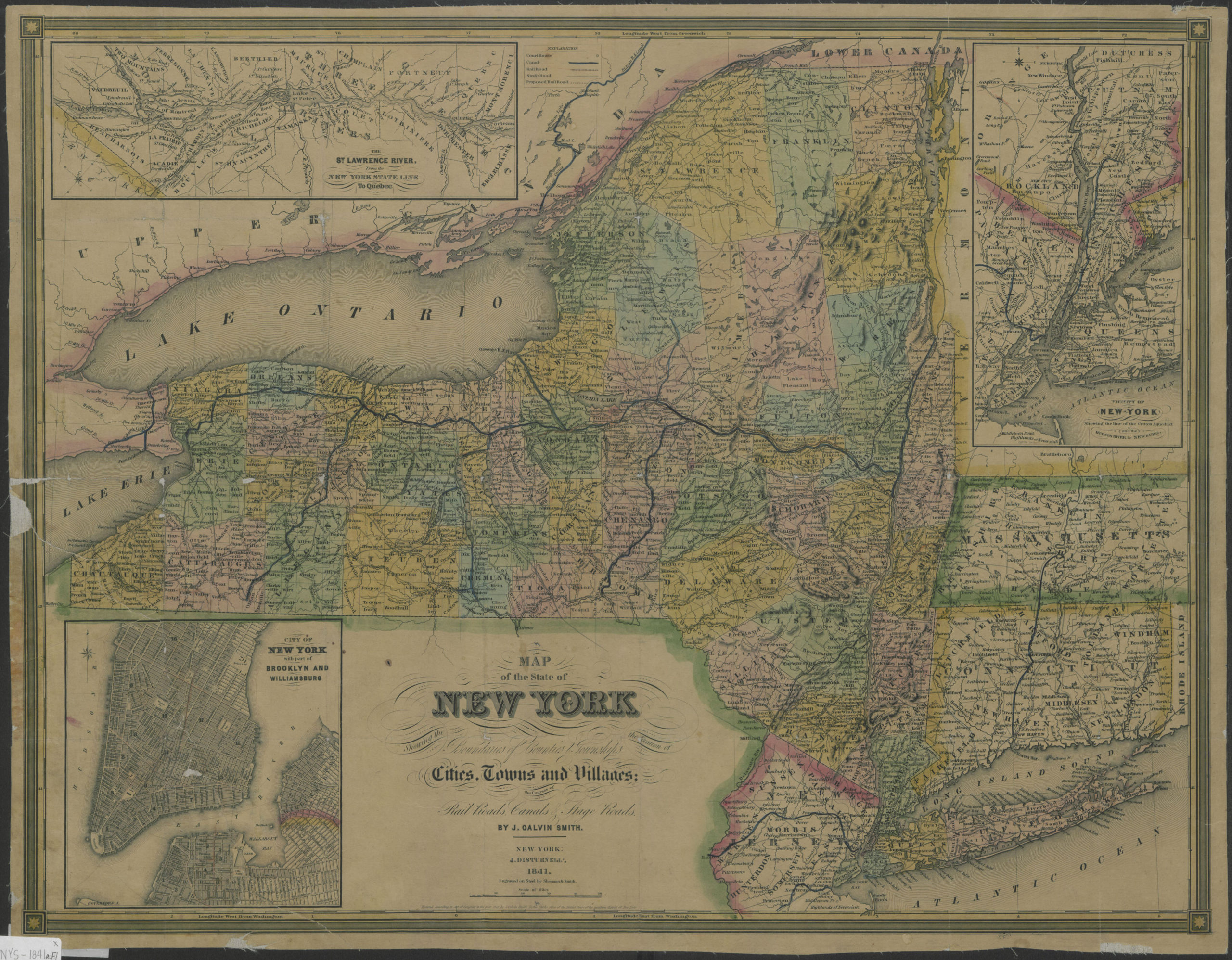
Creator
Smith, J. Calvin,Publisher
Brooklyn Historical SocietyCitation
Map of the state of New York: showing the boundaries of counties & townships, the location of cities, towns and villages, the courses of rail roads, canals & stage roads: by J. Calvin Smith; 1841, Map Collection, NYS-1841a.Fl; Brooklyn Historical Society.Scale
Scale [ca. 1:1,140,480]Loading zoom image...