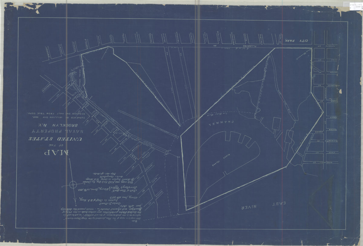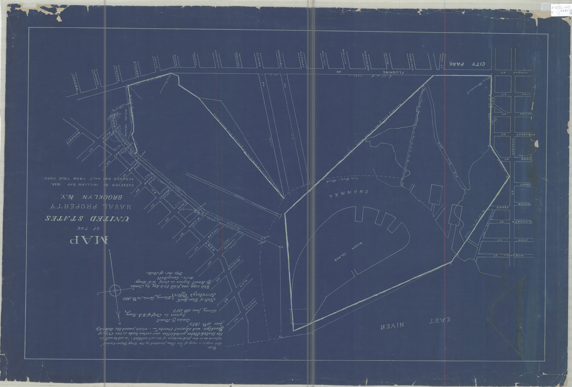
Map of the United States Naval Property, Brooklyn, N.Y.: surveyed by William Day, 1849 [19??]
Map No. B P-1849 (19--?).R
Cadastral map covering the modern-day Brooklyn Navy Yard. Shows surrounding streets, monuments, bridges, dams, and low water marks. Proposed road(?) from Clymer St. to Washington Ave. shown in red. Blueprint. “Reduced one half from true copy.” “Note: This map is a copy of ‘the Plan furnished by the Navy Department’ referred to in the first section of the act entitled: ‘an act to rest in the United States jurisdiction over certain lands in the City of Brooklyn and adjacent thereto,’ which passed the Assembly June 10th, 1853 … this copy was filed this day by Charles B. Stuart, Engineer in Chief U.S. Navy, Arch. Campbell, Dep. Sec. of State.”
Map area shown
Genre
Cadastral mapsRelation
Full catalog recordSize
54 × 85 cmDownload
Low Resolution Image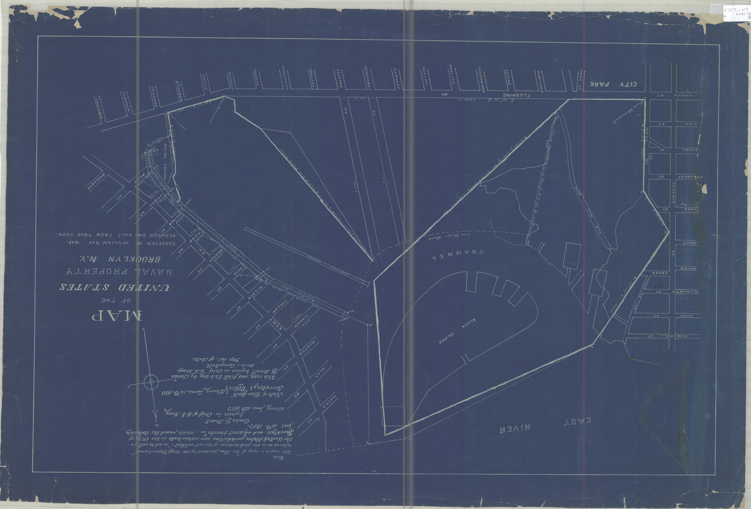
Creator
Day, William,Publisher
Brooklyn Historical SocietyCitation
Map of the United States Naval Property, Brooklyn, N.Y.: surveyed by William Day, 1849; [19??], Map Collection, B P-1849 (19--?).R; Brooklyn Historical Society.Scale
Scale not givenLoading zoom image...