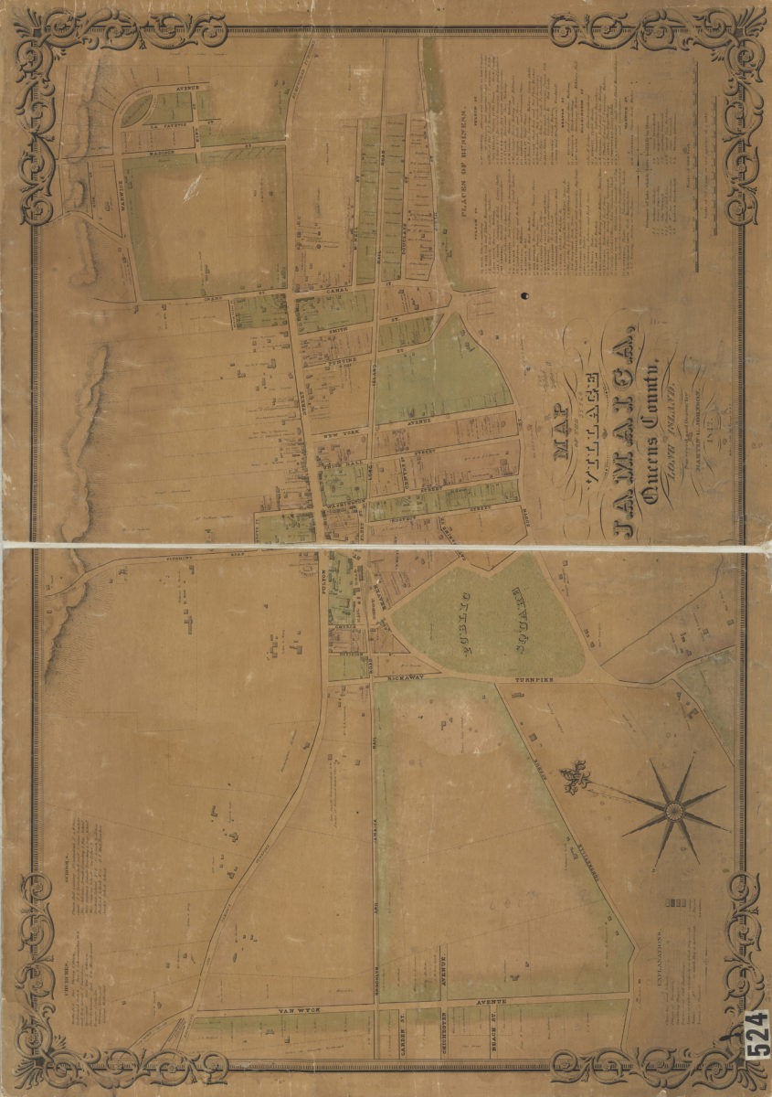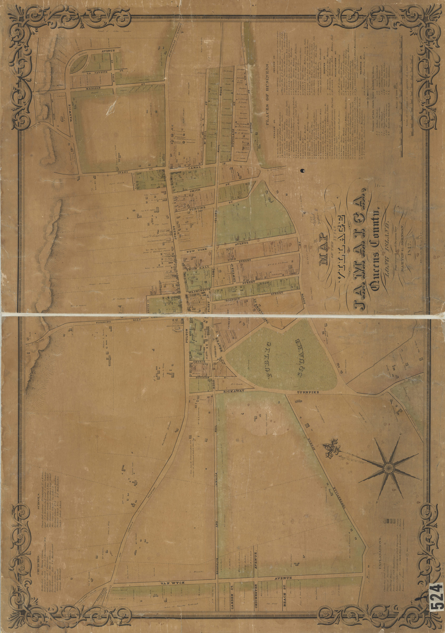
Map of the village of Jamaica, Queens County, Long Island: surveyed and drawn by Martin G. Johnson 1842
Map No. Q-1842.Fl
Cadastral map covering area north from approximately South St. to High St., and east from Van Wyck Ave. to Warwick Ave. Shows personal property, churches, schools, businesses, and names of landowners and tenants. Relief shown by hachures. Oriented with north to the upper right. Includes text, key, indexes, and decorative border. “671”–Lower center margin.
Map area shown
Genre
Cadastral mapsRelation
Full catalog recordSize
63 × 93 cmDownload
Low Resolution Image
Creator
Johnson, Martin G.,Publisher
Brooklyn Historical SocietyCitation
Map of the village of Jamaica, Queens County, Long Island: surveyed and drawn by Martin G. Johnson; 1842, Map Collection, Q-1842.Fl; Brooklyn Historical Society.Scale
Scale [ca. 1:3,200]Loading zoom image...