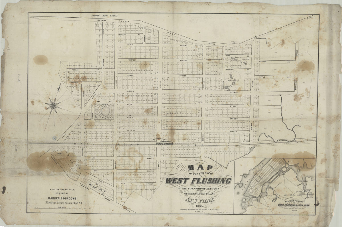
Map of the village of West Flushing in the township of Newtown, Queens Co. Long Island, New York: comprising the parts laid out and described on sectional maps no. 1, 2, 3, and 4 1854
Map No. Q-1854.Fl.Folio
Cadastral map showing lot lines, lot numbers, lot/street dimensions, railroad line, and extant buildings. Railroad train shown pictorially. Oriented with north to the upper right. Includes location map (inset): Relative position of West Flushing & New York.
Subjects
Places
Map area shown
Genre
Cadastral mapsRelation
Full catalog recordSize
66 × 89 cmDownload
Low Resolution Image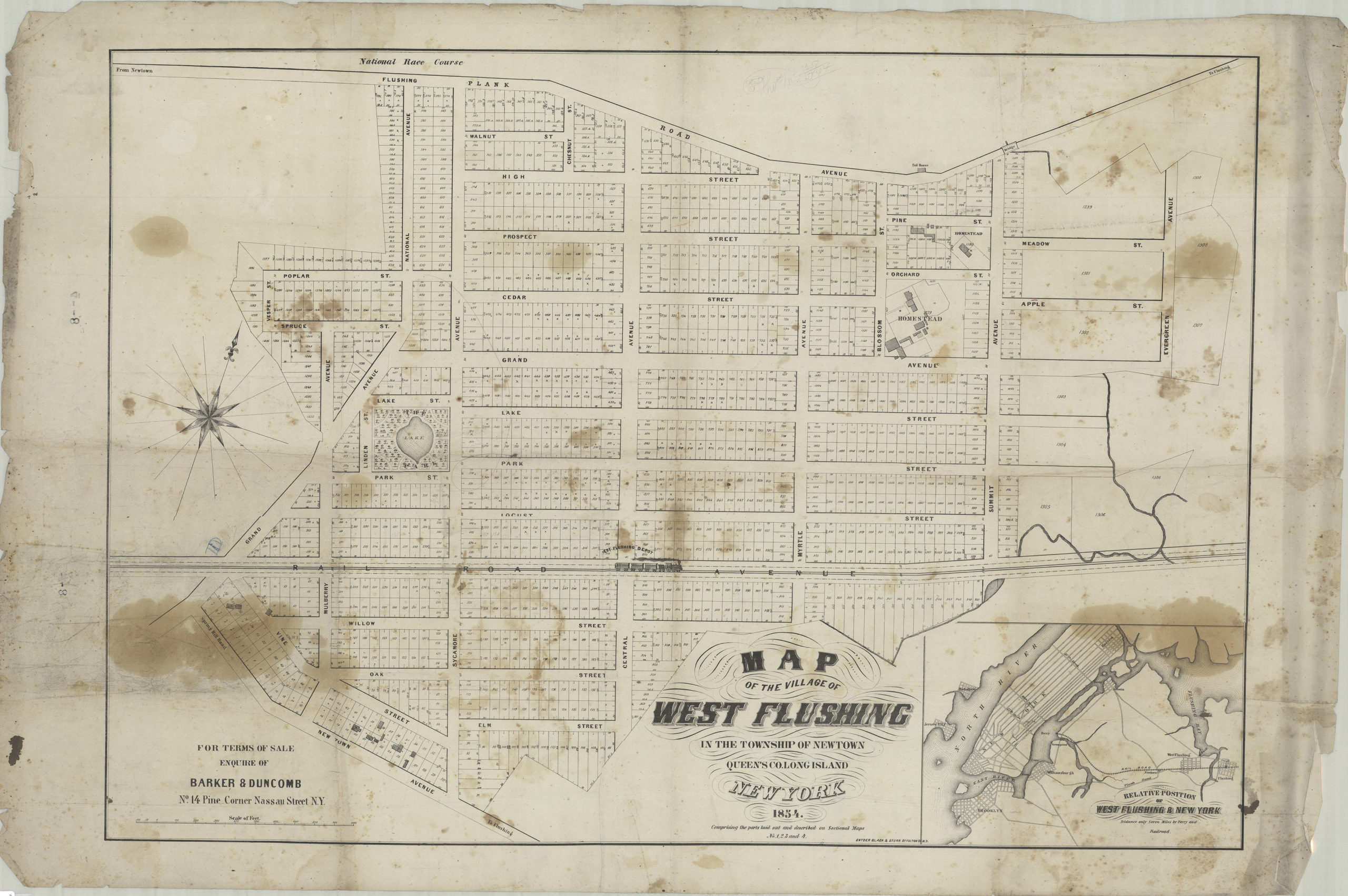
Creator
Barker & Elliott,Publisher
Brooklyn Historical SocietyCitation
Map of the village of West Flushing in the township of Newtown, Queens Co. Long Island, New York: comprising the parts laid out and described on sectional maps no. 1, 2, 3, and 4; 1854, Map Collection, Q-1854.Fl.Folio; Brooklyn Historical Society.Scale
Scale [ca. 1:1,930]Loading zoom image...