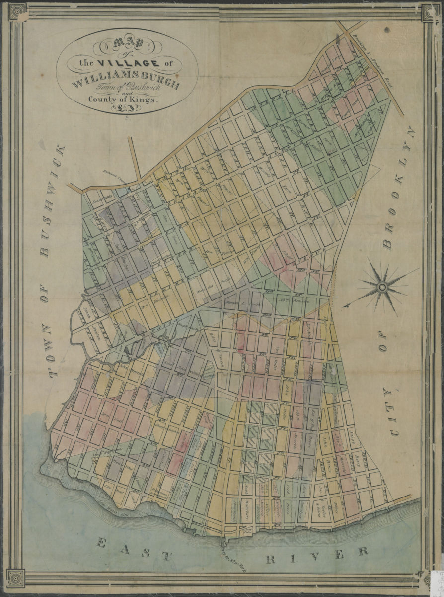
Map of the village of Williamsburgh, town of Bushwick, and county of Kings, L.I. [18??]
Map No. B A-[18--?]e.Fl
Covers the village of Williamsburgh north from S. 11th St. to N. 15th St. and east to Brooklyn & Newton Rd. Shows the low and high water lines, piers, a ferry slip, and names of property owners. Does not significantly cover the town of Bushwick or other parts of Kings County. Oriented with north to the lower left. Includes decorative border.
Map area shown
Genre
Cadastral mapsRelation
Full catalog recordSize
65 × 47 cmDownload
Low Resolution Image
Creator
Publisher
Brooklyn Historical SocietyCitation
Map of the village of Williamsburgh, town of Bushwick, and county of Kings, L.I.; [18??], Map Collection, B A-[18--?]e.Fl; Brooklyn Historical Society.Scale
Scale not givenLoading zoom image...