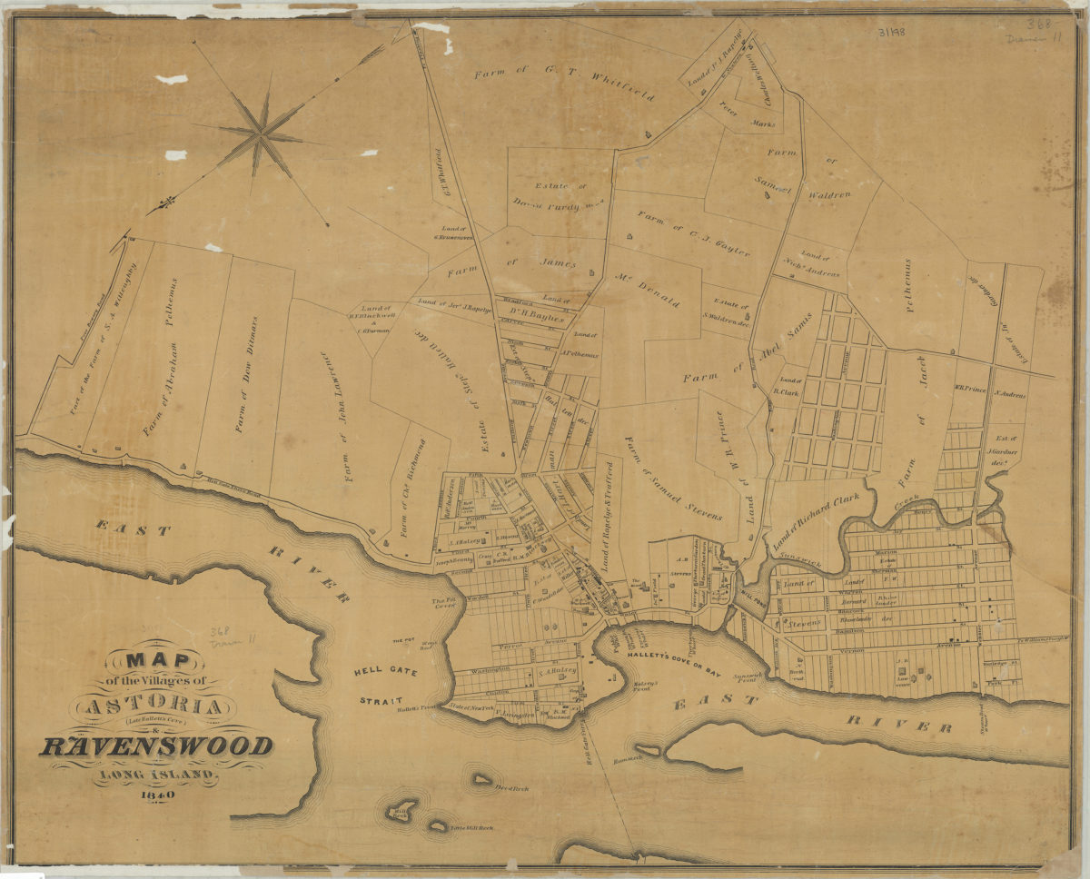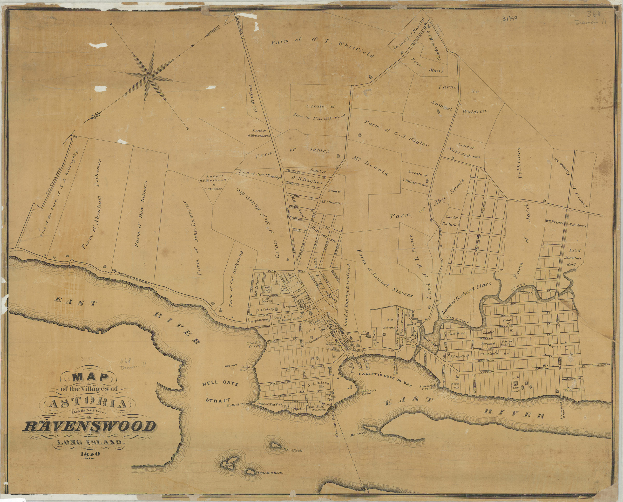
Map of the villages of Astoria (late Hallett’s Cove) & Ravenswood, Long Island 1840
Map No. Q-1840.Fl
Cadastral map covering area north from approximately Webster Ave. to Poor Bowery Rd. and east from the East River to the Road to Newtown. Shows property (including buildings, farms, and estates), and names of landowners. Oriented with north to the lower left. BHS copy imperfect missing portions of the lower margin and lower right corner, likely containing publication information.
Subjects
Places
Map area shown
Genre
Cadastral mapsRelation
Full catalog recordSize
55 × 69 cmDownload
Low Resolution Image
Creator
Publisher
Brooklyn Historical SocietyCitation
Map of the villages of Astoria (late Hallett’s Cove) & Ravenswood, Long Island; 1840, Map Collection, Q-1840.Fl; Brooklyn Historical Society.Scale
Scale not givenLoading zoom image...