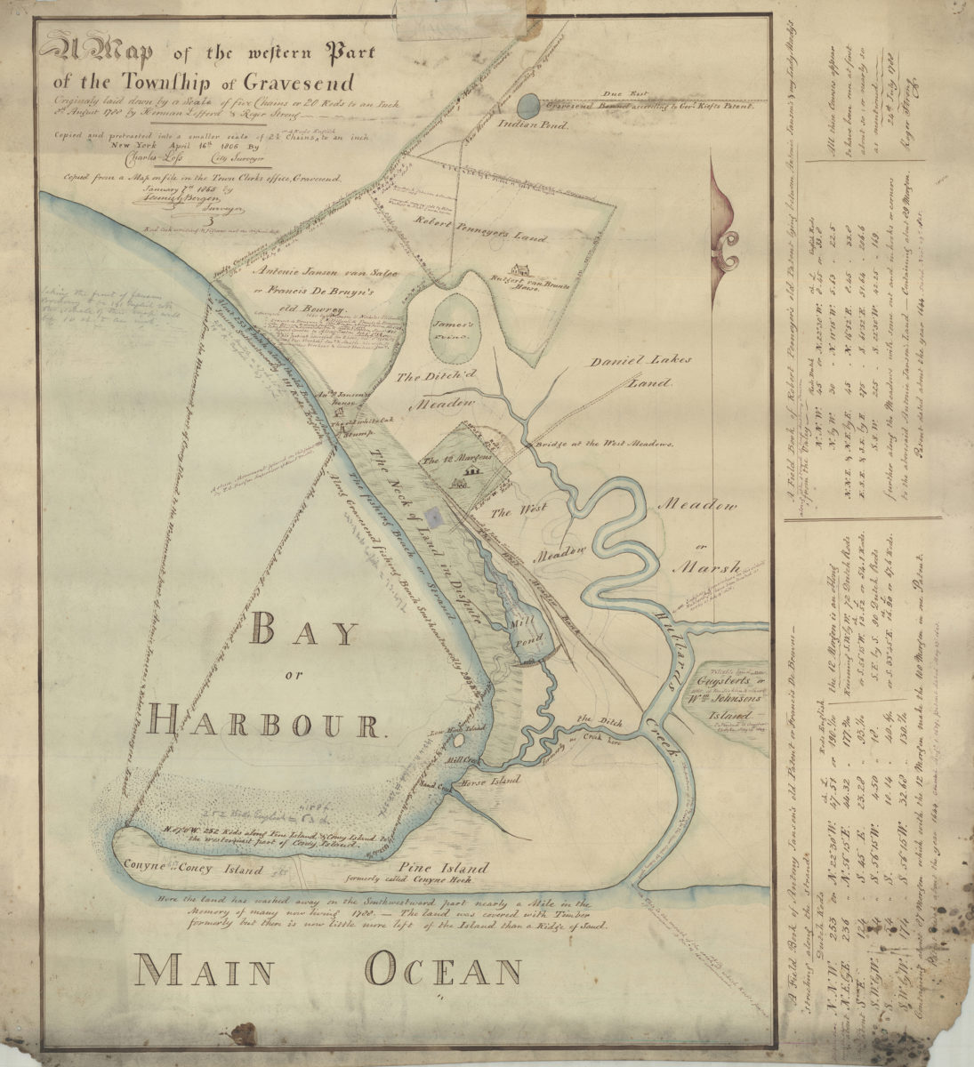
Map of the western part of the Township of Gravesend originally laid down by a scale of five chains or 20 rods to an inch, 8th August 1788 by Herman Lefford & Roger Strong: April 16th 1806 [18??]
Map No. Bergen-[18--?]uu.Fl
Covers portion of the town of Gravesend in modern-day Gravesend and Coney Island. Shows ponds, meadows, creeks, property and names of landowners. Includes text and historical notes added by Teunis G. Bergen. Includes ist of cordinates labeled “A field book of Antony Jansen’s old Patent or Francis DeBrowns – stretching along the strands” and “A field book of Robert Pennoyer’s old Patent lying between Antonie Jansen’s and my Lady Moody’s.”
Map area shown
Genre
Cadastral mapsRelation
Full catalog recordSize
63 × 60 cmDownload
Low Resolution Image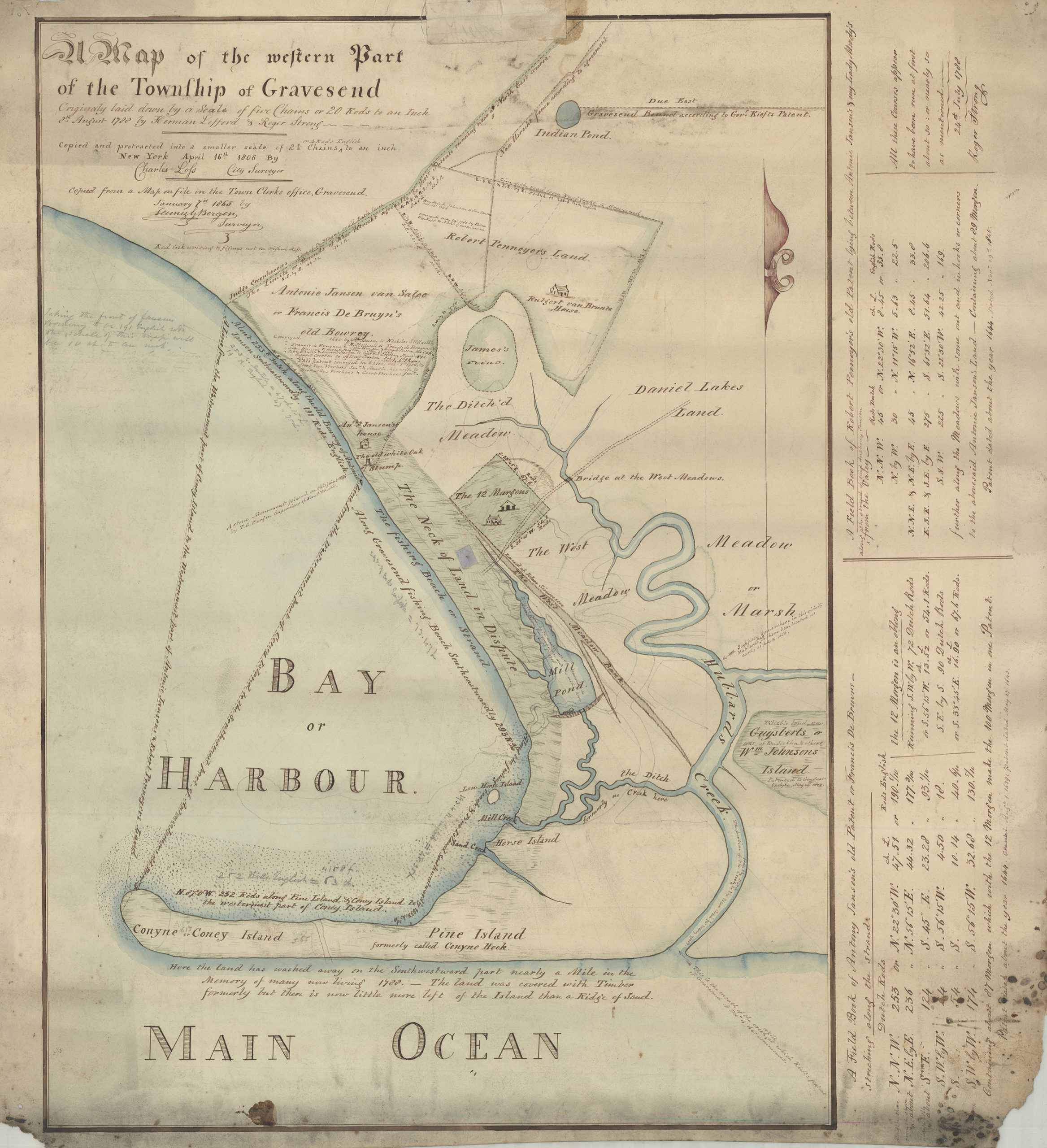
Creator
Bergen, Teunis G.,Publisher
Brooklyn Historical SocietyCitation
Map of the western part of the Township of Gravesend originally laid down by a scale of five chains or 20 rods to an inch, 8th August 1788 by Herman Lefford & Roger Strong: April 16th 1806; [18??], Map Collection, Bergen-[18--?]uu.Fl; Brooklyn Historical Society.Scale
Scale not givenLoading zoom image...