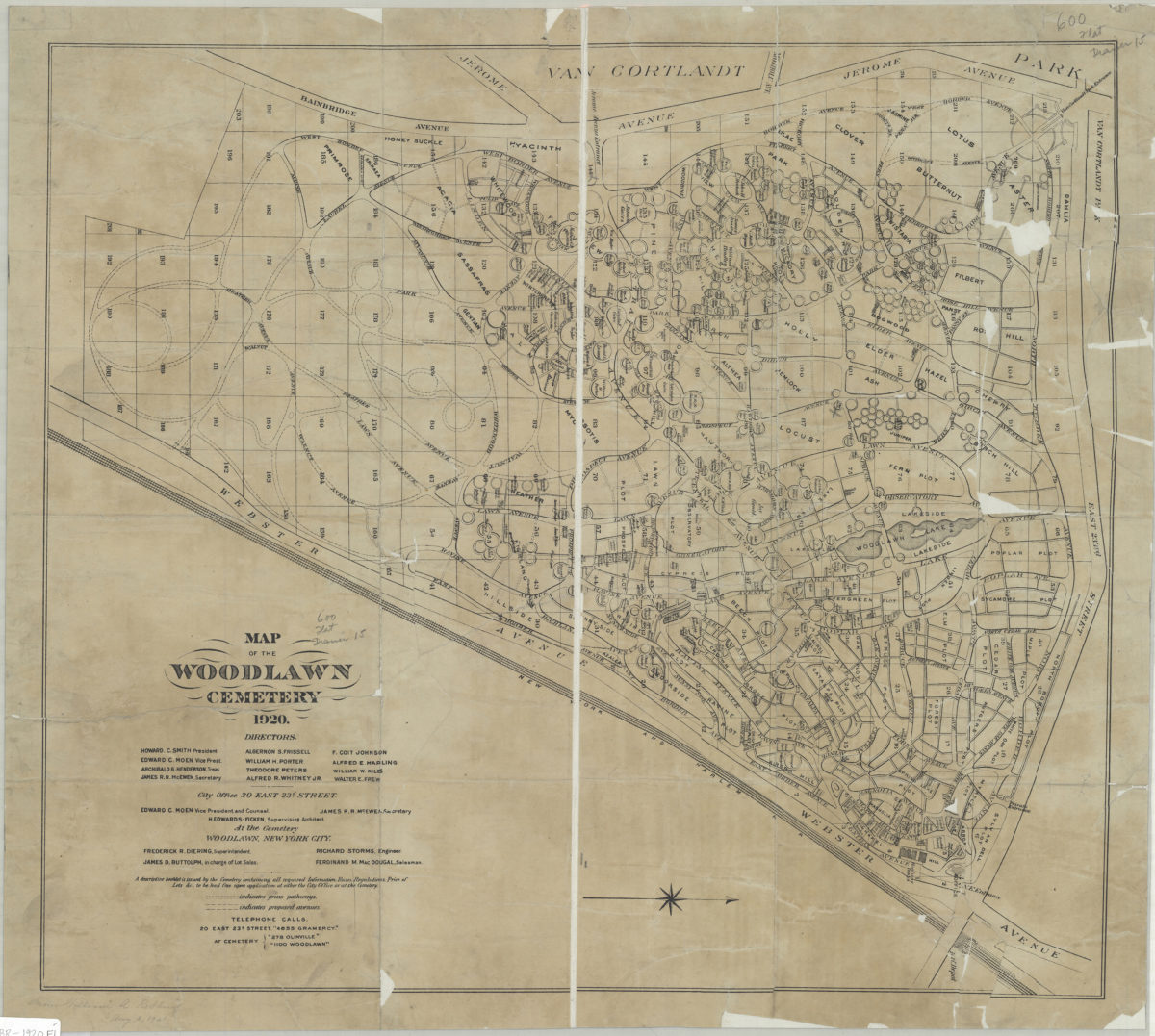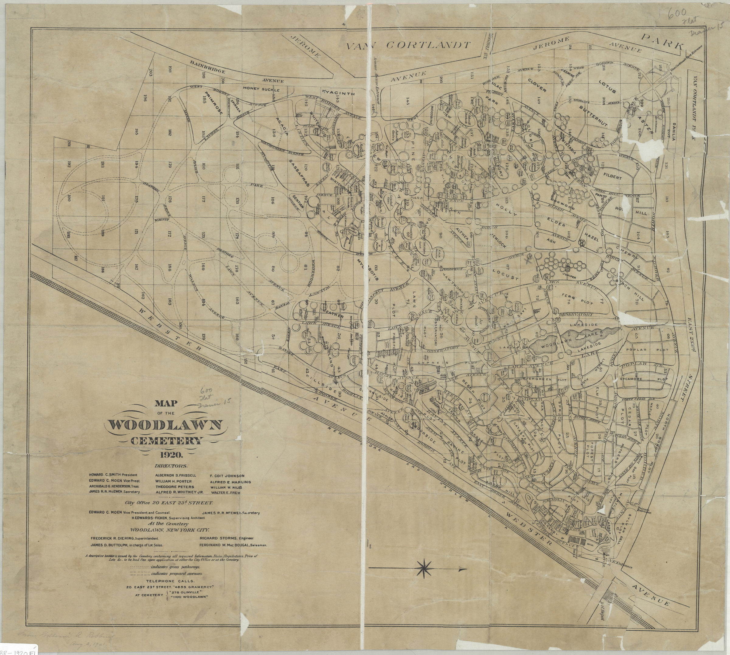
Map of the Woodlawn Cemetery, 1920 [1920]
Map No. BR-1920.Fl
Shows named and numbered sections, grass pathways, existing and proposed avenues. Oriented with north toward right. Includes list of board of directors. BHS copy dissected and mounted on linen.
Map area shown
Genre
Cadastral mapsRelation
Full catalog recordSize
51 × 57 cmDownload
Low Resolution Image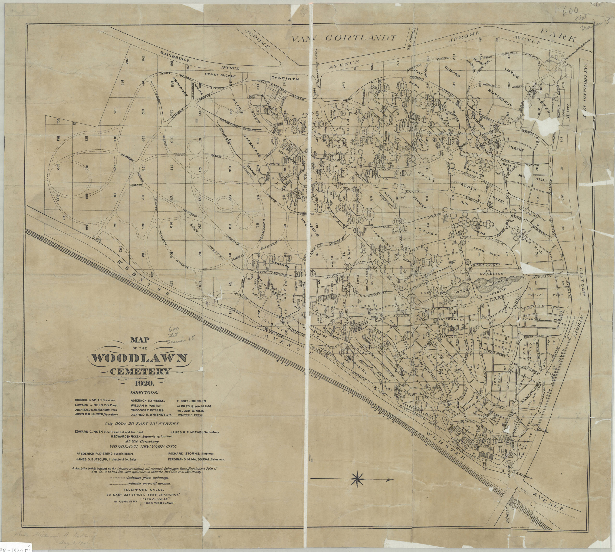
Creator
Woodlawn Cemetery (New York, N.Y.),Publisher
Brooklyn Historical SocietyCitation
Map of the Woodlawn Cemetery, 1920; [1920], Map Collection, BR-1920.Fl; Brooklyn Historical Society.Scale
Scale not givenLoading zoom image...