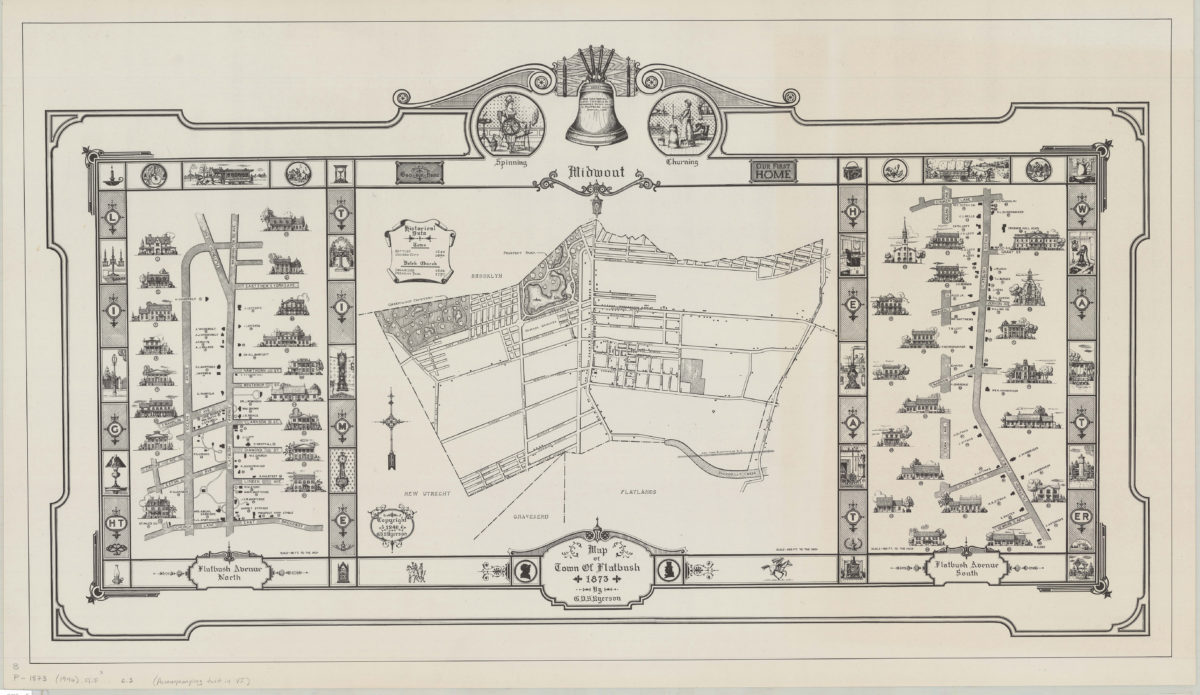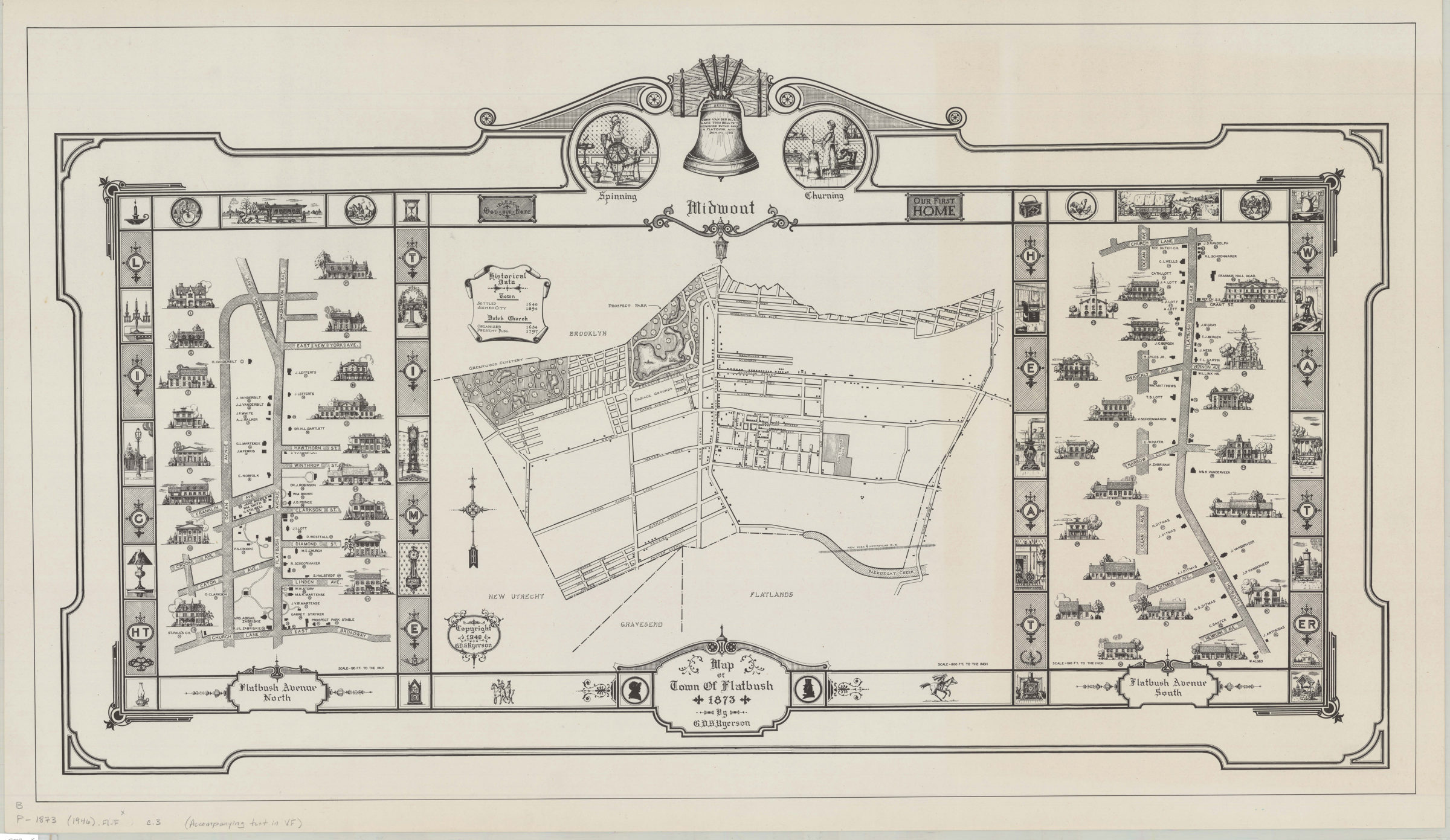
Map of town of Flatbush, 1873: by G.V.S. Ryerson 1946
Map No. B P-1873(1946).Fl.Folio
Cadastral map covering area north from Foster Ave. to Malbone St. and east from Greenwood Cemetery to Kings Highway (modern-day Flatbush, Prospect Lefferts Gardens, and Windsor Terrace). Shows property (including buildings), and names of landowners. Place of publication and publisher taken from accompanying text. Includes ill., decorative borders, and historical data. Flatbush Avenue north (Scale [1:2,280] 190 ft. to the in.). Midwout (Scale [1:7,920] 660 ft. to the in.). Flatbush Avenue south (Scale [1:2,280] 190 ft. to the in.). BHS has 3 copies.
Subjects
Places
Map area shown
Relation
Full catalog recordSize
62 × 107 cmDownload
Low Resolution Image
Creator
Ryerson, G. V. S.,Publisher
Brooklyn Historical SocietyCitation
Map of town of Flatbush, 1873: by G.V.S. Ryerson; 1946, Map Collection, B P-1873(1946).Fl.Folio; Brooklyn Historical Society.Scale
Scales differLoading zoom image...