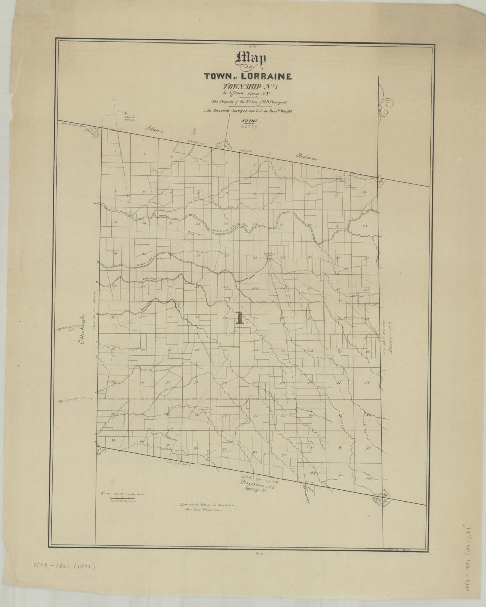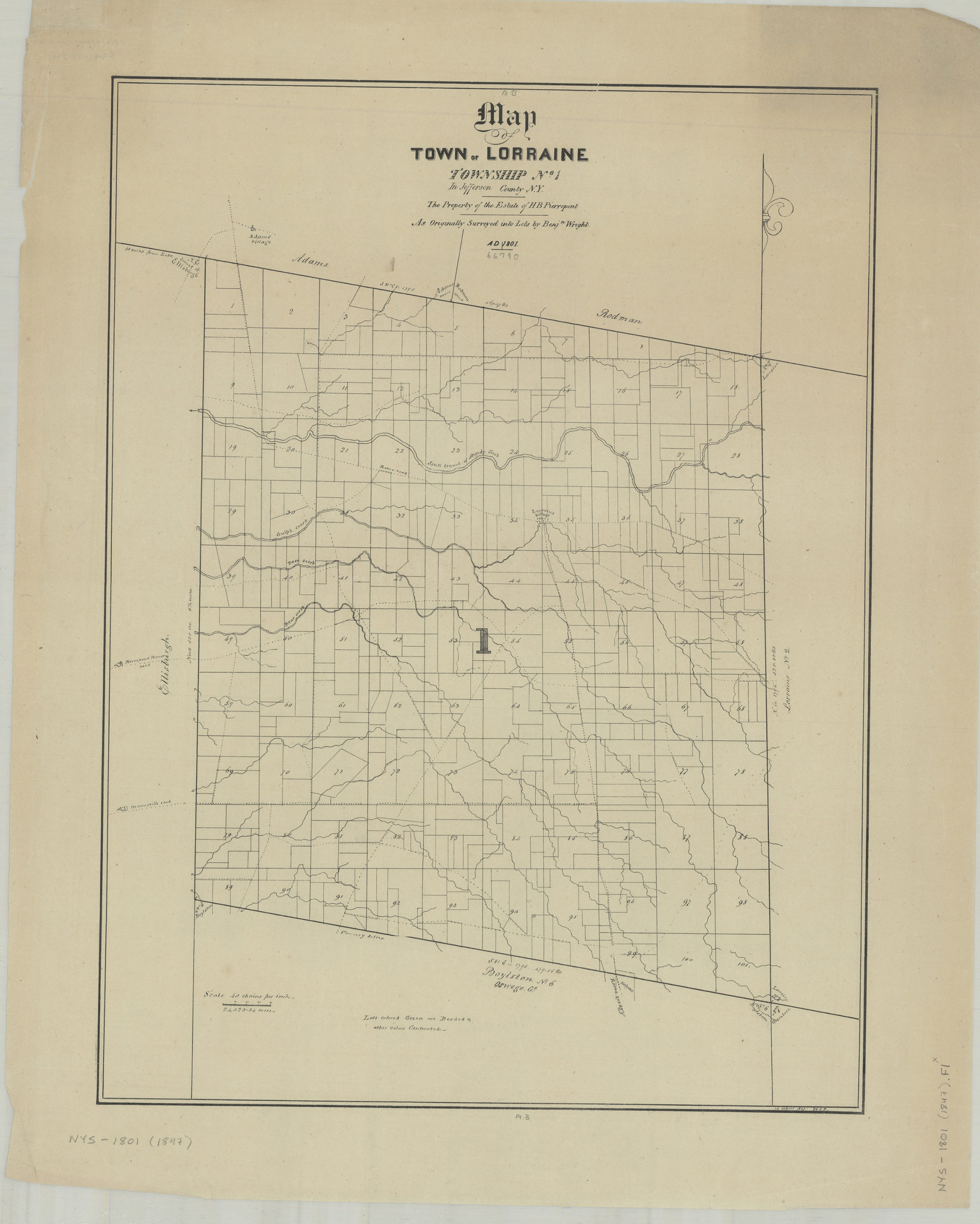
Map of town of Lorraine: Township No. 1 in Jefferson County, N.Y. : the property of the estate of H.B. Pierrepont, as originally surveyed into lots by Benjn. Wright, A.D. 1801: W.C.P., 14 April 1847 [1847]
Map No. NYS-1801 (1847).Fl
Cadastral map showing disposition of numbered lots circa 1823[?]. Also shows drainage, roads, and parts of surrounding counties. Based on 1801 survey. “Lots colored green are deeded lots in other colors contracted.”
Map area shown
Genre
Cadastral mapsRelation
Full catalog recordSize
53 × 40 cmDownload
Low Resolution Image
Creator
Pierrepont, W. C.,Publisher
Brooklyn Historical SocietyCitation
Map of town of Lorraine: Township No. 1 in Jefferson County, N.Y. : the property of the estate of H.B. Pierrepont, as originally surveyed into lots by Benjn. Wright, A.D. 1801: W.C.P., 14 April 1847; [1847], Map Collection, NYS-1801 (1847).Fl; Brooklyn Historical Society.Scale
Scale [1:31,680] 1 in toLoading zoom image...