
Map of U.S. Wallabout property: surveyed for Washington Avenue extension, Dec. 1859: by Samuel McElroy, civil engineer December 1859
Map No. B P-1859.Fl
Cadastral map covering area north from Flushing Ave. to S. 10th St. and east from the Cob Dock to Classon Ave. Shows property at the Brooklyn Navy Yard (including the naval hospital and cemetery). Also shows city and state bulkhead lines, docks, lines of jurisdiction, and street measurements. Oriented with north to the left.
Map area shown
Relation
Full catalog recordSize
73 × 112 cmDownload
Low Resolution Image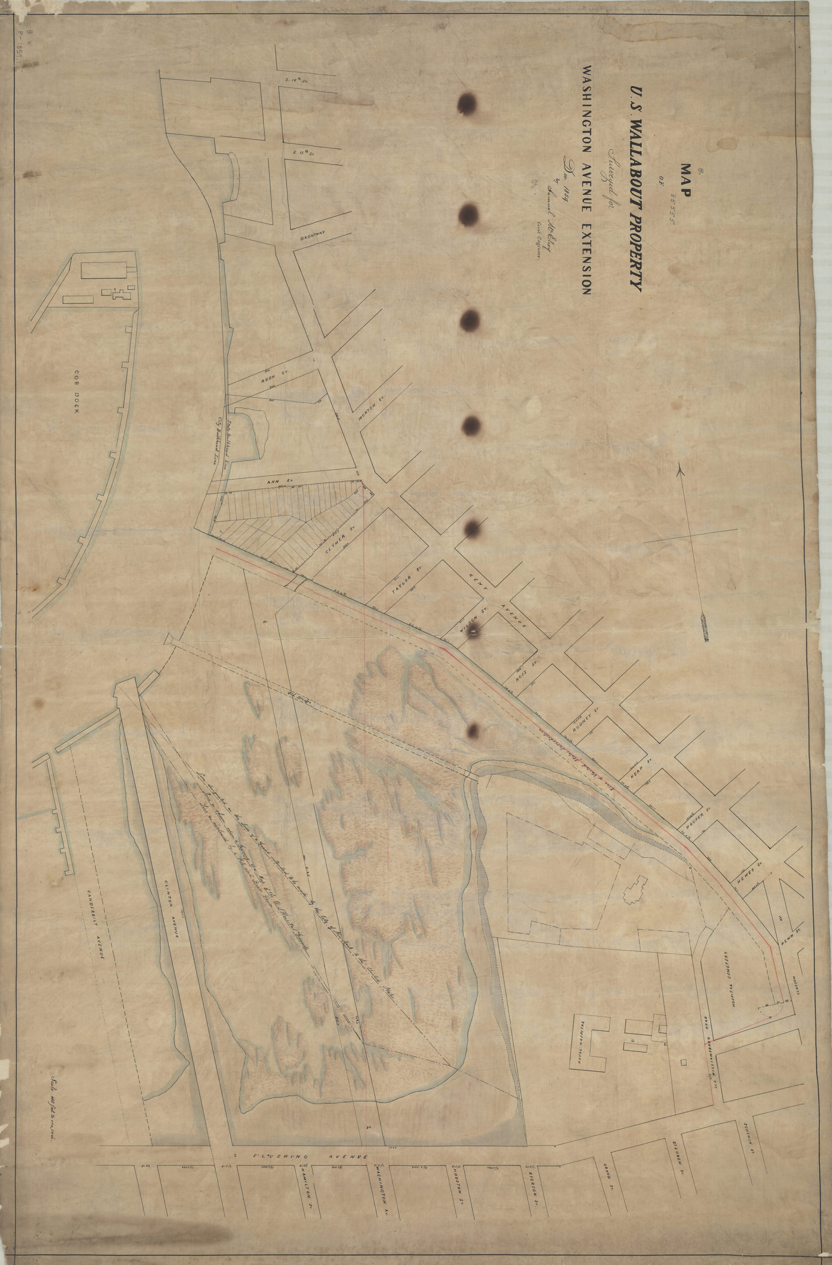
Creator
McElroy, Samuel,Publisher
Brooklyn Historical SocietyCitation
Map of U.S. Wallabout property: surveyed for Washington Avenue extension, Dec. 1859: by Samuel McElroy, civil engineer; December 1859, Map Collection, B P-1859.Fl; Brooklyn Historical Society.Scale
Scale [1:1,200] 1 in to 1Loading zoom image... 