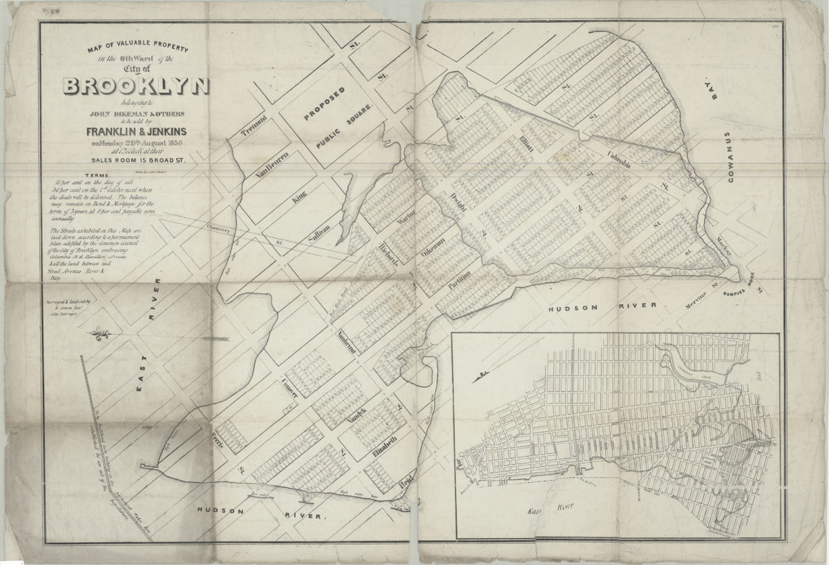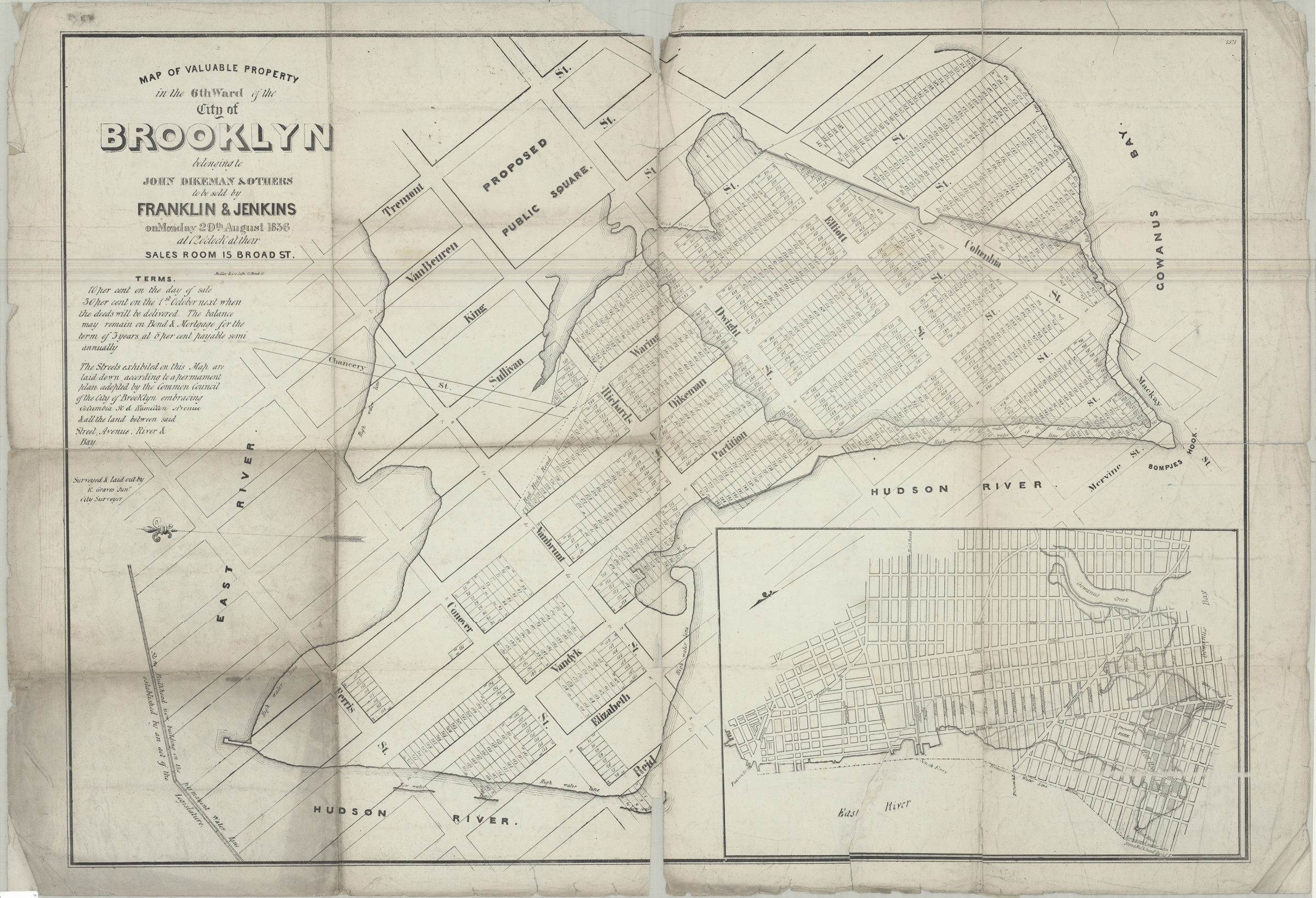
Map of valuable property in the 6th ward of the city of Brooklyn: belonging to John Dikeman & others to be sold by Franklin & Jenkins on Monday, 29th August, 1836 at 12 o’clock at their sales room, 15 Broad St.: surveyed & laid out by R. Graves [1836]
Map No. B P-[1836].Fl.Folio
Cadastral map covering Brooklyn from Gowanus Bay to the East River, and from Mervine St. to Tremont Street. Shows lot numbers and dimensions, high and low water lines, stone bulkhead on the permanent water line, proposed public square and streets. Oriented with north to the left. Includes text and location map (oriented with north to the lower left). “1521”–Upper right corner.
Map area shown
Genre
Cadastral mapsRelation
Full catalog recordSize
69 × 98 cmDownload
Low Resolution Image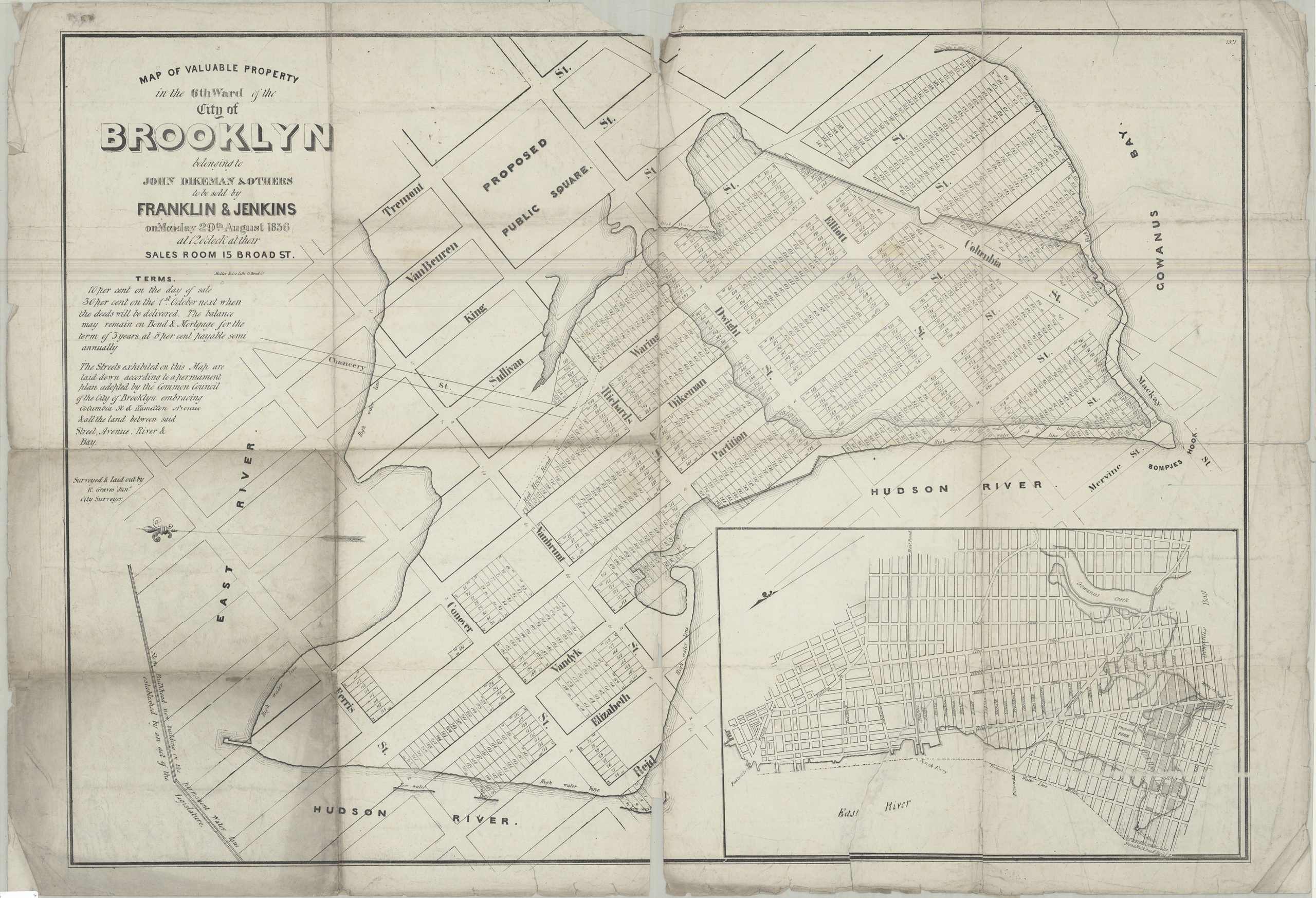
Creator
Graves, Roswell,Publisher
Brooklyn Historical SocietyCitation
Map of valuable property in the 6th ward of the city of Brooklyn: belonging to John Dikeman & others to be sold by Franklin & Jenkins on Monday, 29th August, 1836 at 12 o’clock at their sales room, 15 Broad St.: surveyed & laid out by R. Graves; [1836], Map Collection, B P-[1836].Fl.Folio; Brooklyn Historical Society.Scale
Scale not givenLoading zoom image...