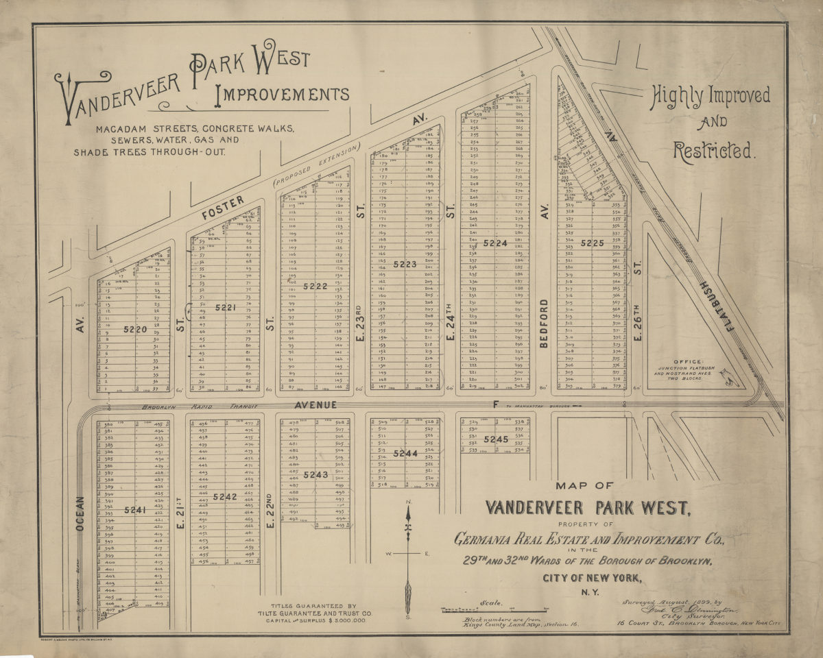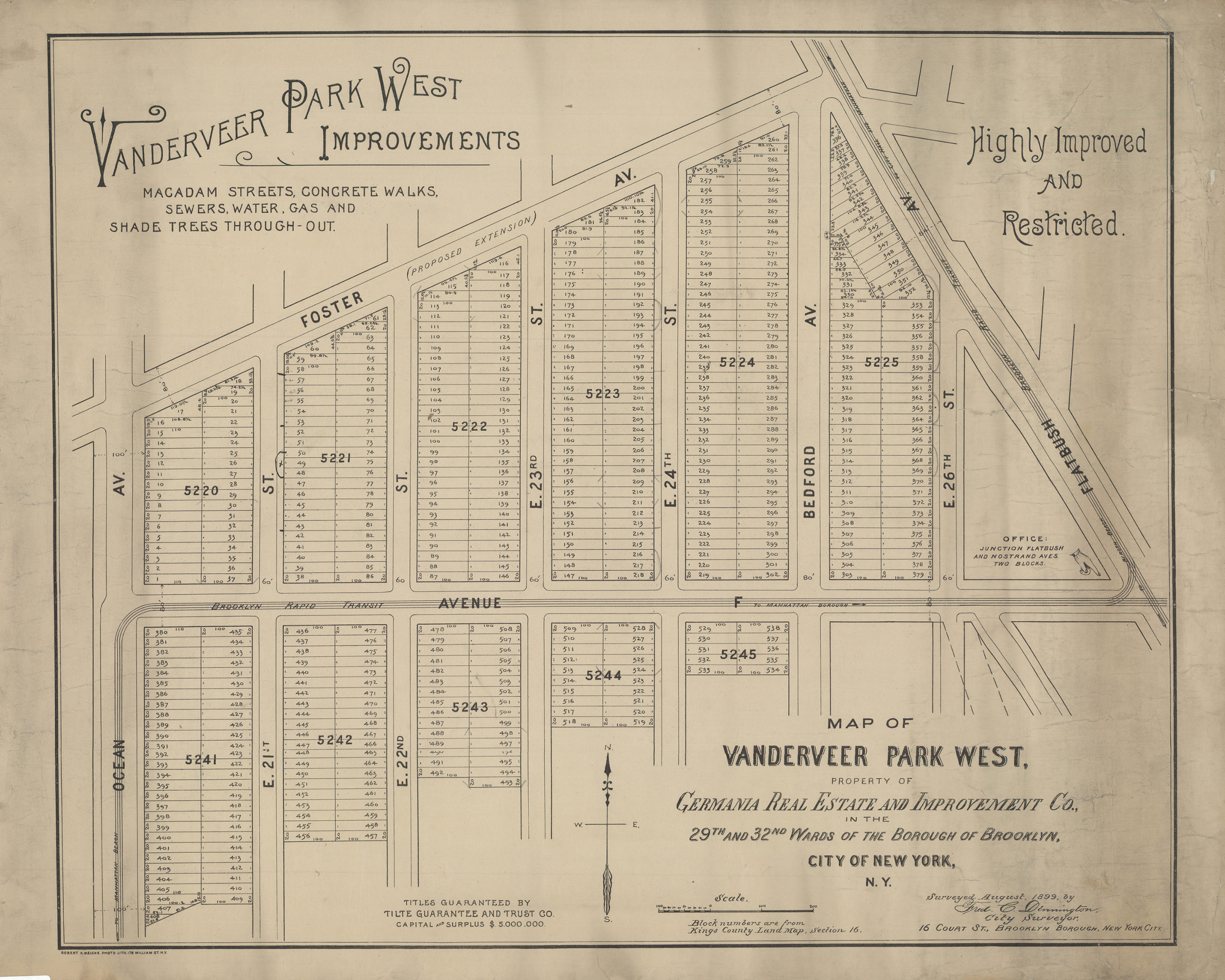
Map of Vanderveer Park West, property of Germania Real Estate and Improvement Co., in the 29th and 32nd Wards of the borough of Brooklyn, city of New York, N.Y.: surveyed August, 1899, by Fred. C. Dennington, city surveyor [1899]
Map No. B P-[1899].Fl
Cadastral map covering area south of Foster Ave. between Flatbush Ave. and Ocean Ave. (modern-day Midwood). Shows property (including block numbers, lot numbers, and dimensions), and elevated train lines. “Block numbers are from Kings County Land Map, section 16.” Includes text.
Map area shown
Genre
Cadastral mapsRelation
Full catalog recordSize
56 × 68 cmDownload
Low Resolution Image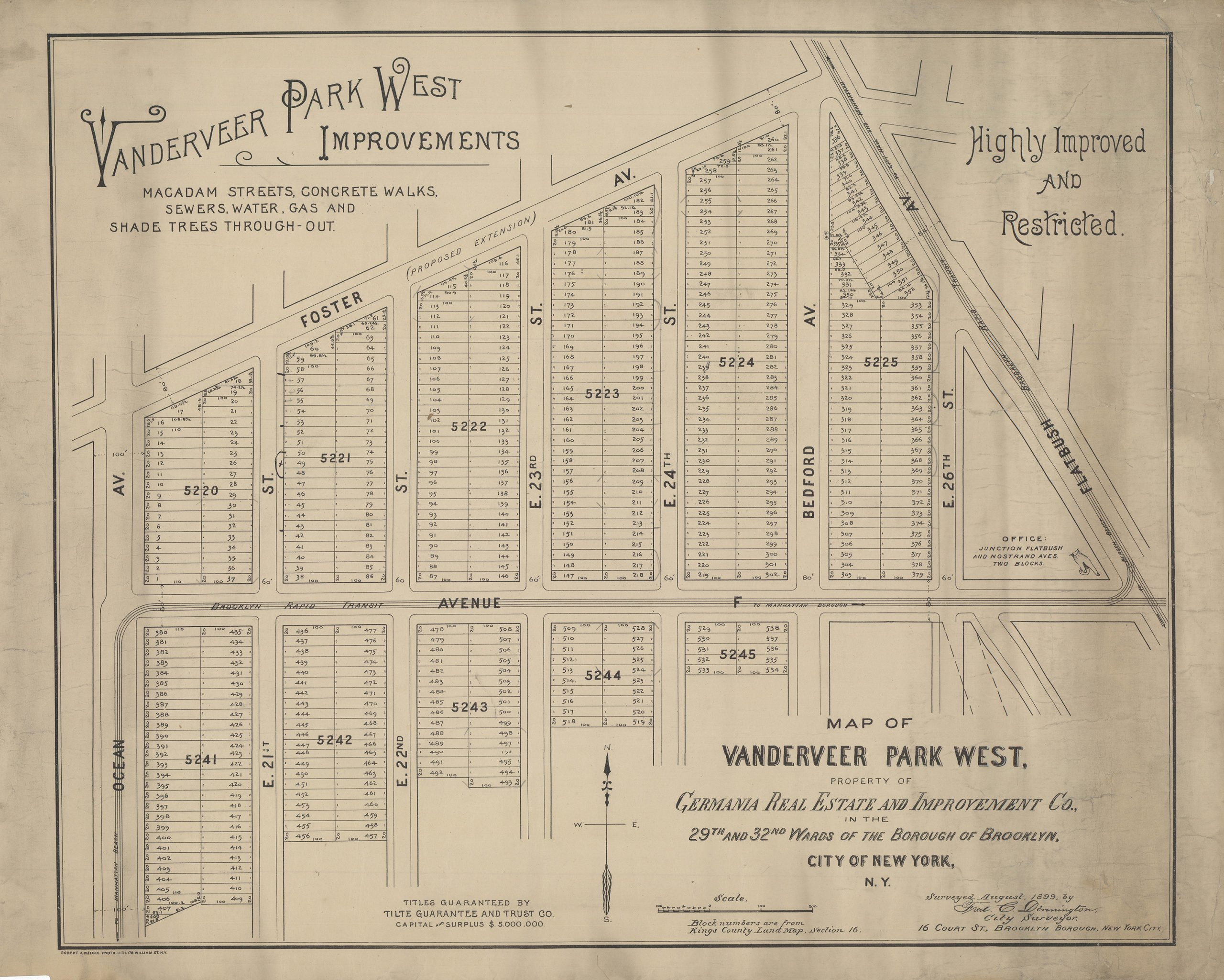
Creator
Dennington, Frederick C.,Publisher
Brooklyn Historical SocietyCitation
Map of Vanderveer Park West, property of Germania Real Estate and Improvement Co., in the 29th and 32nd Wards of the borough of Brooklyn, city of New York, N.Y.: surveyed August, 1899, by Fred. C. Dennington, city surveyor; [1899], Map Collection, B P-[1899].Fl; Brooklyn Historical Society.Scale
Scale not givenLoading zoom image...