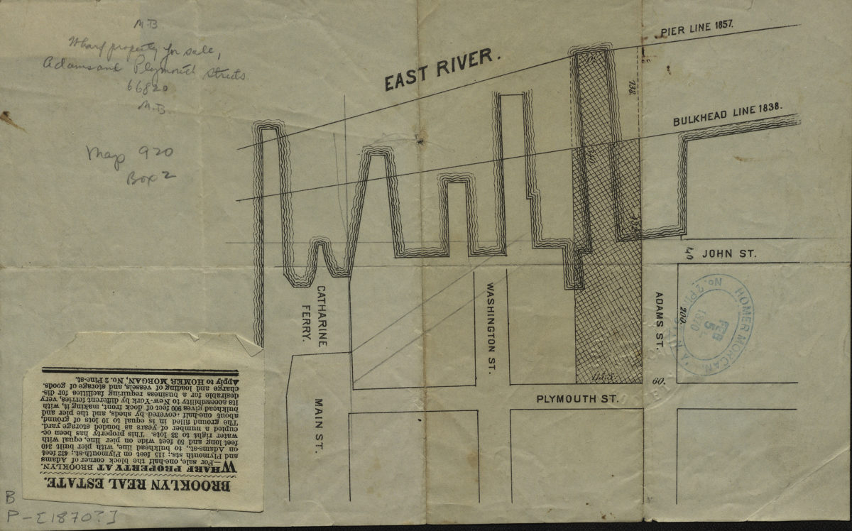
[Map showing area north from Plymouth St. to the East River and west from Adams St. to Main St.]. [1870]
Map No. B P-[1870?].Fl
Cadastral map covering modern-day DUMBO and Vinegar Hill. Shows property for sale, and bulkhead and pierhead lines. Title devised by cataloger. Date of publication conjectured from stamp. BHS copy stamped: Homer Morgan, No. 2 Pine St., N.Y., Feb. 5th 1870. Pasted on BHS copy: Real estate listing for property shown on map.
Subjects
Places
Map area shown
Genre
Cadastral mapsRelation
Full catalog recordSize
15 × 25 cmDownload
Low Resolution Image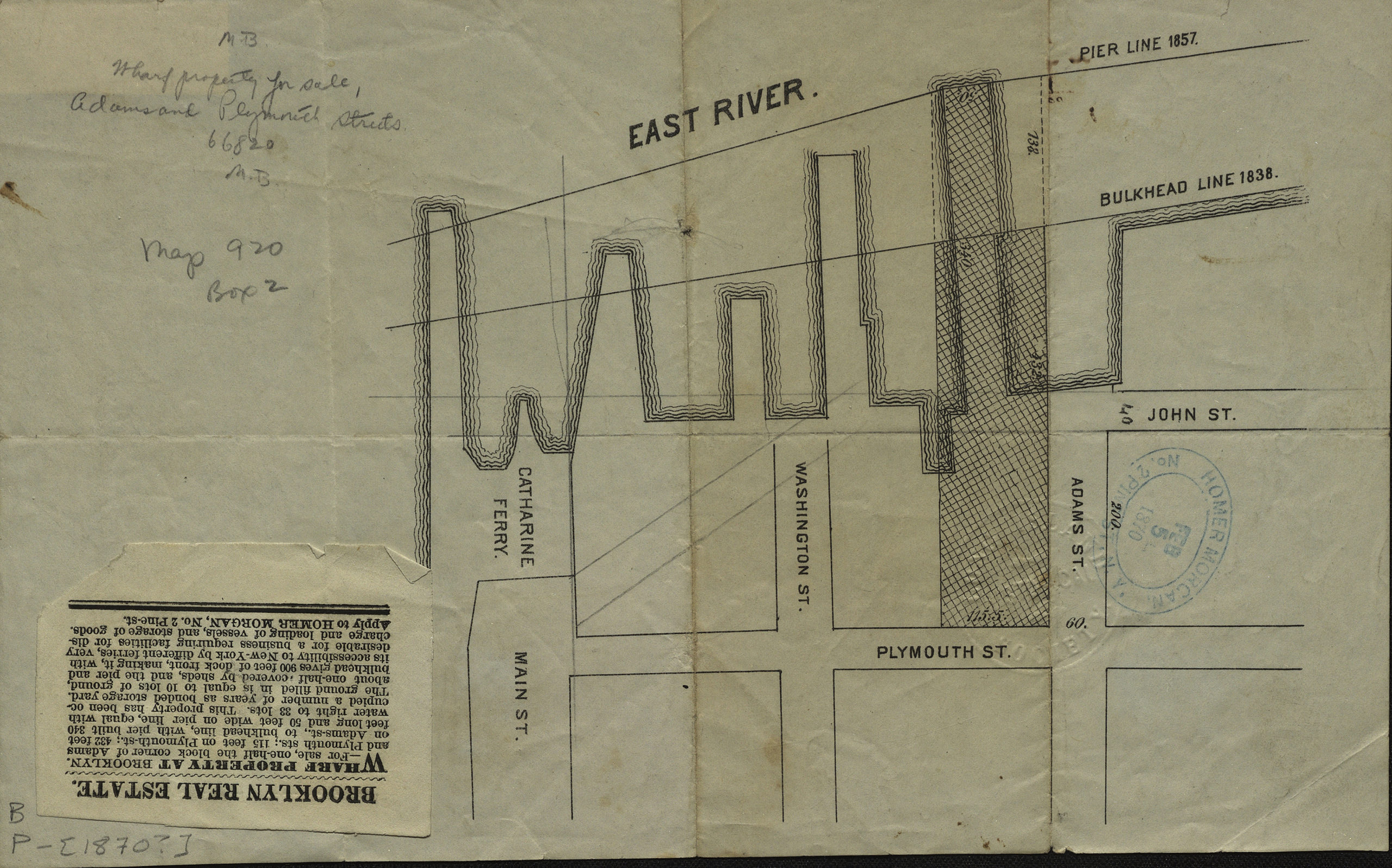
Creator
Publisher
Brooklyn Historical SocietyCitation
[Map showing area north from Plymouth St. to the East River and west from Adams St. to Main St.].; [1870], Map Collection, B P-[1870?].Fl; Brooklyn Historical Society.Scale
Scale not givenLoading zoom image...