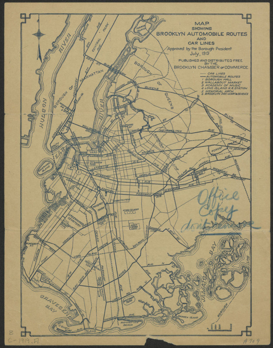
Map showing Brooklyn automobile routes and car lines approved by the Borough President, July 1919 [1919]
Map No. B C-1919.Fl
Road map covers Brooklyn, Queens, and lower Manhattan. Includes index to points of interest.
Subjects
Places
Map area shown
Genre
Transportation mapsRelation
Full catalog recordSize
27 × 19 cmDownload
Low Resolution Image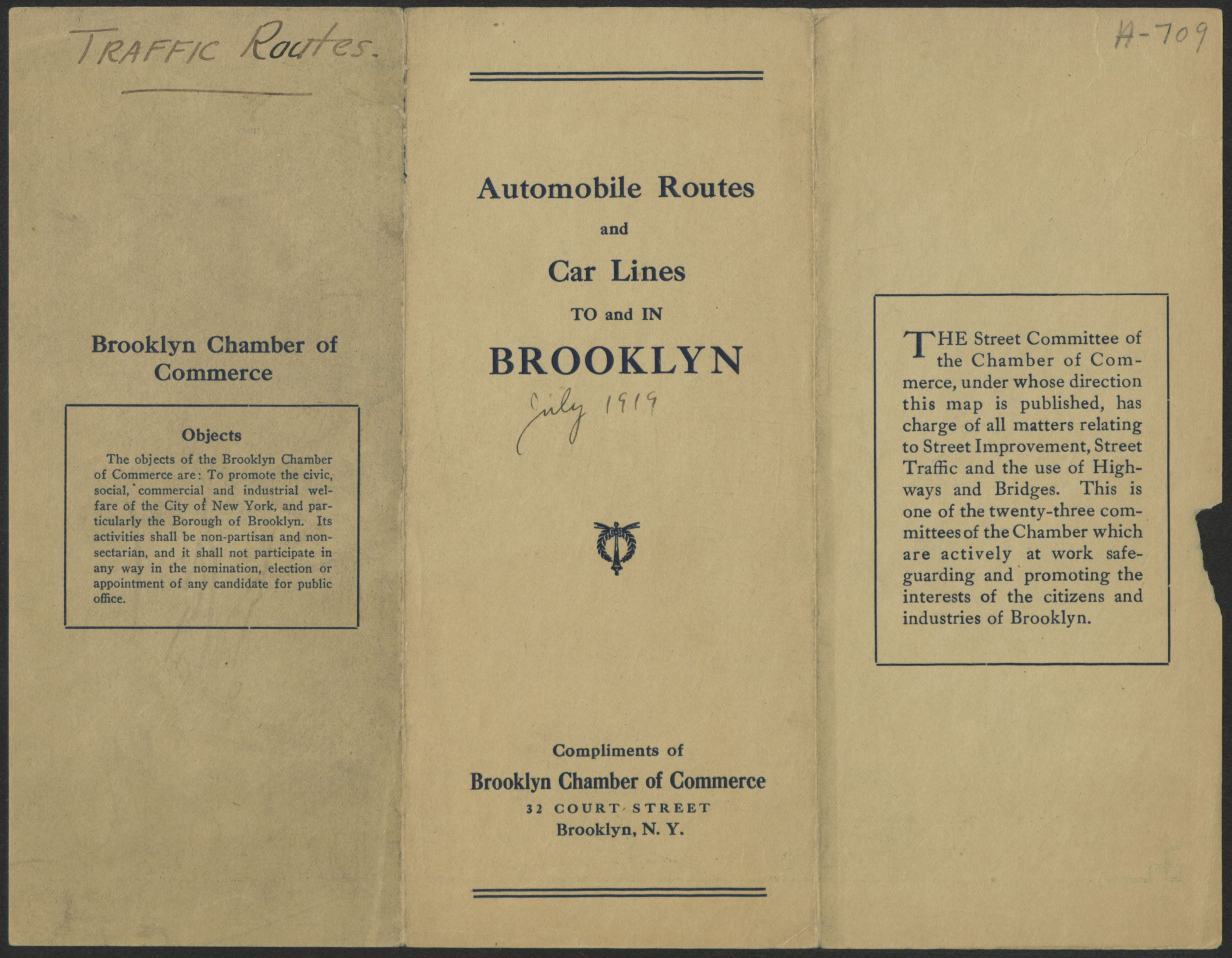
Creator
Brooklyn Chamber of Commerce (Brooklyn, New York, N.Y.),Publisher
Brooklyn Historical SocietyCitation
Map showing Brooklyn automobile routes and car lines approved by the Borough President, July 1919; [1919], Map Collection, B C-1919.Fl; Brooklyn Historical Society.Scale
Scale not givenLoading zoom image...