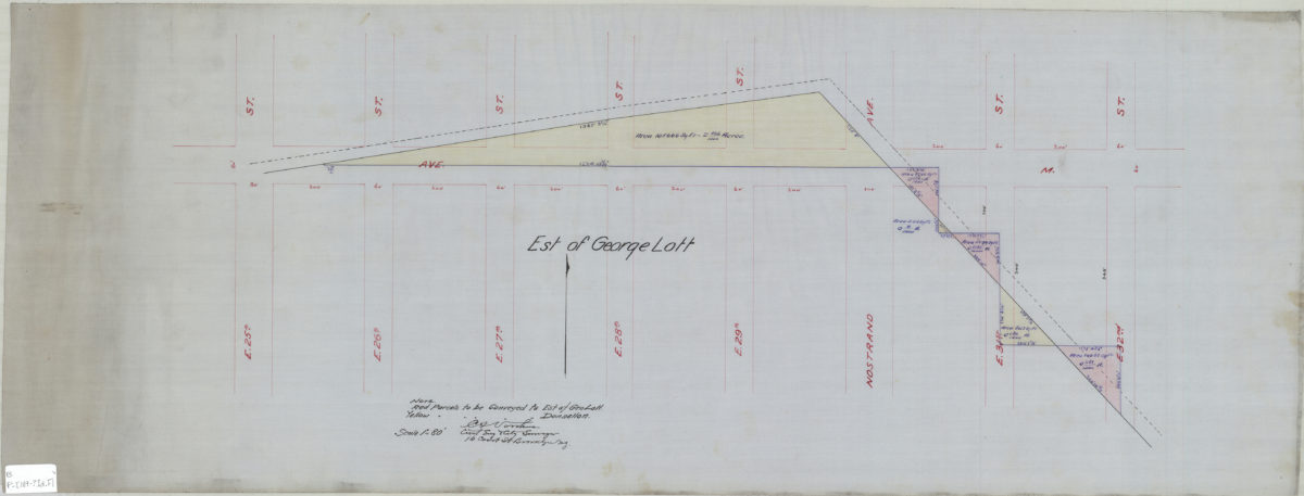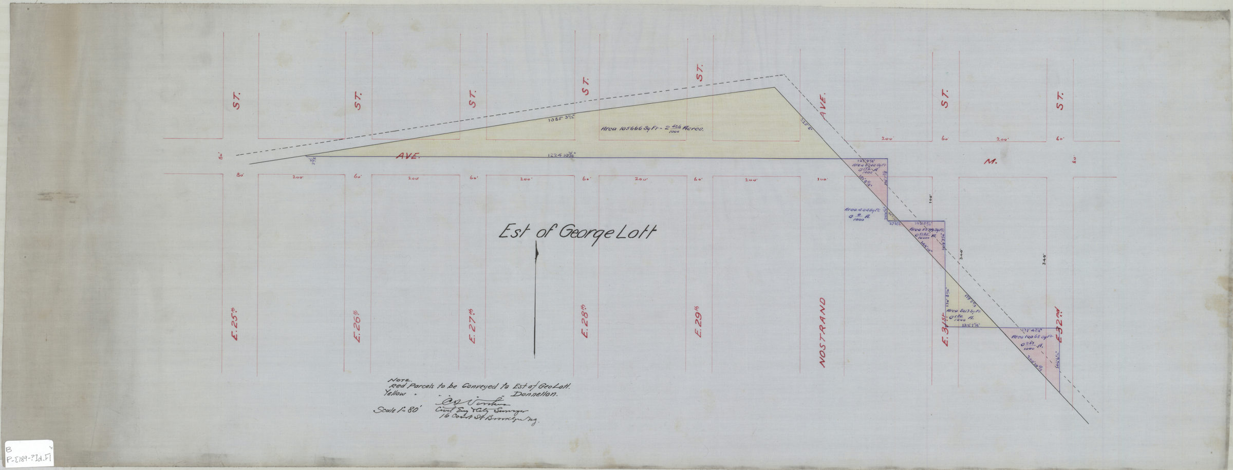
[Map showing estate of George Lott]: C.S. Voorhies, civil eng. & city surveyor [189?]
Map No. B P-[189-?]d.Fl
Cadastral map covering Ave. M between E. 25th St. and E. 32nd St. (modern-day Midwood and Nottingham). Shows property (including dimensions). Title devised by cataloger. Includes key.
Subjects
Places
Map area shown
Relation
Full catalog recordSize
34 × 89 cmDownload
Low Resolution Image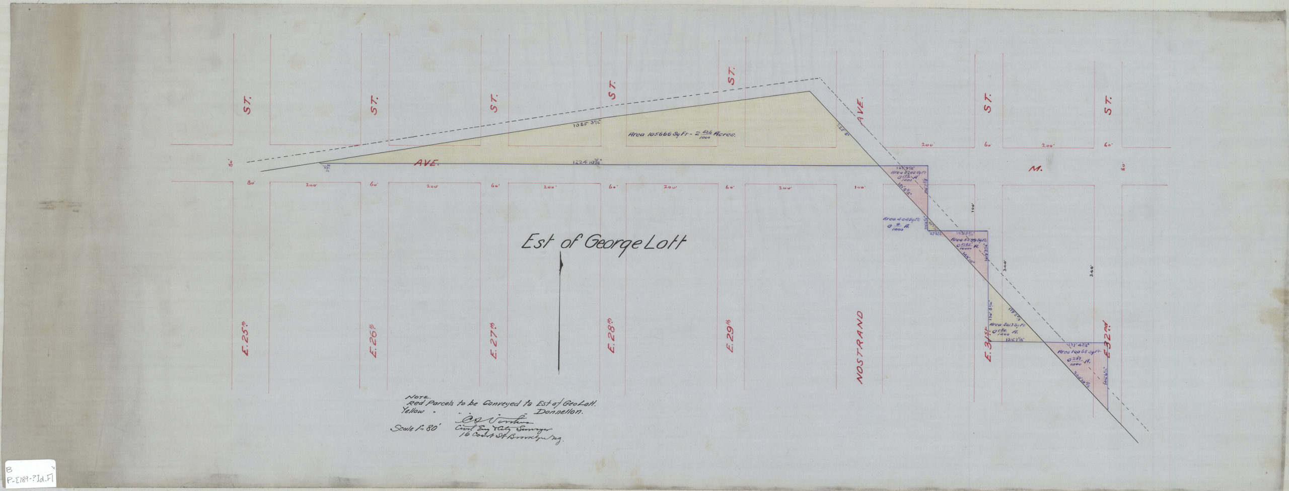
Creator
Voorhies, Chas S.,Publisher
Brooklyn Historical SocietyCitation
[Map showing estate of George Lott]: C.S. Voorhies, civil eng. & city surveyor; [189?], Map Collection, B P-[189-?]d.Fl; Brooklyn Historical Society.Scale
Scale [1:960] 1 in to 80Loading zoom image...