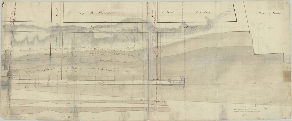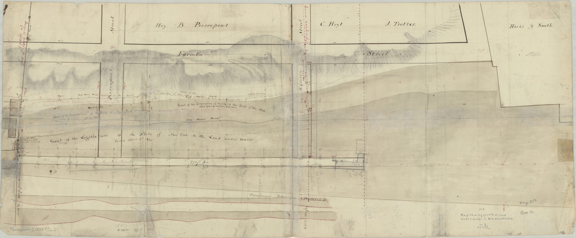
[Map showing grants of land under water in 1804, 1823, and 1835] [1835]
Map No. Pierrepont-[1835?]a.Fl
Covers the waterfront north from approximately Joralemon St. to Pierrepont St. (modern-day Brooklyn Heights). Shows pierhead lines, bulkead lines, high/low water marks, and bluffs overlooking the East River. Relief shown by hachures. Title devised by cataloger. Oriented with north to the left.
Subjects
Places
Map area shown
Genre
Manuscript mapsRelation
Full catalog recordSize
32 × 77 cmDownload
Low Resolution Image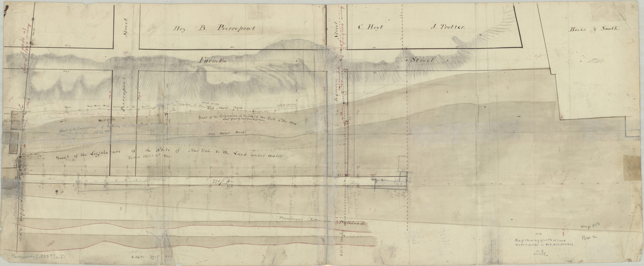
Creator
Publisher
Brooklyn Historical SocietyCitation
[Map showing grants of land under water in 1804, 1823, and 1835]; [1835], Map Collection, Pierrepont-[1835?]a.Fl; Brooklyn Historical Society.Scale
Scale not givenLoading zoom image...