
[Map showing grants of land under water near Montague Pl. and Furman St.]. [1885]
Map No. Pierrepont-[1885?].Fl
Cadastral map covering area in modern-day Brooklyn Heights. Title devised by cataloger. Oriented with north to the upper left. Includes notes.
Subjects
Places
Map area shown
Relation
Full catalog recordSize
65 × 66 cmDownload
Low Resolution Image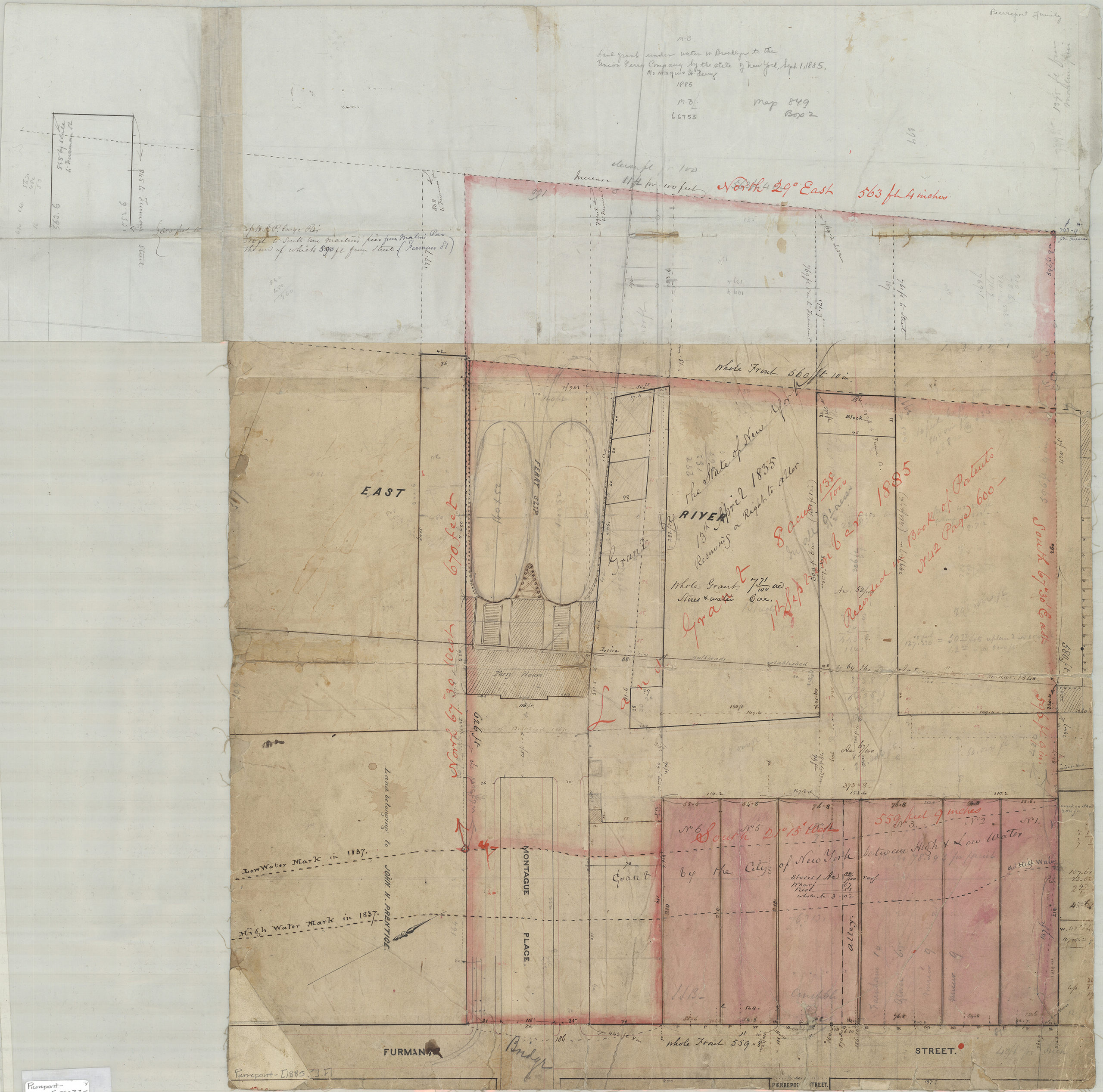
Creator
Publisher
Brooklyn Historical SocietyCitation
[Map showing grants of land under water near Montague Pl. and Furman St.].; [1885], Map Collection, Pierrepont-[1885?].Fl; Brooklyn Historical Society.Scale
Scale not givenLoading zoom image... 