
Map showing improved pavements in the city of Brooklyn in 1891 1891
Map No. B C-1891.Fl
Covers the city of Brooklyn north from approximately 61 St. to Green Point and east to Vandalia Av. also covers portions of southern Queens, Lower Manhattan, and Governors Island. Shows wards, ferry lines, and streets by pavement (granite, Belgian pavement, and asphalt). “Copyrighted by J.B. Beers & Co., 1876 and 1885.” Includes titled ill., text, and key. Titled ill: Water Tower, Prospect Heights Reservoir — New pump house at Ridgewood Station, 26th Ward — Milburn Pump House, main station on new line of water extension, Milburn, L.I.
Map area shown
Genre
Road mapsRelation
Full catalog recordSize
67 × 65 cmDownload
Low Resolution Image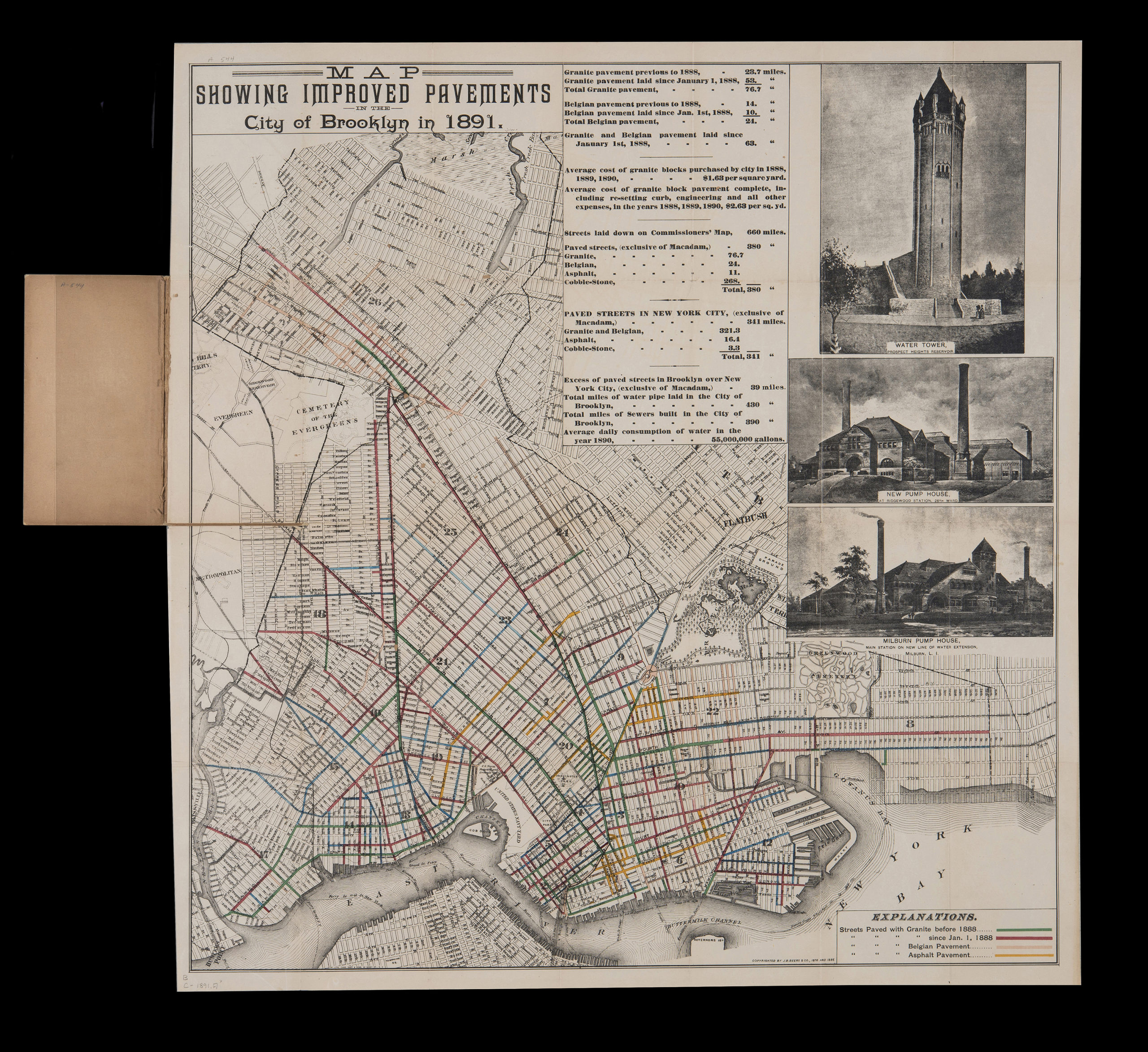
Creator
J.B. Beers & Co.,Publisher
Brooklyn Historical SocietyCitation
Map showing improved pavements in the city of Brooklyn in 1891; 1891, Map Collection, B C-1891.Fl; Brooklyn Historical Society.Scale
Scale not givenLoading zoom image... 