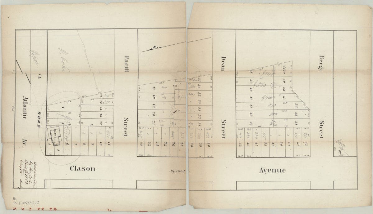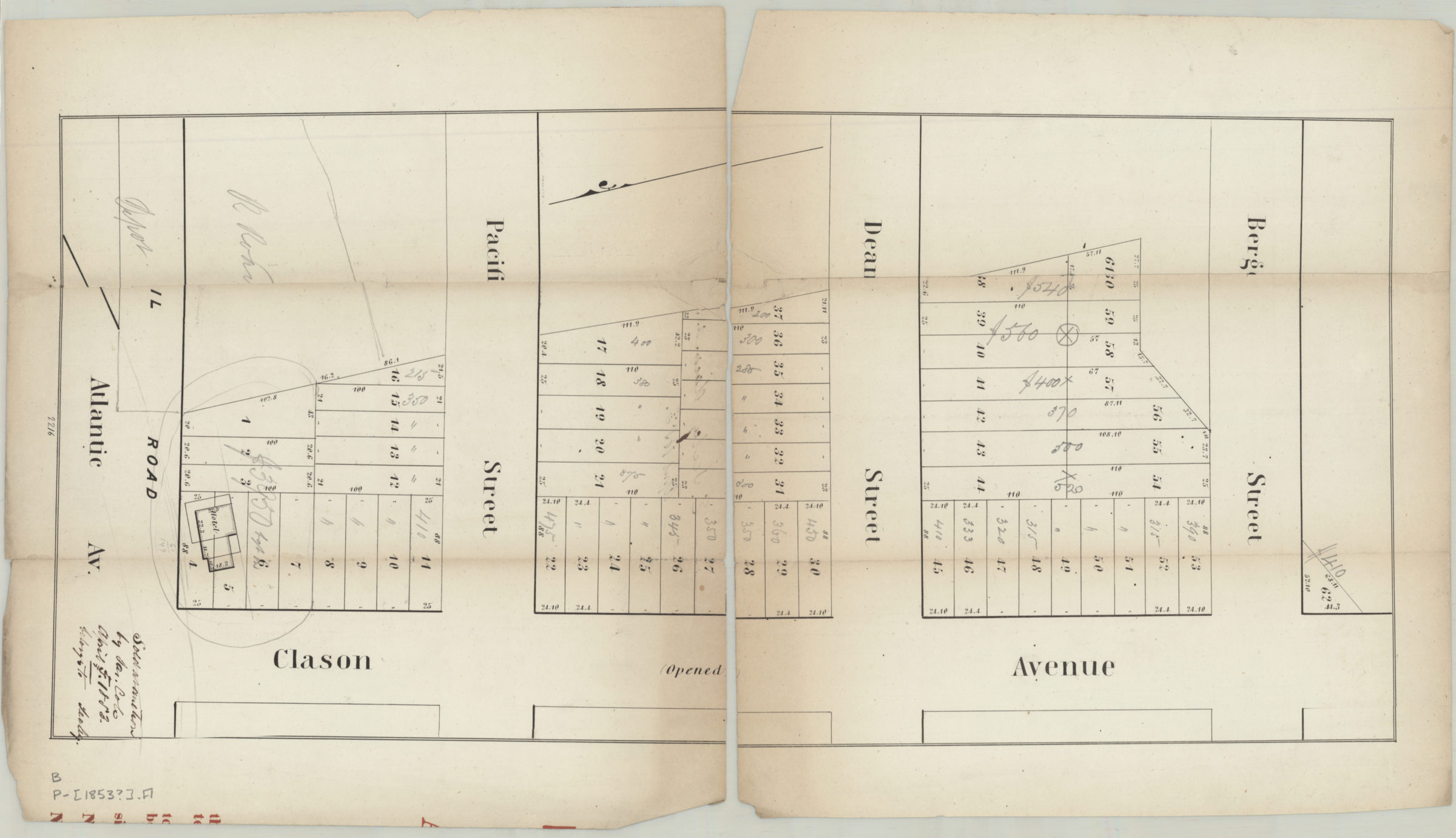
[Map showing intersections of Clason Ave. with Bergen St., Dean St., Pacific St., and Atlantic Ave.]. [1853]
Map No. B P-[1853?].Fl
Cadastral map covering modern-day Bedford-Stuyvesant. Shows property (including lot numbers and dimensions), a railroad, hotel, and the status of streets. Title devised by cataloger. Extracted from a larger map? Date of publication conjectured from annotations. “2216”–Lower center margin. BHS copy annotated in ink and gray pencil.
Map area shown
Genre
Cadastral mapsRelation
Full catalog recordSize
57 × 27 cmDownload
Low Resolution Image
Creator
Publisher
Brooklyn Historical SocietyCitation
[Map showing intersections of Clason Ave. with Bergen St., Dean St., Pacific St., and Atlantic Ave.].; [1853], Map Collection, B P-[1853?].Fl; Brooklyn Historical Society.Scale
Scale not givenLoading zoom image...