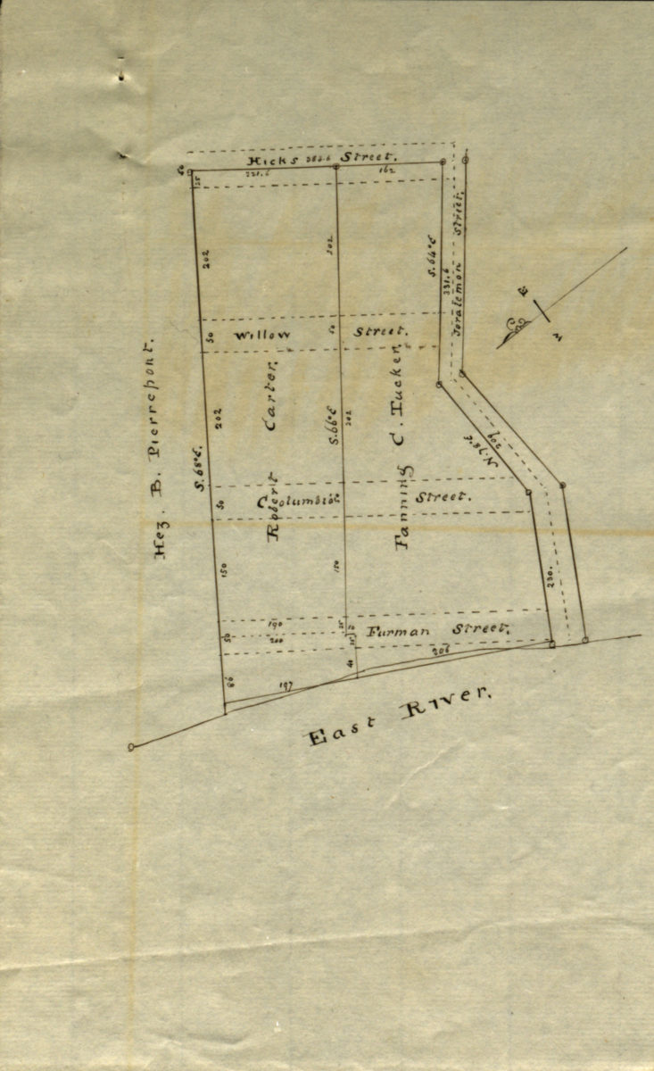
[Map showing land of Robert Carter, Fanning C. Tucker, and Hez. B. Pierrepont] [18??]
Map No. B P-[18--?]q.Fl
Cadastral map covering area bounded by the East River, Joralemon St., and Hicks St. (modern-day Brooklyn Heights). Title devised by cataloger. Oriented with north to the lower left. Watermarked.
Map area shown
Relation
Full catalog recordSize
21 × 13 cmDownload
Low Resolution Image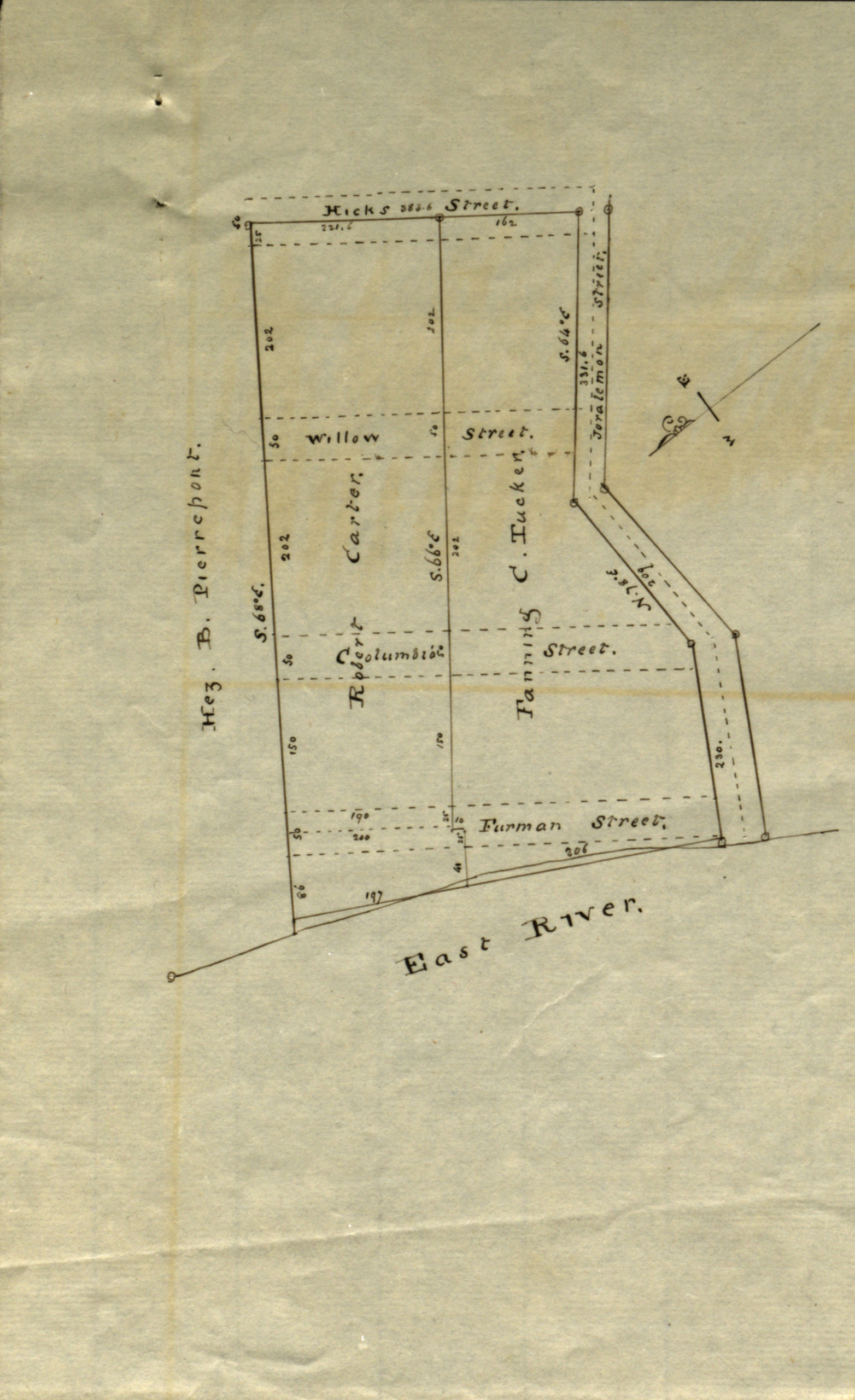
Creator
Publisher
Brooklyn Historical SocietyCitation
[Map showing land of Robert Carter, Fanning C. Tucker, and Hez. B. Pierrepont]; [18??], Map Collection, B P-[18--?]q.Fl; Brooklyn Historical Society.Scale
Scale not givenLoading zoom image...