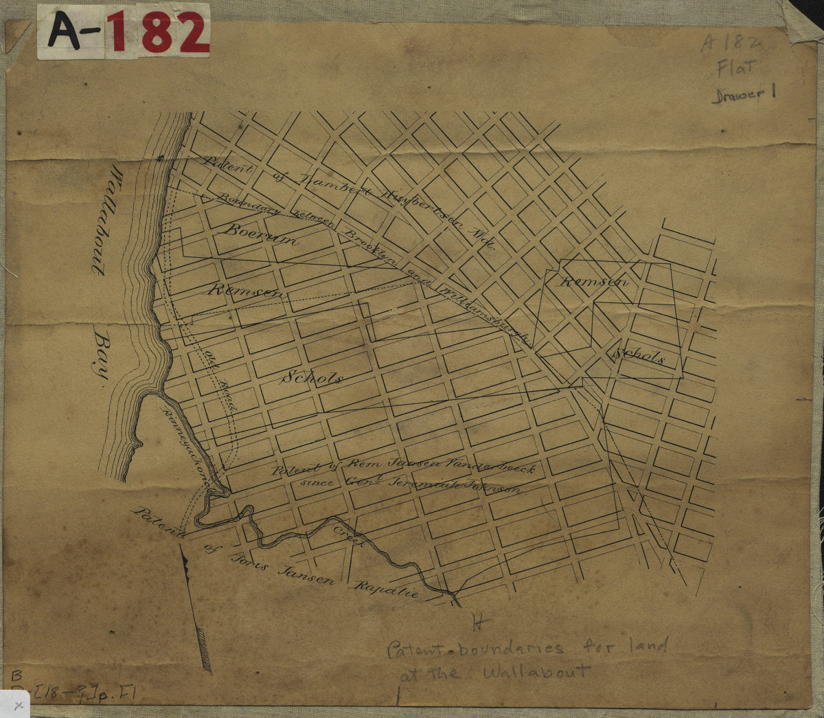
[Map showing land patents near Wallabout Bay] [18??]
Map No. B P-[18--?]p.Fl
Cadastral map covering area in modern-day Fort Greene. Shows names of landowners. Title devised by cataloger.
Subjects
Places
Map area shown
Relation
Full catalog recordSize
22 × 26 cmDownload
Low Resolution Image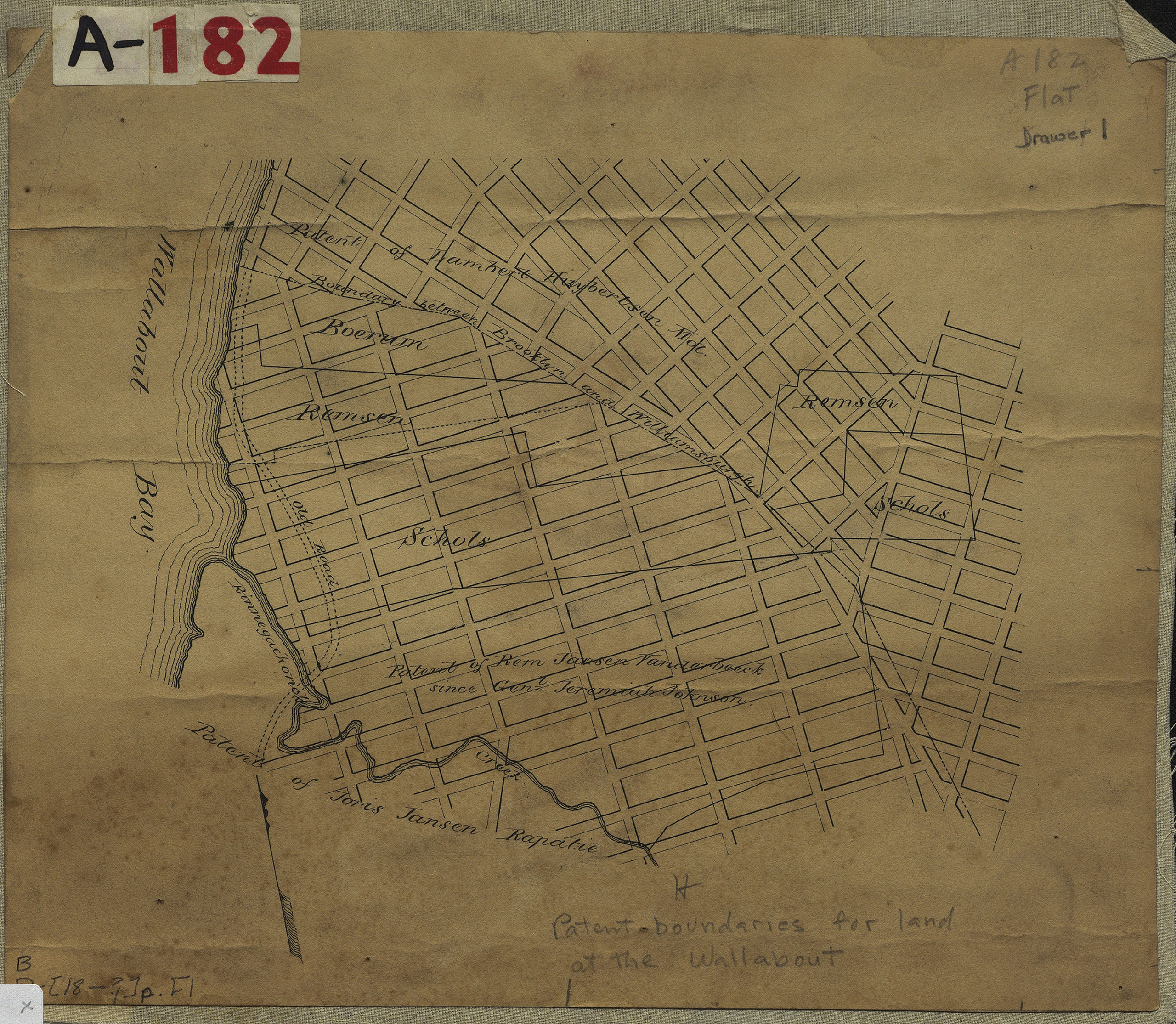
Creator
Publisher
Brooklyn Historical SocietyCitation
[Map showing land patents near Wallabout Bay]; [18??], Map Collection, B P-[18--?]p.Fl; Brooklyn Historical Society.Scale
Scale not givenLoading zoom image...