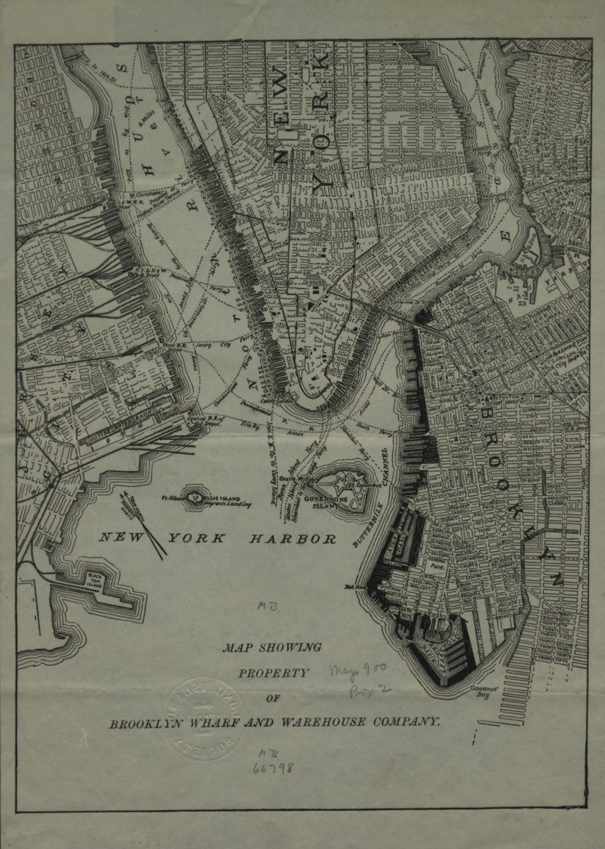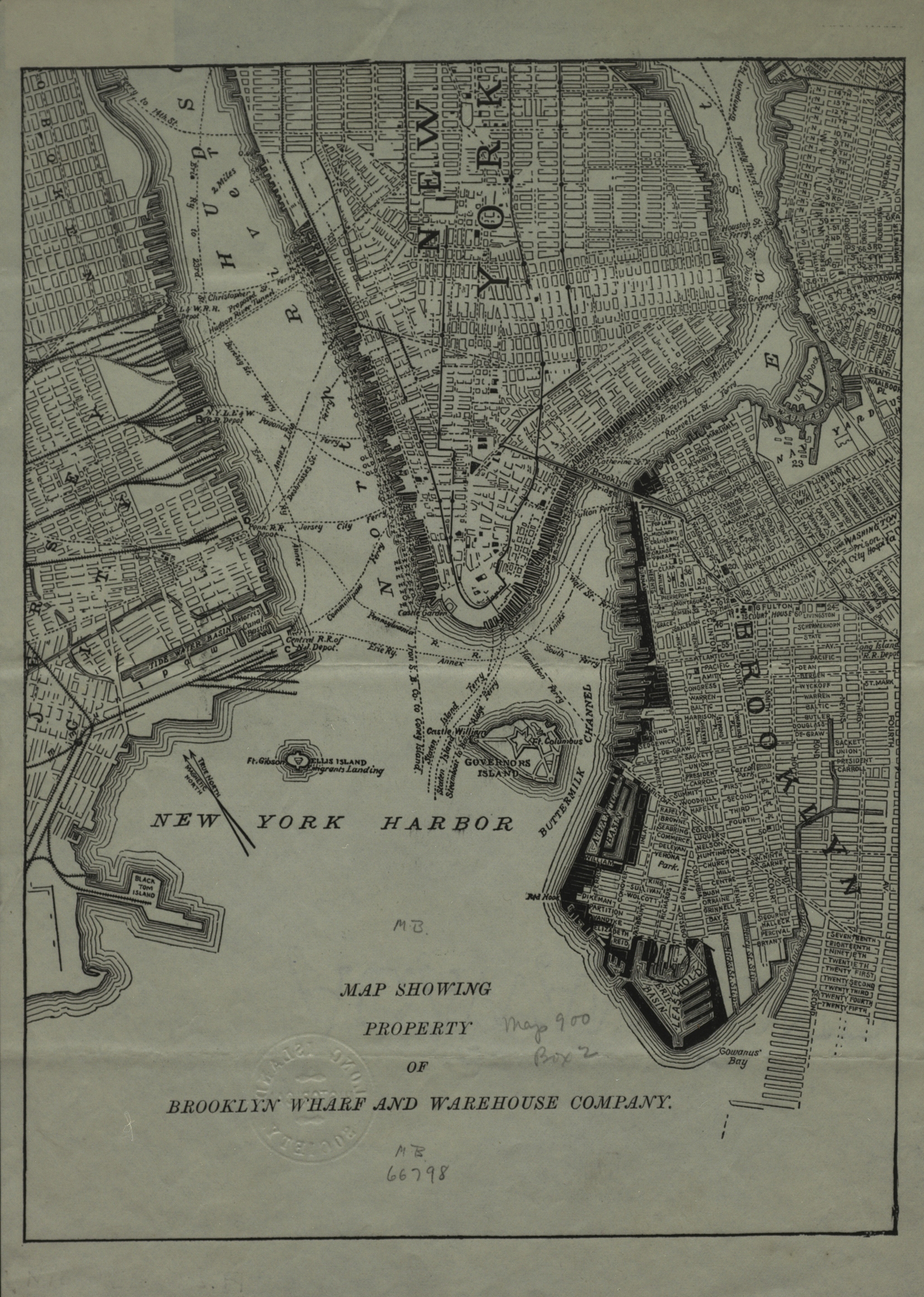
Map showing property of Brooklyn Wharf and Warehouse Company [189?]
Map No. B P-[189-?]b.Fl
Cadastral map covering area north from the Gowanus Bay to N 14th St. and east to the Brooklyn Navy Yard. Also covers Lower Manhattan, Governors Island, Ellis Island, and portions of Hoboken and Jersey City. Shows railroads, piers, and ferry lines. Watermark illegible.
Map area shown
Genre
Cadastral mapsRelation
Full catalog recordSize
28 × 21 cmDownload
Low Resolution ImageCreator
Publisher
Brooklyn Historical SocietyCitation
Map showing property of Brooklyn Wharf and Warehouse Company; [189?], Map Collection, B P-[189-?]b.Fl; Brooklyn Historical Society.Scale
Scale not givenLoading zoom image...